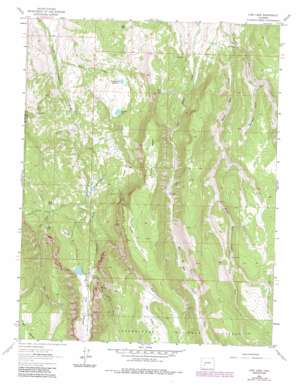
Lost Lake Topo Map Colorado
To zoom in, hover over the map of Lost Lake
USGS Topo Quad 38107c4 - 1:24,000 scale
| Topo Map Name: | Lost Lake |
| USGS Topo Quad ID: | 38107c4 |
| Print Size: | ca. 21 1/4" wide x 27" high |
| Southeast Coordinates: | 38.25° N latitude / 107.375° W longitude |
| Map Center Coordinates: | 38.3125° N latitude / 107.4375° W longitude |
| U.S. State: | CO |
| Filename: | o38107c4.jpg |
| Download Map JPG Image: | Lost Lake topo map 1:24,000 scale |
| Map Type: | Topographic |
| Topo Series: | 7.5´ |
| Map Scale: | 1:24,000 |
| Source of Map Images: | United States Geological Survey (USGS) |
| Alternate Map Versions: |
Lost Lake CO 1963, updated 1966 Download PDF Buy paper map Lost Lake CO 1963, updated 1970 Download PDF Buy paper map Lost Lake CO 1963, updated 1970 Download PDF Buy paper map Lost Lake CO 1963, updated 1984 Download PDF Buy paper map Lost Lake CO 2011 Download PDF Buy paper map Lost Lake CO 2013 Download PDF Buy paper map Lost Lake CO 2016 Download PDF Buy paper map |
| FStopo: | US Forest Service topo Lost Lake is available: Download FStopo PDF Download FStopo TIF |
1:24,000 Topo Quads surrounding Lost Lake
> Back to 38107a1 at 1:100,000 scale
> Back to 38106a1 at 1:250,000 scale
> Back to U.S. Topo Maps home
Lost Lake topo map: Gazetteer
Lost Lake: Bridges
Burro Bridge elevation 2759m 9051′Lost Lake: Canals
Butte Ditch elevation 2398m 7867′McKinley Ditch elevation 2328m 7637′
Lost Lake: Flats
Big Park elevation 3078m 10098′Coyote Park elevation 3138m 10295′
Duckett Park elevation 2695m 8841′
Fire Park elevation 3224m 10577′
Grasshopper Park elevation 2800m 9186′
Johnson Park elevation 2827m 9274′
Lost Lake: Lakes
Lost Lake elevation 2800m 9186′Mack Lake elevation 2741m 8992′
Stink Lake elevation 2682m 8799′
Swanson Lake elevation 2666m 8746′
Van Boxel Lakes elevation 2574m 8444′
Lost Lake: Reservoirs
Burnt Lake elevation 2765m 9071′Fitzpatrick Reservoir elevation 2664m 8740′
Lost Lake: Streams
Butte Creek elevation 2435m 7988′East Fork Little Cimarron River elevation 2590m 8497′
Middle Blue Creek elevation 2648m 8687′
Moore Pasture Creek elevation 2754m 9035′
Rabbit Creek elevation 2334m 7657′
Van Boxel Creek elevation 2561m 8402′
West Fork Middle Blue Creek elevation 2837m 9307′
Workman Creek elevation 2714m 8904′
Lost Lake: Summits
Horse Mesa elevation 3079m 10101′Lost Lake: Valleys
Fire Park Draw elevation 2812m 9225′Lost Lake digital topo map on disk
Buy this Lost Lake topo map showing relief, roads, GPS coordinates and other geographical features, as a high-resolution digital map file on DVD:


