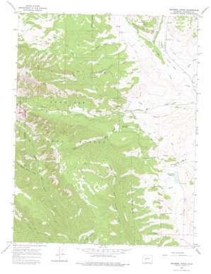
Squirrel Creek Topo Map Colorado
To zoom in, hover over the map of Squirrel Creek
USGS Topo Quad 38107f1 - 1:24,000 scale
| Topo Map Name: | Squirrel Creek |
| USGS Topo Quad ID: | 38107f1 |
| Print Size: | ca. 21 1/4" wide x 27" high |
| Southeast Coordinates: | 38.625° N latitude / 107° W longitude |
| Map Center Coordinates: | 38.6875° N latitude / 107.0625° W longitude |
| U.S. State: | CO |
| Filename: | o38107f1.jpg |
| Download Map JPG Image: | Squirrel Creek topo map 1:24,000 scale |
| Map Type: | Topographic |
| Topo Series: | 7.5´ |
| Map Scale: | 1:24,000 |
| Source of Map Images: | United States Geological Survey (USGS) |
| Alternate Map Versions: |
Squirrel Creek CO 1965, updated 1968 Download PDF Buy paper map Squirrel Creek CO 1965, updated 1968 Download PDF Buy paper map Squirrel Creek CO 1965, updated 1975 Download PDF Buy paper map Squirrel Creek CO 2001, updated 2004 Download PDF Buy paper map Squirrel Creek CO 2011 Download PDF Buy paper map Squirrel Creek CO 2013 Download PDF Buy paper map Squirrel Creek CO 2016 Download PDF Buy paper map |
| FStopo: | US Forest Service topo Squirrel Creek is available: Download FStopo PDF Download FStopo TIF |
1:24,000 Topo Quads surrounding Squirrel Creek
> Back to 38107e1 at 1:100,000 scale
> Back to 38106a1 at 1:250,000 scale
> Back to U.S. Topo Maps home
Squirrel Creek topo map: Gazetteer
Squirrel Creek: Canals
Acme Ditch elevation 2618m 8589′Campbell Ditch elevation 2520m 8267′
Castleton Ditch elevation 2561m 8402′
Eilebrecht Ditch Number 1 elevation 2794m 9166′
Highline Ditch elevation 3013m 9885′
Hope Resich Ditch elevation 2608m 8556′
Judy North Highline Ditch elevation 2656m 8713′
Little Mill Creek Ditch elevation 2725m 8940′
Stratman Ditch elevation 2633m 8638′
Squirrel Creek: Dams
Kenny Moore Dam elevation 2647m 8684′Squirrel Creek: Mines
Baldwin Star Mine elevation 2681m 8795′Hinkle Mine elevation 2802m 9192′
Ohio Creek Mine elevation 2825m 9268′
Ohio Creek Number Two Mine elevation 2826m 9271′
Ohio Mine elevation 2828m 9278′
Smith Mine elevation 2736m 8976′
Sunbeam Mine elevation 2690m 8825′
Squirrel Creek: Reservoirs
Cunningham Lake elevation 2776m 9107′Cunningham Reservoir elevation 2768m 9081′
Kenny Moore Reservoir elevation 2647m 8684′
Squirrel Creek: Streams
Carbon Creek elevation 2556m 8385′Little Mill Creek elevation 2651m 8697′
Middle Beaver Creek elevation 2931m 9616′
Middle Creek elevation 2572m 8438′
Mill Creek elevation 2510m 8234′
Price Creek elevation 2573m 8441′
Squirrel Creek elevation 2542m 8339′
Willow Creek elevation 2514m 8248′
Squirrel Creek: Trails
Lowline Trail elevation 3032m 9947′Squirrel Creek: Valleys
Baler Gulch elevation 2632m 8635′Clay Gulch elevation 2611m 8566′
Farnum Gulch elevation 2610m 8562′
Grays Gulch elevation 2587m 8487′
Squirrel Creek digital topo map on disk
Buy this Squirrel Creek topo map showing relief, roads, GPS coordinates and other geographical features, as a high-resolution digital map file on DVD:


