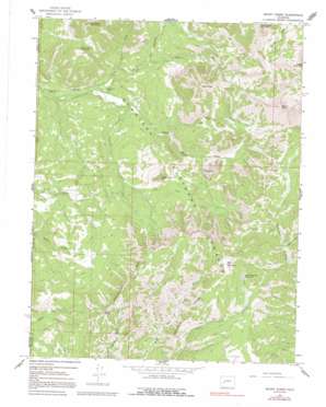
Mount Guero Topo Map Colorado
To zoom in, hover over the map of Mount Guero
USGS Topo Quad 38107f4 - 1:24,000 scale
| Topo Map Name: | Mount Guero |
| USGS Topo Quad ID: | 38107f4 |
| Print Size: | ca. 21 1/4" wide x 27" high |
| Southeast Coordinates: | 38.625° N latitude / 107.375° W longitude |
| Map Center Coordinates: | 38.6875° N latitude / 107.4375° W longitude |
| U.S. State: | CO |
| Filename: | o38107f4.jpg |
| Download Map JPG Image: | Mount Guero topo map 1:24,000 scale |
| Map Type: | Topographic |
| Topo Series: | 7.5´ |
| Map Scale: | 1:24,000 |
| Source of Map Images: | United States Geological Survey (USGS) |
| Alternate Map Versions: |
Mount Guero CO 1965, updated 1968 Download PDF Buy paper map Mount Guero CO 1965, updated 1968 Download PDF Buy paper map Mount Guero CO 1965, updated 1992 Download PDF Buy paper map Mount Guero CO 1965, updated 1992 Download PDF Buy paper map Mount Guero CO 2001, updated 2004 Download PDF Buy paper map Mount Guero CO 2011 Download PDF Buy paper map Mount Guero CO 2013 Download PDF Buy paper map Mount Guero CO 2016 Download PDF Buy paper map |
| FStopo: | US Forest Service topo Mount Guero is available: Download FStopo PDF Download FStopo TIF |
1:24,000 Topo Quads surrounding Mount Guero
> Back to 38107e1 at 1:100,000 scale
> Back to 38106a1 at 1:250,000 scale
> Back to U.S. Topo Maps home
Mount Guero topo map: Gazetteer
Mount Guero: Canals
Virginia Ditch elevation 2734m 8969′Mount Guero: Dams
Bald Mountain Dam elevation 3381m 11092′Mount Guero: Pillars
Castle Rock elevation 3356m 11010′Mount Guero: Reservoirs
Bald Mountain Reservoir elevation 3345m 10974′Mount Guero: Ridges
Bellmire Ridge elevation 3413m 11197′Mendicant Ridge elevation 3478m 11410′
Mount Guero: Streams
Cow Creek elevation 2200m 7217′East Creek elevation 2937m 9635′
Fall Creek elevation 2998m 9835′
Lone Pine Creek elevation 2355m 7726′
Lunch Creek elevation 2544m 8346′
North Smith Fork Gunnison River elevation 2239m 7345′
Sink Creek elevation 2407m 7896′
South Smith Fork elevation 2239m 7345′
Trail Creek elevation 2292m 7519′
Virginia Creek elevation 2297m 7536′
Mount Guero: Summits
Bald Mountain elevation 3592m 11784′Big Sand Mountain elevation 3184m 10446′
Black Mesa elevation 3385m 11105′
Little Sand Mountain elevation 2930m 9612′
Mount Guero elevation 3674m 12053′
Tater Heap elevation 3347m 10980′
The Knob elevation 2969m 9740′
Mount Guero digital topo map on disk
Buy this Mount Guero topo map showing relief, roads, GPS coordinates and other geographical features, as a high-resolution digital map file on DVD:


