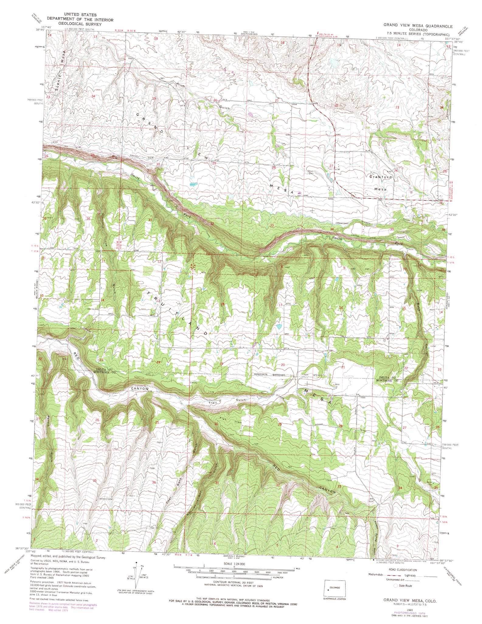
Grand View Mesa Topo Map Colorado
To zoom in, hover over the map of Grand View Mesa
USGS Topo Quad 38107f6 - 1:24,000 scale
| Topo Map Name: | Grand View Mesa |
| USGS Topo Quad ID: | 38107f6 |
| Print Size: | ca. 21 1/4" wide x 27" high |
| Southeast Coordinates: | 38.625° N latitude / 107.625° W longitude |
| Map Center Coordinates: | 38.6875° N latitude / 107.6875° W longitude |
| U.S. State: | CO |
| Filename: | o38107f6.jpg |
| Download Map JPG Image: | Grand View Mesa topo map 1:24,000 scale |
| Map Type: | Topographic |
| Topo Series: | 7.5´ |
| Map Scale: | 1:24,000 |
| Source of Map Images: | United States Geological Survey (USGS) |
| Alternate Map Versions: |
Grand View Mesa CO 1965, updated 1968 Download PDF Buy paper map Grand View Mesa CO 1965, updated 1968 Download PDF Buy paper map Grand View Mesa CO 1965, updated 1979 Download PDF Buy paper map Grand View Mesa CO 2010 Download PDF Buy paper map Grand View Mesa CO 2013 Download PDF Buy paper map Grand View Mesa CO 2016 Download PDF Buy paper map |
1:24,000 Topo Quads surrounding Grand View Mesa
Cedaredge |
Dry Creek |
Gray Reservoir |
Bowie |
Somerset |
Orchard City |
Lazear |
Hotchkiss |
Paonia |
Minnesota Pass |
Olathe Nw |
Black Ridge |
Grand View Mesa |
Crawford |
Mount Guero |
Olathe |
Red Rock Canyon |
Grizzly Ridge |
Cathedral Peak |
X Lazy F Ranch |
Montrose West |
Montrose East |
Cerro Summit |
Cimarron |
Curecanti Needle |
> Back to 38107e1 at 1:100,000 scale
> Back to 38106a1 at 1:250,000 scale
> Back to U.S. Topo Maps home
Grand View Mesa topo map: Gazetteer
Grand View Mesa: Airports
Crawford Airport elevation 1969m 6459′Grand View Mesa: Canals
Crawford Clipper Ditch elevation 1947m 6387′Gould Canal elevation 2197m 7208′
Grand View Ditch elevation 1948m 6391′
Grand View Mesa: Reservoirs
Crystal Lake elevation 2164m 7099′Grand View Mesa: Streams
Crystal Creek elevation 2136m 7007′Grand View Mesa: Summits
Crawford Mesa elevation 1902m 6240′Flat Iron elevation 2233m 7326′
Grand View Mesa elevation 1985m 6512′
Scenic Mesa elevation 1798m 5898′
Grand View Mesa: Valleys
Buck Canyon elevation 1906m 6253′Coal Bank Gulch elevation 2125m 6971′
Diamond Joe Gulch elevation 1767m 5797′
Parvin Gulch elevation 2031m 6663′
Poison Spring Gulch elevation 2261m 7417′
Son-of-a-Gun Gulch elevation 2130m 6988′
Trail Gulch elevation 2093m 6866′
Grand View Mesa digital topo map on disk
Buy this Grand View Mesa topo map showing relief, roads, GPS coordinates and other geographical features, as a high-resolution digital map file on DVD: