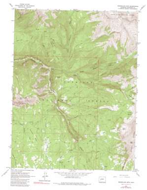
Marcellina Mountain Topo Map Colorado
To zoom in, hover over the map of Marcellina Mountain
USGS Topo Quad 38107h2 - 1:24,000 scale
| Topo Map Name: | Marcellina Mountain |
| USGS Topo Quad ID: | 38107h2 |
| Print Size: | ca. 21 1/4" wide x 27" high |
| Southeast Coordinates: | 38.875° N latitude / 107.125° W longitude |
| Map Center Coordinates: | 38.9375° N latitude / 107.1875° W longitude |
| U.S. State: | CO |
| Filename: | o38107h2.jpg |
| Download Map JPG Image: | Marcellina Mountain topo map 1:24,000 scale |
| Map Type: | Topographic |
| Topo Series: | 7.5´ |
| Map Scale: | 1:24,000 |
| Source of Map Images: | United States Geological Survey (USGS) |
| Alternate Map Versions: |
Marcellina Mountain CO 1961, updated 1964 Download PDF Buy paper map Marcellina Mountain CO 1961, updated 1964 Download PDF Buy paper map Marcellina Mountain CO 1961, updated 1968 Download PDF Buy paper map Marcellina Mountain CO 1961, updated 1968 Download PDF Buy paper map Marcellina Mountain CO 1961, updated 1980 Download PDF Buy paper map Marcellina Mountain CO 2001, updated 2004 Download PDF Buy paper map Marcellina Mountain CO 2011 Download PDF Buy paper map Marcellina Mountain CO 2013 Download PDF Buy paper map Marcellina Mountain CO 2016 Download PDF Buy paper map |
| FStopo: | US Forest Service topo Marcellina Mountain is available: Download FStopo PDF Download FStopo TIF |
1:24,000 Topo Quads surrounding Marcellina Mountain
> Back to 38107e1 at 1:100,000 scale
> Back to 38106a1 at 1:250,000 scale
> Back to U.S. Topo Maps home
Marcellina Mountain topo map: Gazetteer
Marcellina Mountain: Basins
Buck Basin elevation 3247m 10652′Gold Basin elevation 3368m 11049′
Silver Basin elevation 3354m 11003′
Swan Basin elevation 3188m 10459′
Marcellina Mountain: Cliffs
Devils Stairway elevation 2373m 7785′Marcellina Mountain: Mines
Belcher Mine elevation 3159m 10364′Marcellina Mountain: Ridges
Lightning Ridge elevation 2810m 9219′Snowline Ridge elevation 2809m 9215′
The Dyke elevation 3382m 11095′
Marcellina Mountain: Streams
Ant Creek elevation 2255m 7398′Buck Creek elevation 2454m 8051′
Dyke Creek elevation 2523m 8277′
Gold Creek elevation 2461m 8074′
Hell Creek elevation 2329m 7641′
Middle Anthracite Creek elevation 2294m 7526′
Middle Creek elevation 2480m 8136′
North Anthracite Creek elevation 2227m 7306′
Ruby Anthracite Creek elevation 2190m 7185′
Sardine Creek elevation 2348m 7703′
Silver Creek elevation 2288m 7506′
Trout Creek elevation 2308m 7572′
West Red Creek elevation 2713m 8900′
Marcellina Mountain: Summits
Marcellina Mountain elevation 3459m 11348′Mount Owen elevation 3969m 13021′
Prospect Point elevation 2638m 8654′
Ruby Peak elevation 3853m 12641′
Marcellina Mountain: Trails
Munsey Ruby Stock Driveway elevation 2630m 8628′Marcellina Mountain: Valleys
Bear Gulch elevation 2176m 7139′Marcellina Mountain digital topo map on disk
Buy this Marcellina Mountain topo map showing relief, roads, GPS coordinates and other geographical features, as a high-resolution digital map file on DVD:


