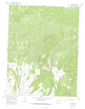
Dry Creek Topo Map Colorado
To zoom in, hover over the map of Dry Creek
USGS Topo Quad 38107h7 - 1:24,000 scale
| Topo Map Name: | Dry Creek |
| USGS Topo Quad ID: | 38107h7 |
| Print Size: | ca. 21 1/4" wide x 27" high |
| Southeast Coordinates: | 38.875° N latitude / 107.75° W longitude |
| Map Center Coordinates: | 38.9375° N latitude / 107.8125° W longitude |
| U.S. State: | CO |
| Filename: | o38107h7.jpg |
| Download Map JPG Image: | Dry Creek topo map 1:24,000 scale |
| Map Type: | Topographic |
| Topo Series: | 7.5´ |
| Map Scale: | 1:24,000 |
| Source of Map Images: | United States Geological Survey (USGS) |
| Alternate Map Versions: |
Dry Creek CO 1965, updated 1968 Download PDF Buy paper map Dry Creek CO 1965, updated 1968 Download PDF Buy paper map Dry Creek CO 1965, updated 1973 Download PDF Buy paper map Dry Creek CO 1965, updated 1979 Download PDF Buy paper map Dry Creek CO 2011 Download PDF Buy paper map Dry Creek CO 2013 Download PDF Buy paper map Dry Creek CO 2016 Download PDF Buy paper map |
| FStopo: | US Forest Service topo Dry Creek is available: Download FStopo PDF Download FStopo TIF |
1:24,000 Topo Quads surrounding Dry Creek
> Back to 38107e1 at 1:100,000 scale
> Back to 38106a1 at 1:250,000 scale
> Back to U.S. Topo Maps home
Dry Creek topo map: Gazetteer
Dry Creek: Basins
Hells Hole elevation 2576m 8451′Dry Creek: Canals
Cow Creek Ditch elevation 2195m 7201′Currant Creek Number 2 Ditch elevation 1967m 6453′
Overland Canal elevation 2165m 7103′
Shindledecker Ditch elevation 2347m 7700′
Sooner Ditch elevation 2447m 8028′
Stull Ditch elevation 2175m 7135′
Dry Creek: Dams
Carl Smith Dam elevation 2513m 8244′Hunt Dam elevation 2246m 7368′
Patterson Number 1 Dam elevation 2513m 8244′
Dry Creek: Flats
Cactus Park elevation 1965m 6446′Dry Creek: Mines
Bennett Mine elevation 2245m 7365′Farmers Mine elevation 2227m 7306′
Landerth Mine elevation 2103m 6899′
Newman Mine elevation 2357m 7732′
Owens Mine elevation 2333m 7654′
Ward Mine elevation 2096m 6876′
Dry Creek: Reservoirs
Carl Smith Reservoir elevation 2513m 8244′Hunt Reservoir elevation 2246m 7368′
Patterson Reservoir elevation 2513m 8244′
Patterson Reservoir Number 1 elevation 2513m 8244′
Dry Creek: Ridges
Durkee Ridge elevation 2696m 8845′Dry Creek: Streams
Caesar Creek elevation 2594m 8510′Cow Creek elevation 2214m 7263′
Dever Creek elevation 1981m 6499′
Dry Creek elevation 1879m 6164′
West Fork Currant Creek elevation 1949m 6394′
Dry Creek: Summits
Spaulding Peak elevation 2619m 8592′Wilbanks Mesa elevation 2490m 8169′
Dry Creek: Valleys
Grassy Gulch elevation 2174m 7132′Dry Creek digital topo map on disk
Buy this Dry Creek topo map showing relief, roads, GPS coordinates and other geographical features, as a high-resolution digital map file on DVD:


