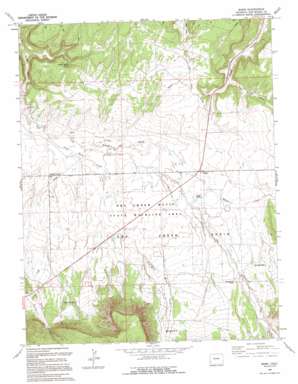
Basin Topo Map Colorado
To zoom in, hover over the map of Basin
USGS Topo Quad 38108a5 - 1:24,000 scale
| Topo Map Name: | Basin |
| USGS Topo Quad ID: | 38108a5 |
| Print Size: | ca. 21 1/4" wide x 27" high |
| Southeast Coordinates: | 38° N latitude / 108.5° W longitude |
| Map Center Coordinates: | 38.0625° N latitude / 108.5625° W longitude |
| U.S. State: | CO |
| Filename: | o38108a5.jpg |
| Download Map JPG Image: | Basin topo map 1:24,000 scale |
| Map Type: | Topographic |
| Topo Series: | 7.5´ |
| Map Scale: | 1:24,000 |
| Source of Map Images: | United States Geological Survey (USGS) |
| Alternate Map Versions: |
Basin CO 1964, updated 1968 Download PDF Buy paper map Basin CO 1964, updated 1968 Download PDF Buy paper map Basin CO 1964, updated 1980 Download PDF Buy paper map Basin CO 1964, updated 1991 Download PDF Buy paper map Basin CO 1994, updated 1994 Download PDF Buy paper map Basin CO 2010 Download PDF Buy paper map Basin CO 2013 Download PDF Buy paper map Basin CO 2016 Download PDF Buy paper map |
1:24,000 Topo Quads surrounding Basin
> Back to 38108a1 at 1:100,000 scale
> Back to 38108a1 at 1:250,000 scale
> Back to U.S. Topo Maps home
Basin topo map: Gazetteer
Basin: Areas
The Burn elevation 1961m 6433′Basin: Basins
Dry Creek Basin elevation 1957m 6420′Basin: Lakes
Cottonwood Pond elevation 2046m 6712′Basin: Parks
Dry Creek Basin State Wildlife Area elevation 2027m 6650′Basin: Populated Places
Basin elevation 1990m 6528′Beards Corner elevation 1941m 6368′
Basin: Springs
Poison Spider Spring elevation 1972m 6469′Basin: Streams
Dead Horse Creek elevation 1928m 6325′Nelson Creek elevation 1940m 6364′
Basin: Valleys
Desert Claim Arroyo elevation 2074m 6804′East Broad Canyon elevation 1957m 6420′
Pony Draw elevation 2118m 6948′
Basin digital topo map on disk
Buy this Basin topo map showing relief, roads, GPS coordinates and other geographical features, as a high-resolution digital map file on DVD:


