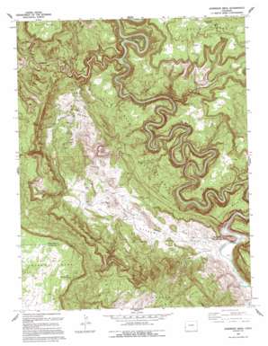
Anderson Mesa Topo Map Colorado
To zoom in, hover over the map of Anderson Mesa
USGS Topo Quad 38108b8 - 1:24,000 scale
| Topo Map Name: | Anderson Mesa |
| USGS Topo Quad ID: | 38108b8 |
| Print Size: | ca. 21 1/4" wide x 27" high |
| Southeast Coordinates: | 38.125° N latitude / 108.875° W longitude |
| Map Center Coordinates: | 38.1875° N latitude / 108.9375° W longitude |
| U.S. State: | CO |
| Filename: | o38108b8.jpg |
| Download Map JPG Image: | Anderson Mesa topo map 1:24,000 scale |
| Map Type: | Topographic |
| Topo Series: | 7.5´ |
| Map Scale: | 1:24,000 |
| Source of Map Images: | United States Geological Survey (USGS) |
| Alternate Map Versions: |
Anderson Mesa CO 1949, updated 1955 Download PDF Buy paper map Anderson Mesa CO 1949, updated 1955 Download PDF Buy paper map Anderson Mesa CO 1950 Download PDF Buy paper map Anderson Mesa CO 1960, updated 1961 Download PDF Buy paper map Anderson Mesa CO 1960, updated 1961 Download PDF Buy paper map Anderson Mesa CO 1960, updated 1971 Download PDF Buy paper map Anderson Mesa CO 1960, updated 1986 Download PDF Buy paper map Anderson Mesa CO 1994, updated 1994 Download PDF Buy paper map Anderson Mesa CO 2011 Download PDF Buy paper map Anderson Mesa CO 2013 Download PDF Buy paper map Anderson Mesa CO 2016 Download PDF Buy paper map |
1:24,000 Topo Quads surrounding Anderson Mesa
> Back to 38108a1 at 1:100,000 scale
> Back to 38108a1 at 1:250,000 scale
> Back to U.S. Topo Maps home
Anderson Mesa topo map: Gazetteer
Anderson Mesa: Basins
Silveys Pocket elevation 1622m 5321′Anderson Mesa: Bends
Muleshoe Bend elevation 1700m 5577′Anderson Mesa: Mines
American Eagle Mine elevation 1704m 5590′Big Medicine Mine elevation 1839m 6033′
Canyon View Mine elevation 1768m 5800′
Edith Irene Mine elevation 1705m 5593′
Expectant One Mine elevation 1748m 5734′
Faultless Mine elevation 1832m 6010′
Franklin Mine elevation 1638m 5374′
Grassy Hill Mine elevation 1869m 6131′
Gyp Mine elevation 1715m 5626′
Happy Jack Mine elevation 1768m 5800′
Happy Joe Mine elevation 1832m 6010′
Joker Mine elevation 1718m 5636′
Jumbo Mine elevation 1676m 5498′
Little Jewel Mine elevation 1745m 5725′
Modeen Mine elevation 1648m 5406′
Morning Star Mine elevation 1613m 5291′
Navajo Mine elevation 1831m 6007′
Pooch Mine elevation 1817m 5961′
Probable Mine elevation 1776m 5826′
Radar Mine elevation 1944m 6377′
Redbird Mine elevation 1648m 5406′
Regis Mine elevation 2048m 6719′
Sky Lark Mine elevation 1885m 6184′
Sunset Mine elevation 1881m 6171′
Terrible Brook Number One Mine elevation 1885m 6184′
Terrible Mine elevation 1718m 5636′
The Raven Mine elevation 1751m 5744′
Watchman Mine elevation 1772m 5813′
White Cow Mine elevation 1816m 5958′
Whiz Bang Mine elevation 1942m 6371′
Yorktown Mine elevation 1854m 6082′
Anderson Mesa: Reservoirs
Muleshoe Bend Reservoir elevation 1981m 6499′Anderson Mesa: Springs
Cabin Spring elevation 1717m 5633′East Island Mesa Spring elevation 2106m 6909′
Skein Spring elevation 1995m 6545′
Anderson Mesa: Streams
Coyote Wash elevation 1548m 5078′Leach Creek elevation 1575m 5167′
Little Gypsum Creek elevation 1622m 5321′
Anderson Mesa: Summits
Anderson Mesa elevation 1924m 6312′Andys Mesa elevation 1911m 6269′
Buck Mesa elevation 1766m 5793′
The Hat elevation 1898m 6227′
Anderson Mesa: Valleys
Coyote Wash elevation 1548m 5078′Little Gypsum Valley elevation 1630m 5347′
Spring Canyon elevation 1551m 5088′
Anderson Mesa digital topo map on disk
Buy this Anderson Mesa topo map showing relief, roads, GPS coordinates and other geographical features, as a high-resolution digital map file on DVD:


