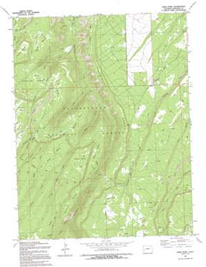
Davis Point Topo Map Colorado
To zoom in, hover over the map of Davis Point
USGS Topo Quad 38108d2 - 1:24,000 scale
| Topo Map Name: | Davis Point |
| USGS Topo Quad ID: | 38108d2 |
| Print Size: | ca. 21 1/4" wide x 27" high |
| Southeast Coordinates: | 38.375° N latitude / 108.125° W longitude |
| Map Center Coordinates: | 38.4375° N latitude / 108.1875° W longitude |
| U.S. State: | CO |
| Filename: | o38108d2.jpg |
| Download Map JPG Image: | Davis Point topo map 1:24,000 scale |
| Map Type: | Topographic |
| Topo Series: | 7.5´ |
| Map Scale: | 1:24,000 |
| Source of Map Images: | United States Geological Survey (USGS) |
| Alternate Map Versions: |
Davis Point CO 1973, updated 1976 Download PDF Buy paper map Davis Point CO 1973, updated 1976 Download PDF Buy paper map Davis Point CO 1973, updated 1985 Download PDF Buy paper map Davis Point CO 1994, updated 1994 Download PDF Buy paper map Davis Point CO 2011 Download PDF Buy paper map Davis Point CO 2013 Download PDF Buy paper map Davis Point CO 2016 Download PDF Buy paper map |
| FStopo: | US Forest Service topo Davis Point is available: Download FStopo PDF Download FStopo TIF |
1:24,000 Topo Quads surrounding Davis Point
> Back to 38108a1 at 1:100,000 scale
> Back to 38108a1 at 1:250,000 scale
> Back to U.S. Topo Maps home
Davis Point topo map: Gazetteer
Davis Point: Basins
Davis Basin elevation 2391m 7844′East Basin elevation 2376m 7795′
Horseshoe Basin elevation 2343m 7687′
Traver Basin elevation 2277m 7470′
Davis Point: Benches
Goddard Bench elevation 2597m 8520′Roubideau Bench elevation 2293m 7522′
Davis Point: Flats
Murray Park elevation 2356m 7729′Davis Point: Lakes
Moore Basin Lake elevation 2255m 7398′Davis Point: Plains
Uncompahgre Plateau elevation 2603m 8540′Davis Point: Ridges
Ashley Ridge elevation 2584m 8477′Davis Point: Streams
Al Wright Creek elevation 2007m 6584′Beach Creek elevation 2432m 7979′
Bull Creek elevation 2025m 6643′
Christie Creek elevation 2523m 8277′
East Bull Creek elevation 2427m 7962′
Goddard Creek elevation 2411m 7910′
Grays Creek elevation 2488m 8162′
Long Creek elevation 1989m 6525′
Terrible Creek elevation 2173m 7129′
Traver Creek elevation 1914m 6279′
Davis Point: Summits
Davis Point elevation 2545m 8349′Oak Hill elevation 2578m 8458′
Pine Mesa elevation 2637m 8651′
Davis Point: Trails
Coal Bank Trail elevation 2409m 7903′Rouvideau Trail elevation 2659m 8723′
Transfer Trail elevation 2391m 7844′
Traver Trail elevation 2315m 7595′
Davis Point digital topo map on disk
Buy this Davis Point topo map showing relief, roads, GPS coordinates and other geographical features, as a high-resolution digital map file on DVD:


