Moore Mesa Topo Map Colorado
To zoom in, hover over the map of Moore Mesa
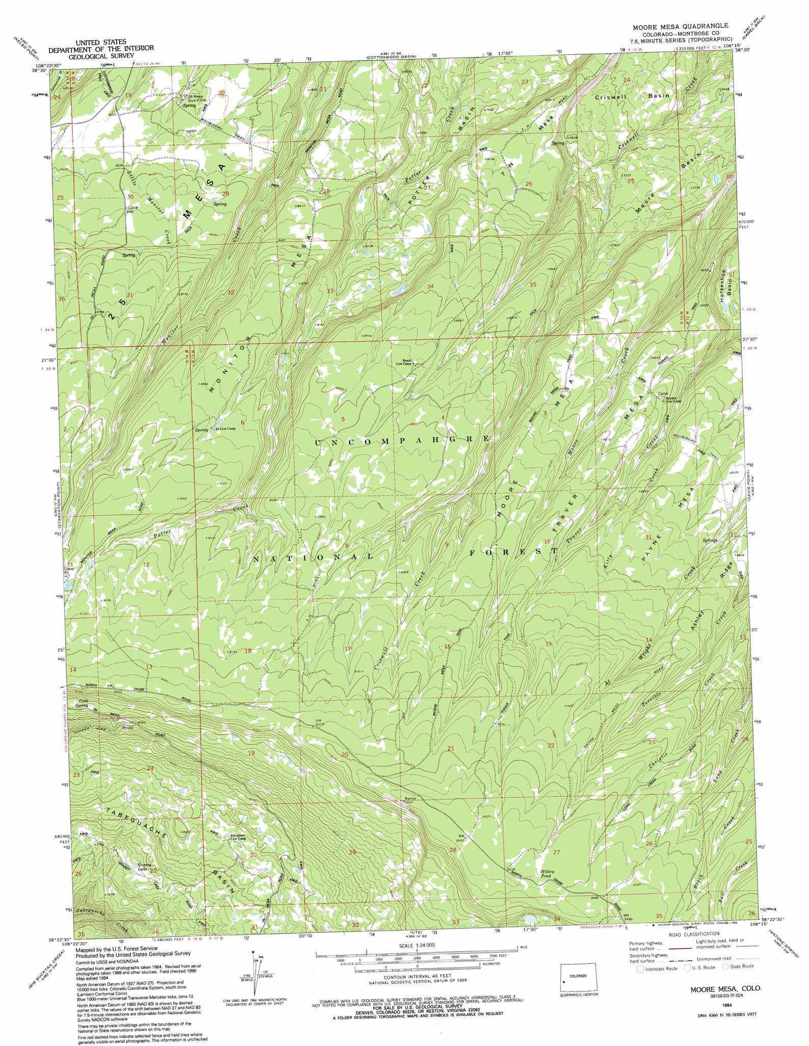
USGS Topo Quad 38108d3 - 1:24,000 scale
| Topo Map Name: | Moore Mesa |
| USGS Topo Quad ID: | 38108d3 |
| Print Size: | ca. 21 1/4" wide x 27" high |
| Southeast Coordinates: | 38.375° N latitude / 108.25° W longitude |
| Map Center Coordinates: | 38.4375° N latitude / 108.3125° W longitude |
| U.S. State: | CO |
| Filename: | o38108d3.jpg |
| Download Map JPG Image: | Moore Mesa topo map 1:24,000 scale |
| Map Type: | Topographic |
| Topo Series: | 7.5´ |
| Map Scale: | 1:24,000 |
| Source of Map Images: | United States Geological Survey (USGS) |
| Alternate Map Versions: |
Moore Mesa CO 1973, updated 1976 Download PDF Buy paper map Moore Mesa CO 1973, updated 1976 Download PDF Buy paper map Moore Mesa CO 1994, updated 1994 Download PDF Buy paper map Moore Mesa CO 2011 Download PDF Buy paper map Moore Mesa CO 2013 Download PDF Buy paper map Moore Mesa CO 2016 Download PDF Buy paper map |
| FStopo: | US Forest Service topo Moore Mesa is available: Download FStopo PDF Download FStopo TIF |
1:24,000 Topo Quads surrounding Moore Mesa
Keith Creek |
Escalante Forks |
Good Point |
Roubideau |
Delta |
Snipe Mountain |
Kelso Point |
Cottonwood Basin |
Camel Back |
Hoovers Corner |
Windy Point |
Starvation Point |
Moore Mesa |
Davis Point |
Dry Creek Basin |
Nucla |
Big Bucktail Creek |
Ute |
Antone Spring |
Pryor Creek |
Naturita |
Redvale |
Norwood |
Sanborn Park |
Hotchkiss Reservoir |
> Back to 38108a1 at 1:100,000 scale
> Back to 38108a1 at 1:250,000 scale
> Back to U.S. Topo Maps home
Moore Mesa topo map: Gazetteer
Moore Mesa: Basins
Moore Basin elevation 2346m 7696′Moore Mesa: Lakes
Grassy Lake elevation 2333m 7654′Hilkey Pond elevation 2903m 9524′
Moore Mesa: Springs
Cobb Spring elevation 2733m 8966′Moore Mesa: Streams
Kitty Creek elevation 2540m 8333′Moore Mesa: Summits
25 Mesa elevation 2541m 8336′7 N Mesa elevation 2489m 8166′
Monitor Mesa elevation 2762m 9061′
Moore Mesa elevation 2784m 9133′
Payne Mesa elevation 2723m 8933′
Traver Mesa elevation 2753m 9032′
Moore Mesa: Trails
Monitor Mesa Trail elevation 2568m 8425′Moore Mesa Trail elevation 2711m 8894′
Roubideau Trail elevation 2642m 8667′
Moore Mesa digital topo map on disk
Buy this Moore Mesa topo map showing relief, roads, GPS coordinates and other geographical features, as a high-resolution digital map file on DVD: