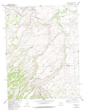
Roubideau Topo Map Colorado
To zoom in, hover over the map of Roubideau
USGS Topo Quad 38108f2 - 1:24,000 scale
| Topo Map Name: | Roubideau |
| USGS Topo Quad ID: | 38108f2 |
| Print Size: | ca. 21 1/4" wide x 27" high |
| Southeast Coordinates: | 38.625° N latitude / 108.125° W longitude |
| Map Center Coordinates: | 38.6875° N latitude / 108.1875° W longitude |
| U.S. State: | CO |
| Filename: | o38108f2.jpg |
| Download Map JPG Image: | Roubideau topo map 1:24,000 scale |
| Map Type: | Topographic |
| Topo Series: | 7.5´ |
| Map Scale: | 1:24,000 |
| Source of Map Images: | United States Geological Survey (USGS) |
| Alternate Map Versions: |
Roubideau CO 1969, updated 1972 Download PDF Buy paper map Roubideau CO 1969, updated 1972 Download PDF Buy paper map Roubideau CO 1969, updated 1981 Download PDF Buy paper map Roubideau CO 1969, updated 1991 Download PDF Buy paper map Roubideau CO 2010 Download PDF Buy paper map Roubideau CO 2013 Download PDF Buy paper map Roubideau CO 2016 Download PDF Buy paper map |
1:24,000 Topo Quads surrounding Roubideau
> Back to 38108e1 at 1:100,000 scale
> Back to 38108a1 at 1:250,000 scale
> Back to U.S. Topo Maps home
Roubideau topo map: Gazetteer
Roubideau: Canals
F N F Lateral elevation 1514m 4967′Roubideau: Dams
Porter Retention Dam elevation 1730m 5675′Roubideau: Gaps
The Narrows elevation 1735m 5692′Roubideau: Parks
Cactus Park elevation 1621m 5318′Roubideau: Reservoirs
Club Gulch Reservoir elevation 1645m 5396′Shortcut Reservoir elevation 1729m 5672′
Twentyfive Mesa Reservoir elevation 1679m 5508′
Roubideau: Springs
Negro Spring Number 1 elevation 1557m 5108′Negro Spring Number 2 elevation 1577m 5173′
Roubideau: Streams
Alkali Creek elevation 1475m 4839′Buttermilk Creek elevation 1516m 4973′
Cottonwood Creek elevation 1500m 4921′
Potter Creek elevation 1588m 5209′
Roubideau Creek elevation 1485m 4872′
Seep Creek elevation 1485m 4872′
Roubideau: Valleys
Club Gulch elevation 1492m 4895′Grade Gulch elevation 1760m 5774′
Kelso Gulch elevation 1556m 5104′
Negro Gulch elevation 1483m 4865′
Potter Canyon elevation 1585m 5200′
Roubideau digital topo map on disk
Buy this Roubideau topo map showing relief, roads, GPS coordinates and other geographical features, as a high-resolution digital map file on DVD:


