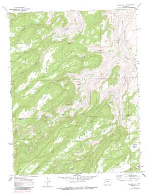
Good Point Topo Map Colorado
To zoom in, hover over the map of Good Point
USGS Topo Quad 38108f3 - 1:24,000 scale
| Topo Map Name: | Good Point |
| USGS Topo Quad ID: | 38108f3 |
| Print Size: | ca. 21 1/4" wide x 27" high |
| Southeast Coordinates: | 38.625° N latitude / 108.25° W longitude |
| Map Center Coordinates: | 38.6875° N latitude / 108.3125° W longitude |
| U.S. State: | CO |
| Filename: | o38108f3.jpg |
| Download Map JPG Image: | Good Point topo map 1:24,000 scale |
| Map Type: | Topographic |
| Topo Series: | 7.5´ |
| Map Scale: | 1:24,000 |
| Source of Map Images: | United States Geological Survey (USGS) |
| Alternate Map Versions: |
Good Point CO 1969, updated 1973 Download PDF Buy paper map Good Point CO 1969, updated 1973 Download PDF Buy paper map Good Point CO 1969, updated 1985 Download PDF Buy paper map Good Point CO 2010 Download PDF Buy paper map Good Point CO 2013 Download PDF Buy paper map Good Point CO 2016 Download PDF Buy paper map |
1:24,000 Topo Quads surrounding Good Point
> Back to 38108e1 at 1:100,000 scale
> Back to 38108a1 at 1:250,000 scale
> Back to U.S. Topo Maps home
Good Point topo map: Gazetteer
Good Point: Basins
Stone Basin elevation 1875m 6151′Good Point: Cliffs
Black Point elevation 2131m 6991′Escalante Rim elevation 1659m 5442′
Little Black Point elevation 2165m 7103′
Good Point: Flats
Tatum Park elevation 2112m 6929′Good Point: Populated Places
Keyhole elevation 1626m 5334′Good Point: Reservoirs
Dry Mesa Reservoir Number 2 elevation 2015m 6610′Stone Basin Reservoir elevation 1868m 6128′
Good Point: Ridges
Camp Ridge elevation 1956m 6417′Sowbelly Ridge elevation 2044m 6706′
Tatum Ridge elevation 2113m 6932′
Good Point: Springs
Alum Spring elevation 2142m 7027′Caps Spring elevation 1699m 5574′
Cottonwood Spring elevation 1797m 5895′
Porter Spring elevation 1966m 6450′
Good Point: Streams
Dry Fork Escalante Creek elevation 1513m 4963′Good Point: Summits
Little Mesa elevation 2205m 7234′Good Point: Trails
Gunnison Trail elevation 1965m 6446′McCarthy Trail elevation 2104m 6902′
Good Point: Valleys
Black Point Draw elevation 1769m 5803′Boyce Gulch elevation 1544m 5065′
Tatum Draw elevation 1612m 5288′
Tatum Gulch elevation 1582m 5190′
West Palmer Gulch elevation 1826m 5990′
Good Point digital topo map on disk
Buy this Good Point topo map showing relief, roads, GPS coordinates and other geographical features, as a high-resolution digital map file on DVD:


