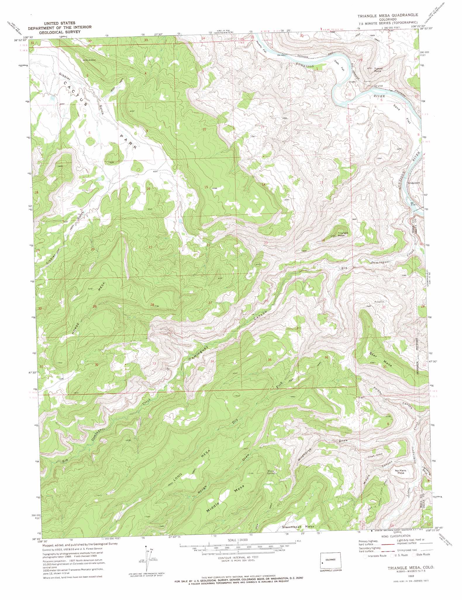
Triangle Mesa Topo Map Colorado
To zoom in, hover over the map of Triangle Mesa
USGS Topo Quad 38108g4 - 1:24,000 scale
| Topo Map Name: | Triangle Mesa |
| USGS Topo Quad ID: | 38108g4 |
| Print Size: | ca. 21 1/4" wide x 27" high |
| Southeast Coordinates: | 38.75° N latitude / 108.375° W longitude |
| Map Center Coordinates: | 38.8125° N latitude / 108.4375° W longitude |
| U.S. State: | CO |
| Filename: | o38108g4.jpg |
| Download Map JPG Image: | Triangle Mesa topo map 1:24,000 scale |
| Map Type: | Topographic |
| Topo Series: | 7.5´ |
| Map Scale: | 1:24,000 |
| Source of Map Images: | United States Geological Survey (USGS) |
| Alternate Map Versions: |
Triangle Mesa CO 1969, updated 1972 Download PDF Buy paper map Triangle Mesa CO 2011 Download PDF Buy paper map Triangle Mesa CO 2013 Download PDF Buy paper map Triangle Mesa CO 2016 Download PDF Buy paper map |
1:24,000 Topo Quads surrounding Triangle Mesa
Colorado National Monument |
Grand Junction |
Clifton |
Palisade |
Lands End |
Glade Park |
Island Mesa |
Whitewater |
Juniata Reservoir |
Indian Point |
Snyder Flats |
Jacks Canyon |
Triangle Mesa |
Dominguez |
Point Creek |
Casto Reservoir |
Keith Creek |
Escalante Forks |
Good Point |
Roubideau |
Uncompahgre Butte |
Snipe Mountain |
Kelso Point |
Cottonwood Basin |
Camel Back |
> Back to 38108e1 at 1:100,000 scale
> Back to 38108a1 at 1:250,000 scale
> Back to U.S. Topo Maps home
Triangle Mesa topo map: Gazetteer
Triangle Mesa: Cliffs
Tunnel Point elevation 1699m 5574′Triangle Mesa: Flats
Cactus Park elevation 1904m 6246′Dads Flat elevation 1445m 4740′
Poverty Flat elevation 1434m 4704′
Sand Flat elevation 1445m 4740′
Triangle Mesa: Populated Places
Bridgeport elevation 1448m 4750′Triangle Mesa: Springs
Warm Spring elevation 2013m 6604′Triangle Mesa: Streams
Big Dominguez Creek elevation 1453m 4767′Dry Fork Big Dominguez Creek elevation 1546m 5072′
Little Dominguez Creek elevation 1463m 4799′
Triangle Mesa: Summits
Flat Iron elevation 1872m 6141′Horse Mesa elevation 2294m 7526′
Ninemile Hill elevation 2052m 6732′
No Mans Mesa elevation 1748m 5734′
Star Mesa elevation 2004m 6574′
Triangle Mesa elevation 1899m 6230′
Triangle Mesa: Valleys
Dominguez Canyon elevation 1453m 4767′Lightening Basin elevation 1627m 5337′
Middle Canyon elevation 1624m 5328′
Poison Canyon elevation 1583m 5193′
Rough Draw elevation 1729m 5672′
Wildhorse Draw elevation 1601m 5252′
Triangle Mesa digital topo map on disk
Buy this Triangle Mesa topo map showing relief, roads, GPS coordinates and other geographical features, as a high-resolution digital map file on DVD: