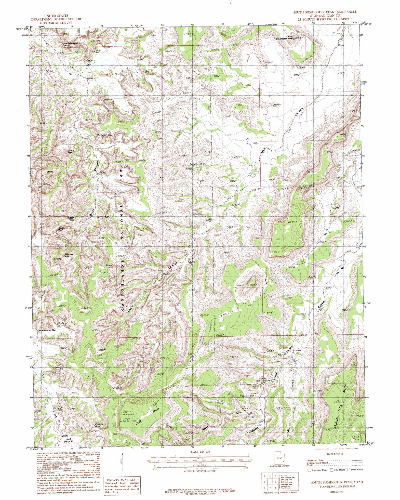
South Six-Shooter Peak Topo Map Utah
To zoom in, hover over the map of South Six-Shooter Peak
USGS Topo Quad 38109a6 - 1:24,000 scale
| Topo Map Name: | South Six-Shooter Peak |
| USGS Topo Quad ID: | 38109a6 |
| Print Size: | ca. 21 1/4" wide x 27" high |
| Southeast Coordinates: | 38° N latitude / 109.625° W longitude |
| Map Center Coordinates: | 38.0625° N latitude / 109.6875° W longitude |
| U.S. State: | UT |
| Filename: | o38109a6.jpg |
| Download Map JPG Image: | South Six-Shooter Peak topo map 1:24,000 scale |
| Map Type: | Topographic |
| Topo Series: | 7.5´ |
| Map Scale: | 1:24,000 |
| Source of Map Images: | United States Geological Survey (USGS) |
| Alternate Map Versions: |
Carlisle 4 SW UT 1954, updated 1954 Download PDF Buy paper map South Six-Shooter Peak UT 1987, updated 1987 Download PDF Buy paper map South Six-Shooter Peak UT 1997, updated 2002 Download PDF Buy paper map South Six-shooter Peak UT 2010 Download PDF Buy paper map South Six-shooter Peak UT 2014 Download PDF Buy paper map |
1:24,000 Topo Quads surrounding South Six-Shooter Peak
Turks Head |
Monument Basin |
Lockhart Basin |
Eightmile Rock |
La Sal Junction |
Spanish Bottom |
The Loop |
North Six-Shooter Peak |
Harts Point North |
Hatch Rock |
Cross Canyon |
Druid Arch |
South Six-Shooter Peak |
Harts Point South |
Photograph Gap |
Fable Valley |
House Park Butte |
Cathedral Butte |
Shay Mountain |
Monticello Lake |
Warren Canyon |
Poison Canyon |
Chippean Rocks |
Mount Linnaeus |
Abajo Peak |
> Back to 38109a1 at 1:100,000 scale
> Back to 38108a1 at 1:250,000 scale
> Back to U.S. Topo Maps home
South Six-Shooter Peak topo map: Gazetteer
South Six-Shooter Peak: Arches
Anchor Arch elevation 1638m 5374′Castle Arch elevation 1728m 5669′
Caterpillar Arch elevation 1726m 5662′
Fisheye Arch elevation 1849m 6066′
Fortress Arch elevation 1683m 5521′
Gothic Arch elevation 1644m 5393′
Gunsight Natural Bridge elevation 1864m 6115′
Hand Hold Arch elevation 1658m 5439′
Long Arch elevation 1840m 6036′
Natural Arch elevation 1799m 5902′
Paul Bunyans Potty elevation 1618m 5308′
South Six-Shooter Peak: Pillars
Thirteen Faces elevation 1671m 5482′South Six-Shooter Peak: Streams
West Fork Lavender Creek elevation 1657m 5436′South Six-Shooter Peak: Summits
South Sixshooter Peak elevation 1855m 6085′South Six-Shooter Peak: Valleys
Davis Canyon elevation 1572m 5157′Dry Fork Canyon elevation 1630m 5347′
South Six-Shooter Peak digital topo map on disk
Buy this South Six-Shooter Peak topo map showing relief, roads, GPS coordinates and other geographical features, as a high-resolution digital map file on DVD: