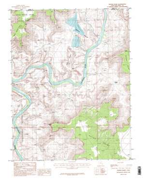
Shafer Basin Topo Map Utah
To zoom in, hover over the map of Shafer Basin
USGS Topo Quad 38109d6 - 1:24,000 scale
| Topo Map Name: | Shafer Basin |
| USGS Topo Quad ID: | 38109d6 |
| Print Size: | ca. 21 1/4" wide x 27" high |
| Southeast Coordinates: | 38.375° N latitude / 109.625° W longitude |
| Map Center Coordinates: | 38.4375° N latitude / 109.6875° W longitude |
| U.S. State: | UT |
| Filename: | o38109d6.jpg |
| Download Map JPG Image: | Shafer Basin topo map 1:24,000 scale |
| Map Type: | Topographic |
| Topo Series: | 7.5´ |
| Map Scale: | 1:24,000 |
| Source of Map Images: | United States Geological Survey (USGS) |
| Alternate Map Versions: |
Carlisle 1 NW UT 1954, updated 1956 Download PDF Buy paper map Shafer Basin UT 1987, updated 1987 Download PDF Buy paper map Shafer Basin UT 1987, updated 1987 Download PDF Buy paper map Shafer Basin UT 2010 Download PDF Buy paper map Shafer Basin UT 2014 Download PDF Buy paper map |
1:24,000 Topo Quads surrounding Shafer Basin
> Back to 38109a1 at 1:100,000 scale
> Back to 38108a1 at 1:250,000 scale
> Back to U.S. Topo Maps home
Shafer Basin topo map: Gazetteer
Shafer Basin: Basins
Shafer Basin elevation 1236m 4055′Shafer Basin: Capes
Dead Horse Point elevation 1827m 5994′Shafer Basin: Dams
TexasGulf Potash Pond One A Dam elevation 1331m 4366′TexasGulf Potash Pond Three A Dam elevation 1285m 4215′
TexasGulf Potash Pond Three B Dam elevation 1282m 4206′
TexasGulf Potash Pond Two G Dam elevation 1309m 4294′
TexasGulf Potash Pond Two N Dam elevation 1287m 4222′
Shafer Basin: Gaps
Hurrah Pass elevation 1462m 4796′Shafer Basin: Reservoirs
TexasGulf Potash Pond One A elevation 1331m 4366′TexasGulf Potash Pond Three A elevation 1285m 4215′
TexasGulf Potash Pond Three B elevation 1282m 4206′
TexasGulf Potash Pond Two G elevation 1309m 4294′
TexasGulf Potash Pond Two N elevation 1287m 4222′
Shafer Basin: Springs
Dripping Spring elevation 1257m 4124′Shafer Basin: Summits
Pyramid Butte elevation 1572m 5157′United Nations Tablet (not official) elevation 1750m 5741′
Shafer Basin: Valleys
Little Bridge Canyon elevation 1201m 3940′Little Bridge Canyon elevation 1200m 3937′
Musselman Canyon elevation 1223m 4012′
Shafer Basin digital topo map on disk
Buy this Shafer Basin topo map showing relief, roads, GPS coordinates and other geographical features, as a high-resolution digital map file on DVD:


