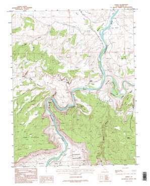
Dewey Topo Map Utah
To zoom in, hover over the map of Dewey
USGS Topo Quad 38109g3 - 1:24,000 scale
| Topo Map Name: | Dewey |
| USGS Topo Quad ID: | 38109g3 |
| Print Size: | ca. 21 1/4" wide x 27" high |
| Southeast Coordinates: | 38.75° N latitude / 109.25° W longitude |
| Map Center Coordinates: | 38.8125° N latitude / 109.3125° W longitude |
| U.S. State: | UT |
| Filename: | o38109g3.jpg |
| Download Map JPG Image: | Dewey topo map 1:24,000 scale |
| Map Type: | Topographic |
| Topo Series: | 7.5´ |
| Map Scale: | 1:24,000 |
| Source of Map Images: | United States Geological Survey (USGS) |
| Alternate Map Versions: |
Mt. Waas 2 SE UT 1955, updated 1956 Download PDF Buy paper map Dewey UT 1985, updated 1986 Download PDF Buy paper map Dewey UT 1985, updated 1995 Download PDF Buy paper map Dewey UT 2010 Download PDF Buy paper map Dewey UT 2014 Download PDF Buy paper map |
1:24,000 Topo Quads surrounding Dewey
> Back to 38109e1 at 1:100,000 scale
> Back to 38108a1 at 1:250,000 scale
> Back to U.S. Topo Maps home
Dewey topo map: Gazetteer
Dewey: Arches
Arrowhead Arch elevation 1390m 4560′Dewey: Bends
Hittle Bottom elevation 1247m 4091′Hotel Bottom elevation 1261m 4137′
Lake Bottom elevation 1254m 4114′
McGraw Bottom elevation 1254m 4114′
Ninemile Bottom elevation 1290m 4232′
Roberts Bottom elevation 1255m 4117′
Dewey: Bridges
Dewey Bridge elevation 1248m 4094′Dewey: Populated Places
Dewey elevation 1262m 4140′Dewey: Springs
Buck Spring elevation 1293m 4242′Cowskin Spring elevation 1537m 5042′
Dewey Spring elevation 1287m 4222′
Tar Bucket elevation 1467m 4812′
Dewey: Streams
Dolores River elevation 1338m 4389′Dewey: Summits
Hotel Mesa elevation 1457m 4780′Little Pinto Mesa elevation 1521m 4990′
Mule Shoe elevation 1413m 4635′
Roberts Mesa elevation 1362m 4468′
Dewey: Valleys
Bull Canyon elevation 1337m 4386′Cisco Wash elevation 1257m 4124′
Cow Canyon elevation 1264m 4146′
Owl Draw elevation 1257m 4124′
Pole Canyon elevation 1253m 4110′
Professor Valley elevation 1260m 4133′
Sagers Wash elevation 1253m 4110′
Trail Canyon elevation 1330m 4363′
Tub Canyon elevation 1380m 4527′
Waring Canyon elevation 1253m 4110′
Yellow Jacket Canyon elevation 1303m 4274′
Dewey digital topo map on disk
Buy this Dewey topo map showing relief, roads, GPS coordinates and other geographical features, as a high-resolution digital map file on DVD:


