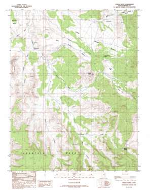
Steele Butte Topo Map Utah
To zoom in, hover over the map of Steele Butte
USGS Topo Quad 38110a8 - 1:24,000 scale
| Topo Map Name: | Steele Butte |
| USGS Topo Quad ID: | 38110a8 |
| Print Size: | ca. 21 1/4" wide x 27" high |
| Southeast Coordinates: | 38° N latitude / 110.875° W longitude |
| Map Center Coordinates: | 38.0625° N latitude / 110.9375° W longitude |
| U.S. State: | UT |
| Filename: | o38110a8.jpg |
| Download Map JPG Image: | Steele Butte topo map 1:24,000 scale |
| Map Type: | Topographic |
| Topo Series: | 7.5´ |
| Map Scale: | 1:24,000 |
| Source of Map Images: | United States Geological Survey (USGS) |
| Alternate Map Versions: |
Steele Butte UT 1986, updated 1987 Download PDF Buy paper map Steele Butte UT 2010 Download PDF Buy paper map Steele Butte UT 2014 Download PDF Buy paper map |
1:24,000 Topo Quads surrounding Steele Butte
> Back to 38110a1 at 1:100,000 scale
> Back to 38110a1 at 1:250,000 scale
> Back to U.S. Topo Maps home
Steele Butte topo map: Gazetteer
Steele Butte: Benches
Pete Steele Bench elevation 1815m 5954′Steele Butte: Flats
Apple Brush Flat elevation 1865m 6118′Dugout Flat elevation 1961m 6433′
Sage Flat elevation 2054m 6738′
Steele Butte: Gaps
Stevens Narrows elevation 1925m 6315′Steele Butte: Springs
Dave Teeples Spring elevation 1909m 6263′Dripping Rock Seep elevation 1684m 5524′
Mud Spring elevation 1869m 6131′
Steele Butte: Streams
South Creek elevation 1671m 5482′Steele Butte: Summits
Steele Butte elevation 2095m 6873′Tarantula Mesa elevation 2099m 6886′
Steele Butte: Valleys
Coleman Hollow Wash elevation 1671m 5482′Five Canyon elevation 1696m 5564′
Poison Wash elevation 1647m 5403′
Seven Canyon elevation 1730m 5675′
Steele Butte digital topo map on disk
Buy this Steele Butte topo map showing relief, roads, GPS coordinates and other geographical features, as a high-resolution digital map file on DVD:


