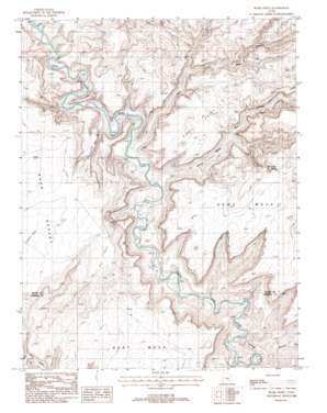
Burr Point Topo Map Utah
To zoom in, hover over the map of Burr Point
USGS Topo Quad 38110b4 - 1:24,000 scale
| Topo Map Name: | Burr Point |
| USGS Topo Quad ID: | 38110b4 |
| Print Size: | ca. 21 1/4" wide x 27" high |
| Southeast Coordinates: | 38.125° N latitude / 110.375° W longitude |
| Map Center Coordinates: | 38.1875° N latitude / 110.4375° W longitude |
| U.S. State: | UT |
| Filename: | o38110b4.jpg |
| Download Map JPG Image: | Burr Point topo map 1:24,000 scale |
| Map Type: | Topographic |
| Topo Series: | 7.5´ |
| Map Scale: | 1:24,000 |
| Source of Map Images: | United States Geological Survey (USGS) |
| Alternate Map Versions: |
Orange Cliffs 3 NW UT 1953, updated 1954 Download PDF Buy paper map Burr Point UT 1988, updated 1988 Download PDF Buy paper map Burr Point UT 1988, updated 1988 Download PDF Buy paper map Burr Point UT 2010 Download PDF Buy paper map Burr Point UT 2014 Download PDF Buy paper map |
1:24,000 Topo Quads surrounding Burr Point
> Back to 38110a1 at 1:100,000 scale
> Back to 38110a1 at 1:250,000 scale
> Back to U.S. Topo Maps home
Burr Point topo map: Gazetteer
Burr Point: Areas
Gilex elevation 1251m 4104′Burr Point: Capes
Burr Point elevation 1697m 5567′Burr Point: Ridges
Gibex Point elevation 1523m 4996′Burr Point: Springs
Sams Mesa Spring elevation 1611m 5285′Burr Point: Summits
Bert Mesa elevation 1677m 5501′Sams Mesa elevation 1588m 5209′
Burr Point: Valleys
Happy Canyon elevation 1187m 3894′Larry Canyon elevation 1235m 4051′
Sams Mesa Box Canyon elevation 1258m 4127′
Twin Corral Box Canyon elevation 1233m 4045′
Burr Point digital topo map on disk
Buy this Burr Point topo map showing relief, roads, GPS coordinates and other geographical features, as a high-resolution digital map file on DVD:


