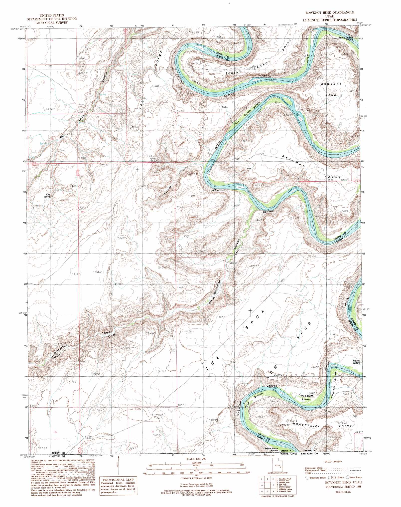
Bowknot Bend Topo Map Utah
To zoom in, hover over the map of Bowknot Bend
USGS Topo Quad 38110e1 - 1:24,000 scale
| Topo Map Name: | Bowknot Bend |
| USGS Topo Quad ID: | 38110e1 |
| Print Size: | ca. 21 1/4" wide x 27" high |
| Southeast Coordinates: | 38.5° N latitude / 110° W longitude |
| Map Center Coordinates: | 38.5625° N latitude / 110.0625° W longitude |
| U.S. State: | UT |
| Filename: | o38110e1.jpg |
| Download Map JPG Image: | Bowknot Bend topo map 1:24,000 scale |
| Map Type: | Topographic |
| Topo Series: | 7.5´ |
| Map Scale: | 1:24,000 |
| Source of Map Images: | United States Geological Survey (USGS) |
| Alternate Map Versions: |
Tidwell 4 SE UT 1952, updated 1954 Download PDF Buy paper map Bowknot Bend UT 1988, updated 1988 Download PDF Buy paper map Bowknot Bend UT 1996, updated 2002 Download PDF Buy paper map Bowknot Bend UT 2011 Download PDF Buy paper map Bowknot Bend UT 2014 Download PDF Buy paper map |
1:24,000 Topo Quads surrounding Bowknot Bend
Horse Bench West |
Horse Bench East |
Green River Se |
Dee Pass |
Valley City |
Spring Canyon |
Moonshine Wash |
Tenmile Point |
Dubinky Wash |
Jug Rock |
Jacks Knob |
Keg Knoll |
Bowknot Bend |
Mineral Canyon |
The Knoll |
Whitbeck Knoll |
Sugarloaf Butte |
Horsethief Canyon |
Upheaval Dome |
Musselman Arch |
Robbers Roost Flats |
Head Spur |
Cleopatras Chair |
Turks Head |
Monument Basin |
> Back to 38110e1 at 1:100,000 scale
> Back to 38110a1 at 1:250,000 scale
> Back to U.S. Topo Maps home
Bowknot Bend topo map: Gazetteer
Bowknot Bend: Bends
Bowknot Bend elevation 1314m 4311′Horsethief Bottom elevation 1207m 3959′
Oak Bottom elevation 1212m 3976′
Point Bottom elevation 1208m 3963′
Spring Canyon Bottom elevation 1207m 3959′
Tidwell Bottom elevation 1202m 3943′
Woodruff Bottom elevation 1207m 3959′
Bowknot Bend: Ridges
Keg Point elevation 1476m 4842′Spring Point Canyon elevation 1449m 4753′
Bowknot Bend: Springs
Keg Spring elevation 1454m 4770′Bowknot Bend: Streams
Barrier Creek elevation 1205m 3953′Bowknot Bend: Trails
Horsethief Trail elevation 1269m 4163′Bowknot Bend: Valleys
Horseshoe Canyon elevation 1225m 4019′Spring Canyon elevation 1205m 3953′
Spring Canyon elevation 1205m 3953′
Twomile Canyon elevation 1205m 3953′
Bowknot Bend digital topo map on disk
Buy this Bowknot Bend topo map showing relief, roads, GPS coordinates and other geographical features, as a high-resolution digital map file on DVD: