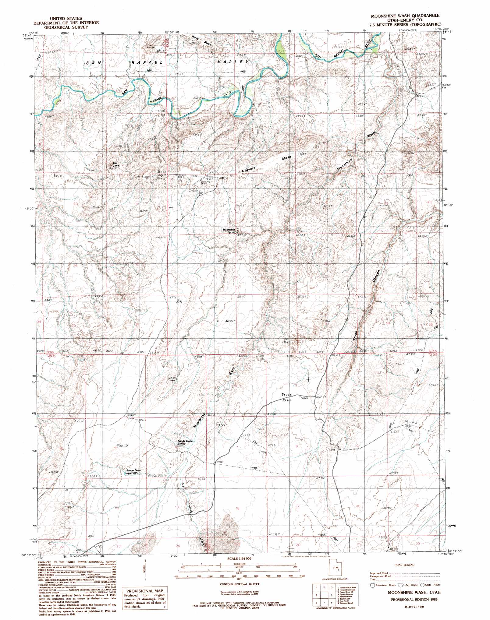
Moonshine Wash Topo Map Utah
To zoom in, hover over the map of Moonshine Wash
USGS Topo Quad 38110f2 - 1:24,000 scale
| Topo Map Name: | Moonshine Wash |
| USGS Topo Quad ID: | 38110f2 |
| Print Size: | ca. 21 1/4" wide x 27" high |
| Southeast Coordinates: | 38.625° N latitude / 110.125° W longitude |
| Map Center Coordinates: | 38.6875° N latitude / 110.1875° W longitude |
| U.S. State: | UT |
| Filename: | o38110f2.jpg |
| Download Map JPG Image: | Moonshine Wash topo map 1:24,000 scale |
| Map Type: | Topographic |
| Topo Series: | 7.5´ |
| Map Scale: | 1:24,000 |
| Source of Map Images: | United States Geological Survey (USGS) |
| Alternate Map Versions: |
Moonshine Wash UT 1986, updated 1987 Download PDF Buy paper map Moonshine Wash UT 2010 Download PDF Buy paper map Moonshine Wash UT 2014 Download PDF Buy paper map |
1:24,000 Topo Quads surrounding Moonshine Wash
Spotted Wolf Canyon |
Jessies Twist |
Green River |
Green River Ne |
Hatch Mesa |
Greasewood Draw |
Horse Bench West |
Horse Bench East |
Green River Se |
Dee Pass |
Crows Nest Spring |
Spring Canyon |
Moonshine Wash |
Tenmile Point |
Dubinky Wash |
The Flat Tops |
Jacks Knob |
Keg Knoll |
Bowknot Bend |
Mineral Canyon |
Point Of Rocks East |
Whitbeck Knoll |
Sugarloaf Butte |
Horsethief Canyon |
Upheaval Dome |
> Back to 38110e1 at 1:100,000 scale
> Back to 38110a1 at 1:250,000 scale
> Back to U.S. Topo Maps home
Moonshine Wash topo map: Gazetteer
Moonshine Wash: Basins
Saucer Basin elevation 1405m 4609′Moonshine Wash: Reservoirs
Saucer Basin Reservoir elevation 1457m 4780′Moonshine Wash: Springs
Moonshine Spring elevation 1390m 4560′Saddle Horse Spring elevation 1429m 4688′
Moonshine Wash: Summits
Gruvers Mesa elevation 1472m 4829′The Cone elevation 1410m 4625′
Moonshine Wash: Valleys
Moonshine Wash elevation 1245m 4084′North Spring Wash elevation 1425m 4675′
San Rafael Valley elevation 1244m 4081′
Spring Canyon elevation 1247m 4091′
Moonshine Wash digital topo map on disk
Buy this Moonshine Wash topo map showing relief, roads, GPS coordinates and other geographical features, as a high-resolution digital map file on DVD: