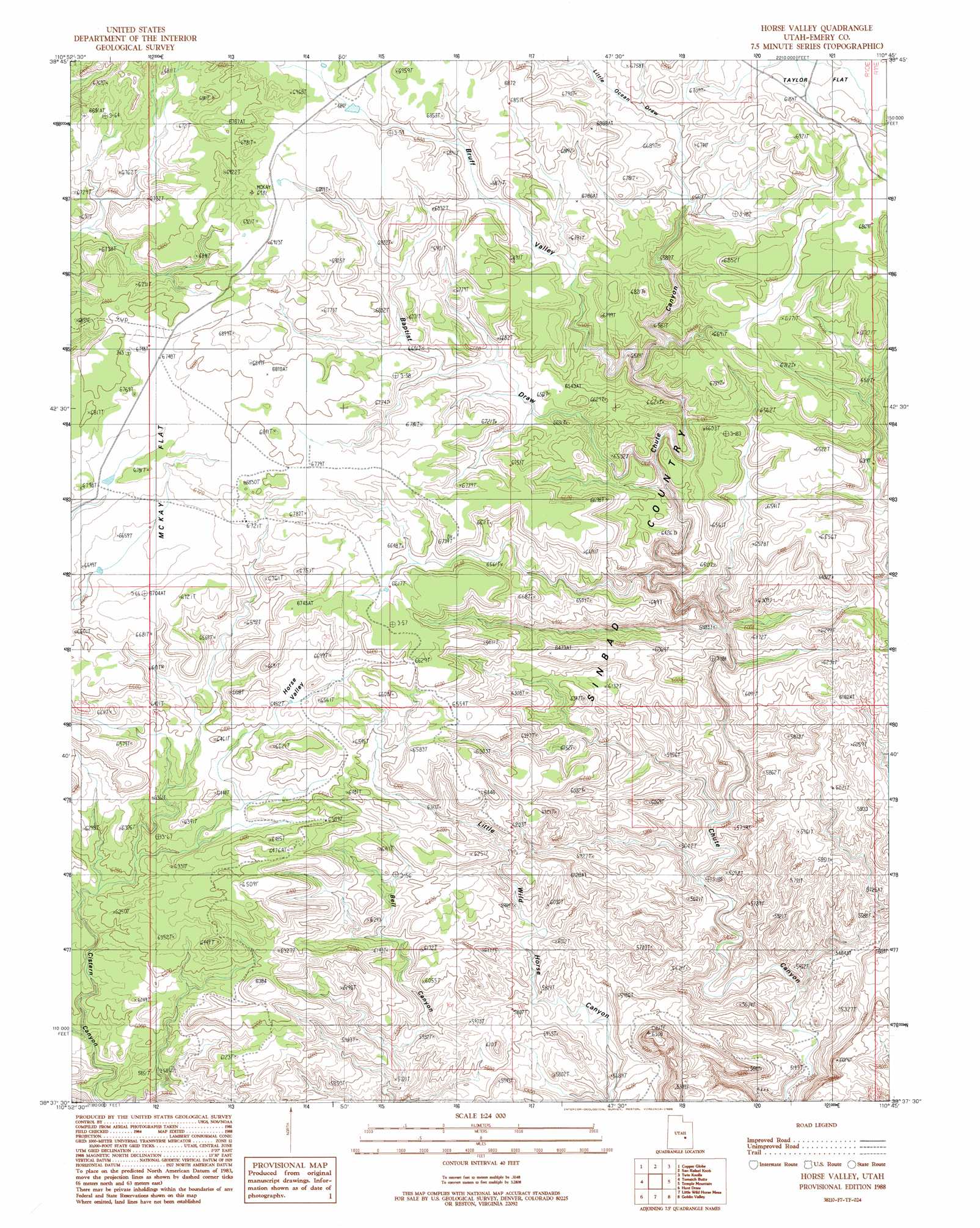
Horse Valley Topo Map Utah
To zoom in, hover over the map of Horse Valley
USGS Topo Quad 38110f7 - 1:24,000 scale
| Topo Map Name: | Horse Valley |
| USGS Topo Quad ID: | 38110f7 |
| Print Size: | ca. 21 1/4" wide x 27" high |
| Southeast Coordinates: | 38.625° N latitude / 110.75° W longitude |
| Map Center Coordinates: | 38.6875° N latitude / 110.8125° W longitude |
| U.S. State: | UT |
| Filename: | o38110f7.jpg |
| Download Map JPG Image: | Horse Valley topo map 1:24,000 scale |
| Map Type: | Topographic |
| Topo Series: | 7.5´ |
| Map Scale: | 1:24,000 |
| Source of Map Images: | United States Geological Survey (USGS) |
| Alternate Map Versions: |
Stinking Spring Creek 3 NE UT 1954 Download PDF Buy paper map Horse Valley UT 1988, updated 1988 Download PDF Buy paper map Horse Valley UT 1988, updated 1988 Download PDF Buy paper map Horse Valley UT 2010 Download PDF Buy paper map Horse Valley UT 2014 Download PDF Buy paper map |
1:24,000 Topo Quads surrounding Horse Valley
Short Canyon |
Sid And Charley |
The Blocks |
The Wickiup |
Drowned Hole Draw |
Big Bend Draw |
Copper Globe |
San Rafael Knob |
Twin Knolls |
Arsons Garden |
Ireland Mesa |
Tomsich Butte |
Horse Valley |
Temple Mountain |
Old Woman Wash |
The Frying Pan |
Hunt Draw |
Little Wild Horse Mesa |
Goblin Valley |
Gilson Butte |
Caine Springs |
Factory Butte |
Skyline Rim |
The Notch |
Point Of Rocks West |
> Back to 38110e1 at 1:100,000 scale
> Back to 38110a1 at 1:250,000 scale
> Back to U.S. Topo Maps home
Horse Valley topo map: Gazetteer
Horse Valley: Basins
Horse Valley elevation 1974m 6476′Horse Valley: Flats
East McKay Flat (historical) elevation 2033m 6669′McKay Flat elevation 2060m 6758′
Horse Valley: Valleys
Baptist Draw elevation 1899m 6230′Bruff Valley elevation 1948m 6391′
Little Ocean Draw elevation 2009m 6591′
Horse Valley digital topo map on disk
Buy this Horse Valley topo map showing relief, roads, GPS coordinates and other geographical features, as a high-resolution digital map file on DVD: