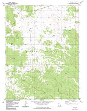
Twin Knolls Topo Map Utah
To zoom in, hover over the map of Twin Knolls
USGS Topo Quad 38110g6 - 1:24,000 scale
| Topo Map Name: | Twin Knolls |
| USGS Topo Quad ID: | 38110g6 |
| Print Size: | ca. 21 1/4" wide x 27" high |
| Southeast Coordinates: | 38.75° N latitude / 110.625° W longitude |
| Map Center Coordinates: | 38.8125° N latitude / 110.6875° W longitude |
| U.S. State: | UT |
| Filename: | o38110g6.jpg |
| Download Map JPG Image: | Twin Knolls topo map 1:24,000 scale |
| Map Type: | Topographic |
| Topo Series: | 7.5´ |
| Map Scale: | 1:24,000 |
| Source of Map Images: | United States Geological Survey (USGS) |
| Alternate Map Versions: |
Stinking Spring Creek 1 SW UT 1954 Download PDF Buy paper map Twin Knolls UT 1983, updated 1983 Download PDF Buy paper map Twin Knolls UT 1983, updated 1991 Download PDF Buy paper map Twin Knolls UT 2011 Download PDF Buy paper map Twin Knolls UT 2014 Download PDF Buy paper map |
1:24,000 Topo Quads surrounding Twin Knolls
> Back to 38110e1 at 1:100,000 scale
> Back to 38110a1 at 1:250,000 scale
> Back to U.S. Topo Maps home
Twin Knolls topo map: Gazetteer
Twin Knolls: Areas
Sinbad Country elevation 2054m 6738′Twin Knolls: Flats
Charley Flat elevation 2009m 6591′Home Base elevation 2100m 6889′
Indian Flat elevation 2044m 6706′
Lone Parson Hole elevation 2039m 6689′
Paige Flat elevation 2059m 6755′
Twin Knolls: Ranges
San Rafael Swell elevation 2106m 6909′Twin Knolls: Reservoirs
State Pond elevation 2045m 6709′The Big Pond elevation 2026m 6646′
Woodpile Pond elevation 2050m 6725′
Twin Knolls: Springs
Charley Holes elevation 1990m 6528′Cottonwood Holes elevation 2037m 6683′
Crawford Holes elevation 1986m 6515′
Twin Knolls: Summits
Block Mountain elevation 2265m 7431′Lone Man Butte elevation 2026m 6646′
Twin Knolls elevation 2035m 6676′
Twin Knolls: Valleys
Earls Draw elevation 2076m 6811′Georges Draw elevation 2007m 6584′
Reid Neilson Draw elevation 1968m 6456′
Road Draw elevation 2045m 6709′
Twin Knolls: Wells
Georges Draw Well elevation 2093m 6866′Twin Knolls digital topo map on disk
Buy this Twin Knolls topo map showing relief, roads, GPS coordinates and other geographical features, as a high-resolution digital map file on DVD:


