Caine Springs Topo Map Utah
To zoom in, hover over the map of Caine Springs
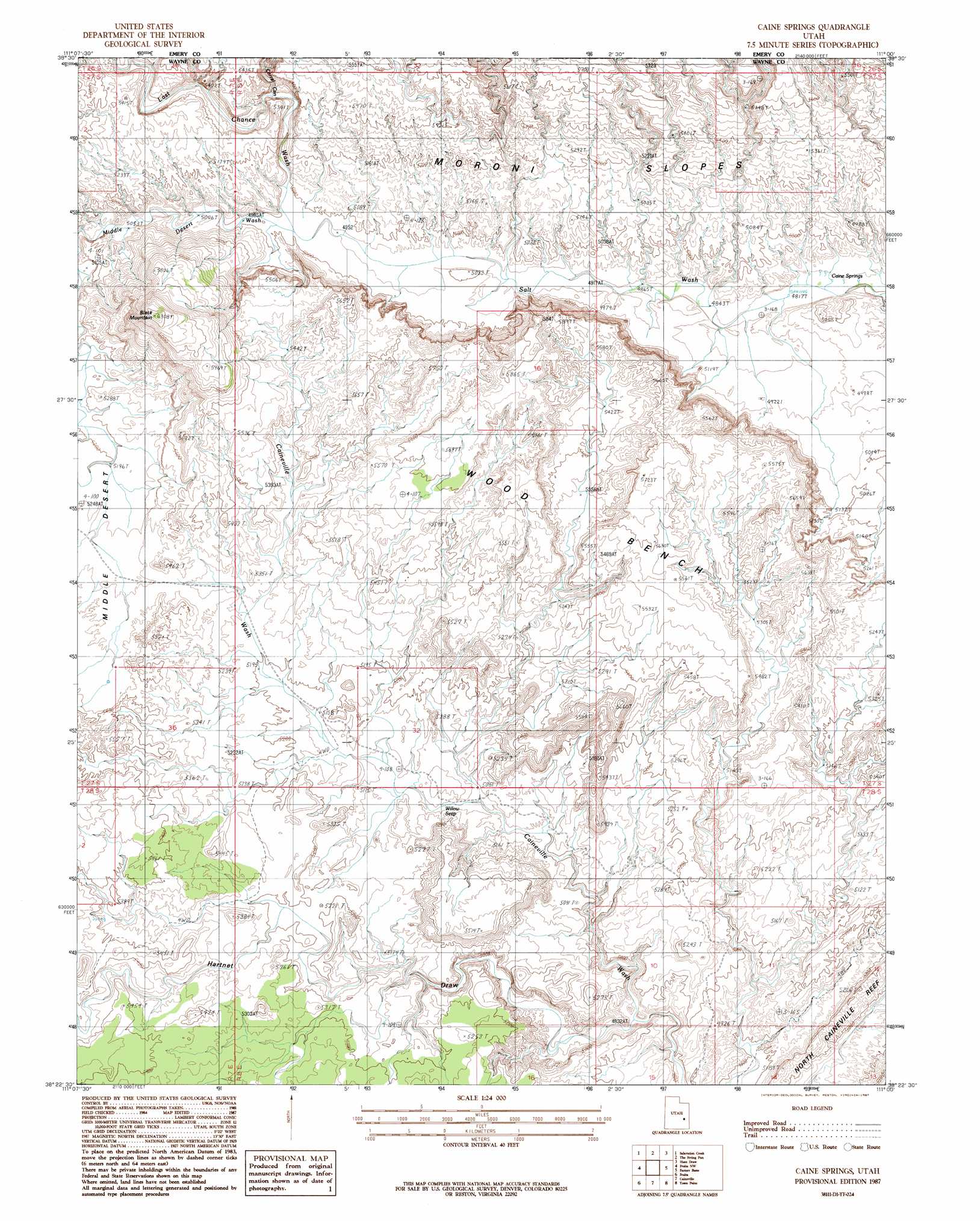
USGS Topo Quad 38111d1 - 1:24,000 scale
| Topo Map Name: | Caine Springs |
| USGS Topo Quad ID: | 38111d1 |
| Print Size: | ca. 21 1/4" wide x 27" high |
| Southeast Coordinates: | 38.375° N latitude / 111° W longitude |
| Map Center Coordinates: | 38.4375° N latitude / 111.0625° W longitude |
| U.S. State: | UT |
| Filename: | o38111d1.jpg |
| Download Map JPG Image: | Caine Springs topo map 1:24,000 scale |
| Map Type: | Topographic |
| Topo Series: | 7.5´ |
| Map Scale: | 1:24,000 |
| Source of Map Images: | United States Geological Survey (USGS) |
| Alternate Map Versions: |
Notom 1 NE UT 1954, updated 1957 Download PDF Buy paper map Caine Springs UT 1987, updated 1987 Download PDF Buy paper map Caine Springs UT 2011 Download PDF Buy paper map Caine Springs UT 2014 Download PDF Buy paper map |
1:24,000 Topo Quads surrounding Caine Springs
Willow Springs |
Mussentuchit Flat |
Ireland Mesa |
Tomsich Butte |
Horse Valley |
Solomons Temple |
Salvation Creek |
The Frying Pan |
Hunt Draw |
Little Wild Horse Mesa |
Cathedral Mountain |
Fruita Nw |
Caine Springs |
Factory Butte |
Skyline Rim |
Twin Rocks |
Fruita |
Caineville |
Town Point |
Steamboat Point |
Grover |
Golden Throne |
Notom |
Stevens Mesa |
Dry Lakes Peak |
> Back to 38111a1 at 1:100,000 scale
> Back to 38110a1 at 1:250,000 scale
> Back to U.S. Topo Maps home
Caine Springs topo map: Gazetteer
Caine Springs: Benches
Wood Bench elevation 1659m 5442′Caine Springs: Springs
Caine Springs elevation 1471m 4826′Willow Seep elevation 1548m 5078′
Caine Springs: Summits
Black Mountain elevation 1906m 6253′Caine Springs: Valleys
Corral Canyon elevation 1546m 5072′Hartnet Draw elevation 1471m 4826′
Last Chance Wash elevation 1520m 4986′
Middle Desert Wash elevation 1520m 4986′
Caine Springs digital topo map on disk
Buy this Caine Springs topo map showing relief, roads, GPS coordinates and other geographical features, as a high-resolution digital map file on DVD: