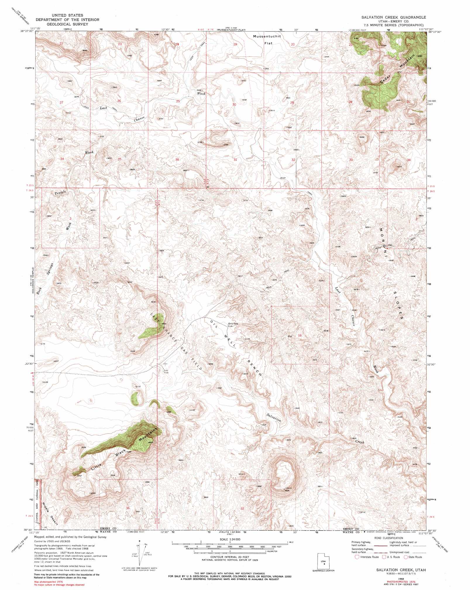
Salvation Creek Topo Map Utah
To zoom in, hover over the map of Salvation Creek
USGS Topo Quad 38111e2 - 1:24,000 scale
| Topo Map Name: | Salvation Creek |
| USGS Topo Quad ID: | 38111e2 |
| Print Size: | ca. 21 1/4" wide x 27" high |
| Southeast Coordinates: | 38.5° N latitude / 111.125° W longitude |
| Map Center Coordinates: | 38.5625° N latitude / 111.1875° W longitude |
| U.S. State: | UT |
| Filename: | o38111e2.jpg |
| Download Map JPG Image: | Salvation Creek topo map 1:24,000 scale |
| Map Type: | Topographic |
| Topo Series: | 7.5´ |
| Map Scale: | 1:24,000 |
| Source of Map Images: | United States Geological Survey (USGS) |
| Alternate Map Versions: |
Salvation Creek UT 1968, updated 1972 Download PDF Buy paper map Salvation Creek UT 2010 Download PDF Buy paper map Salvation Creek UT 2014 Download PDF Buy paper map |
1:24,000 Topo Quads surrounding Salvation Creek
Old Woman Plateau |
Walker Flat |
Mesa Butte |
Big Bend Draw |
Copper Globe |
Johns Peak |
Willow Springs |
Mussentuchit Flat |
Ireland Mesa |
Tomsich Butte |
Geyser Peak |
Solomons Temple |
Salvation Creek |
The Frying Pan |
Hunt Draw |
Flat Top |
Cathedral Mountain |
Fruita Nw |
Caine Springs |
Factory Butte |
Torrey |
Twin Rocks |
Fruita |
Caineville |
Town Point |
> Back to 38111e1 at 1:100,000 scale
> Back to 38110a1 at 1:250,000 scale
> Back to U.S. Topo Maps home
Salvation Creek topo map: Gazetteer
Salvation Creek: Benches
Oil Well Bench elevation 1868m 6128′Salvation Creek: Oilfields
Last Chance Gas Field elevation 1820m 5971′Salvation Creek: Summits
Factory Butte elevation 1947m 6387′Little Black Mountains elevation 2012m 6601′
Salvation Creek: Valleys
Carlyle Wash elevation 1645m 5396′Rock Springs Wash elevation 1737m 5698′
Temple Wash elevation 1708m 5603′
Salvation Creek digital topo map on disk
Buy this Salvation Creek topo map showing relief, roads, GPS coordinates and other geographical features, as a high-resolution digital map file on DVD: