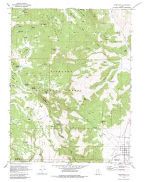
Koosharem Topo Map Utah
To zoom in, hover over the map of Koosharem
USGS Topo Quad 38111e8 - 1:24,000 scale
| Topo Map Name: | Koosharem |
| USGS Topo Quad ID: | 38111e8 |
| Print Size: | ca. 21 1/4" wide x 27" high |
| Southeast Coordinates: | 38.5° N latitude / 111.875° W longitude |
| Map Center Coordinates: | 38.5625° N latitude / 111.9375° W longitude |
| U.S. State: | UT |
| Filename: | o38111e8.jpg |
| Download Map JPG Image: | Koosharem topo map 1:24,000 scale |
| Map Type: | Topographic |
| Topo Series: | 7.5´ |
| Map Scale: | 1:24,000 |
| Source of Map Images: | United States Geological Survey (USGS) |
| Alternate Map Versions: |
Koosharem UT 1968, updated 1972 Download PDF Buy paper map Koosharem UT 1968, updated 1980 Download PDF Buy paper map Koosharem UT 2001, updated 2003 Download PDF Buy paper map Koosharem UT 2011 Download PDF Buy paper map Koosharem UT 2014 Download PDF Buy paper map |
| FStopo: | US Forest Service topo Koosharem is available: Download FStopo PDF Download FStopo TIF |
1:24,000 Topo Quads surrounding Koosharem
> Back to 38111e1 at 1:100,000 scale
> Back to 38110a1 at 1:250,000 scale
> Back to U.S. Topo Maps home
Koosharem topo map: Gazetteer
Koosharem: Areas
Central Pasture elevation 2944m 9658′Koosharem: Basins
Doe Hole elevation 2879m 9445′Milos Kitchen elevation 2662m 8733′
Koosharem: Canals
Koosharem Canal elevation 2112m 6929′Koosharem: Cliffs
Devils Castle elevation 3236m 10616′Koosharem: Dams
Magleby Dam elevation 2878m 9442′Koosharem: Flats
Central Pasture elevation 2941m 9648′Clover Flat elevation 3030m 9940′
Devils Castle Flat elevation 3089m 10134′
Doe Flat elevation 3234m 10610′
Koosharem: Gaps
Magleby Pass elevation 3201m 10501′Koosharem: Populated Places
Koosharem elevation 2109m 6919′Koosharem: Reservoirs
Magelby Reservoir elevation 2850m 9350′Wood Hollow Reservoir elevation 2293m 7522′
Koosharem: Ridges
Doe Ridge elevation 2983m 9786′Tabernacle Ridge elevation 2939m 9642′
Tenderfoot Ridge elevation 2903m 9524′
Koosharem: Springs
Birch Springs elevation 2219m 7280′Burr Springs elevation 2304m 7559′
Christiersen Spring elevation 2227m 7306′
Kinney Spring elevation 2593m 8507′
Koosharem Pasture Spring elevation 2874m 9429′
Lone Pine Spring elevation 2457m 8061′
Rim Seep elevation 2739m 8986′
Whooton Spring elevation 3158m 10360′
Koosharem: Streams
Birch Creek elevation 2232m 7322′Koosharem Creek elevation 2111m 6925′
Little Creek elevation 2275m 7463′
Thurber Fork elevation 2266m 7434′
Koosharem: Summits
Blue Peak elevation 2595m 8513′Cove Mountain elevation 3260m 10695′
Indian Peak elevation 2990m 9809′
Monument Peak elevation 3368m 11049′
Reservoir Hill elevation 2976m 9763′
Koosharem: Valleys
Rock Hollow elevation 2254m 7395′Wood Hollow elevation 2255m 7398′
Koosharem digital topo map on disk
Buy this Koosharem topo map showing relief, roads, GPS coordinates and other geographical features, as a high-resolution digital map file on DVD:


