Willow Springs Topo Map Utah
To zoom in, hover over the map of Willow Springs
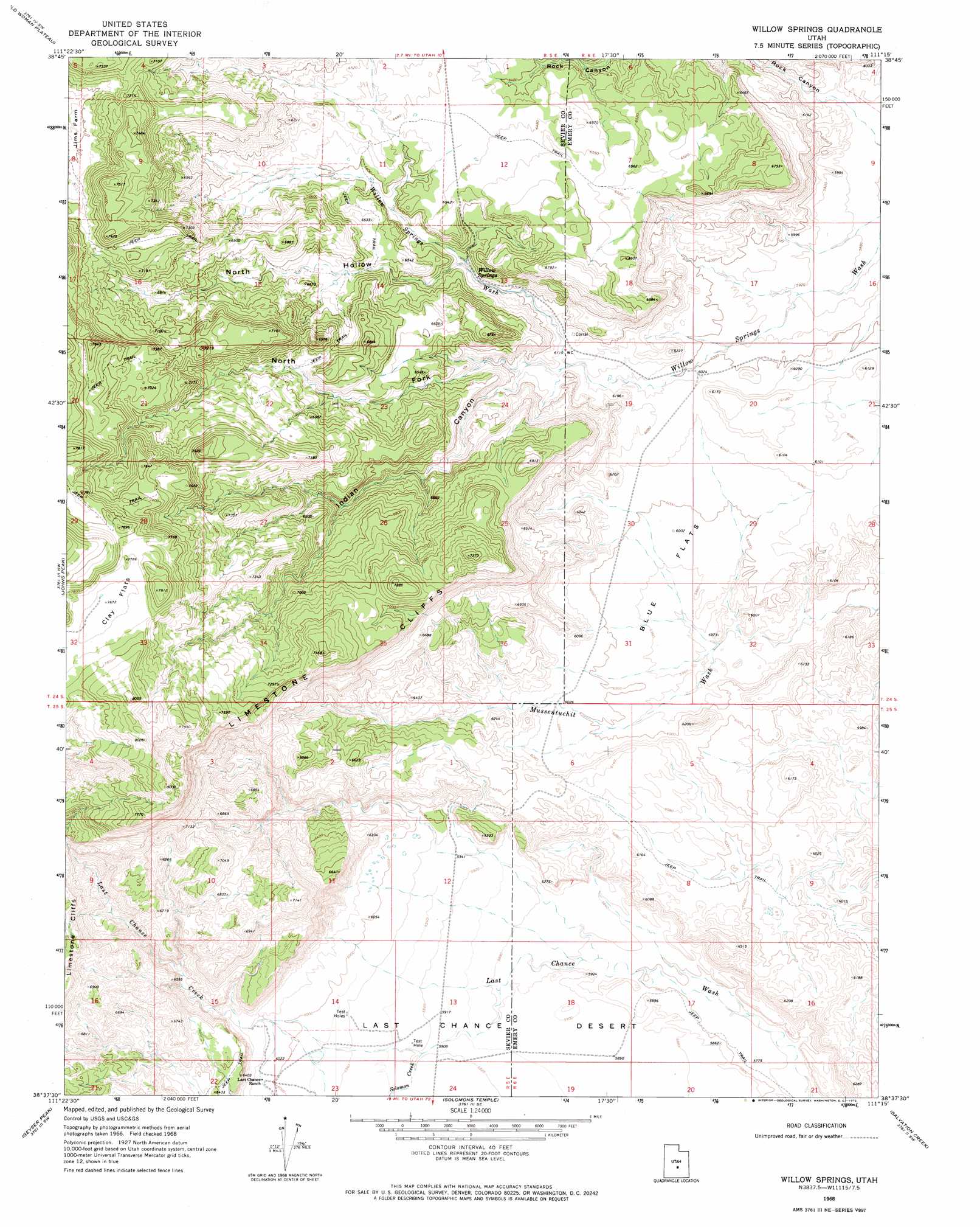
USGS Topo Quad 38111f3 - 1:24,000 scale
| Topo Map Name: | Willow Springs |
| USGS Topo Quad ID: | 38111f3 |
| Print Size: | ca. 21 1/4" wide x 27" high |
| Southeast Coordinates: | 38.625° N latitude / 111.25° W longitude |
| Map Center Coordinates: | 38.6875° N latitude / 111.3125° W longitude |
| U.S. State: | UT |
| Filename: | o38111f3.jpg |
| Download Map JPG Image: | Willow Springs topo map 1:24,000 scale |
| Map Type: | Topographic |
| Topo Series: | 7.5´ |
| Map Scale: | 1:24,000 |
| Source of Map Images: | United States Geological Survey (USGS) |
| Alternate Map Versions: |
Willow Springs UT 1968, updated 1972 Download PDF Buy paper map Willow Springs UT 2010 Download PDF Buy paper map Willow Springs UT 2014 Download PDF Buy paper map |
1:24,000 Topo Quads surrounding Willow Springs
Water Hollow Ridge |
Acord Lakes |
Emery West |
Emery East |
Short Canyon |
Yogo Creek |
Old Woman Plateau |
Walker Flat |
Mesa Butte |
Big Bend Draw |
Hilgard Mountain |
Johns Peak |
Willow Springs |
Mussentuchit Flat |
Ireland Mesa |
Forsyth Reservoir |
Geyser Peak |
Solomons Temple |
Salvation Creek |
The Frying Pan |
Lyman |
Flat Top |
Cathedral Mountain |
Fruita Nw |
Caine Springs |
> Back to 38111e1 at 1:100,000 scale
> Back to 38110a1 at 1:250,000 scale
> Back to U.S. Topo Maps home
Willow Springs topo map: Gazetteer
Willow Springs: Cliffs
Limestone Cliffs elevation 2170m 7119′Willow Springs: Flats
Blue Flats elevation 1819m 5967′Clay Flats elevation 2339m 7673′
Willow Springs: Springs
Willow Springs elevation 1900m 6233′Willow Springs: Streams
Last Chance Creek elevation 1843m 6046′Solomon Creek elevation 1808m 5931′
Willow Springs: Valleys
Indian Canyon elevation 1862m 6108′North Fork Indian Canyon elevation 1881m 6171′
North Hollow elevation 1914m 6279′
Rock Canyon elevation 1791m 5875′
Willow Springs digital topo map on disk
Buy this Willow Springs topo map showing relief, roads, GPS coordinates and other geographical features, as a high-resolution digital map file on DVD: