Short Canyon Topo Map Utah
To zoom in, hover over the map of Short Canyon
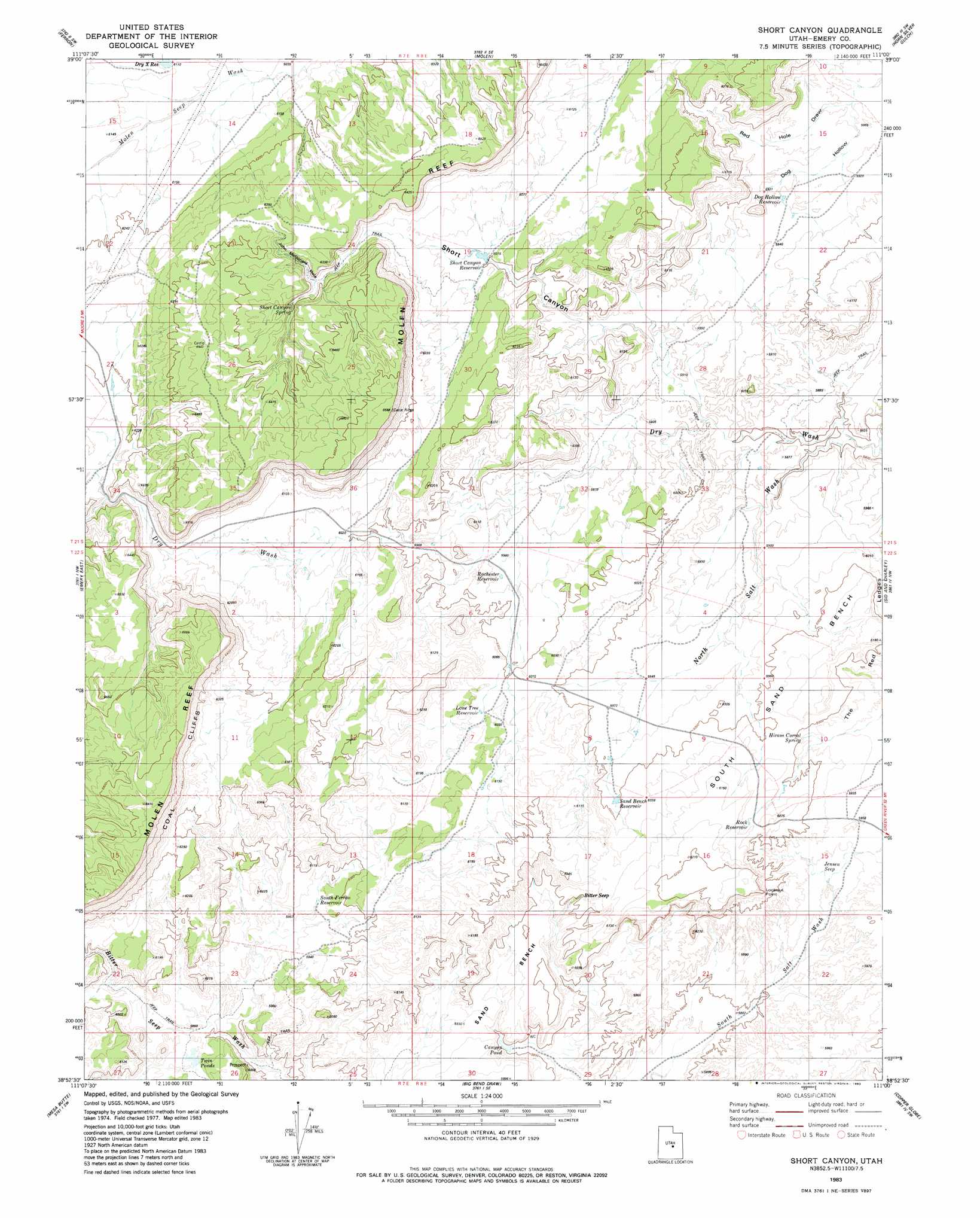
USGS Topo Quad 38111h1 - 1:24,000 scale
| Topo Map Name: | Short Canyon |
| USGS Topo Quad ID: | 38111h1 |
| Print Size: | ca. 21 1/4" wide x 27" high |
| Southeast Coordinates: | 38.875° N latitude / 111° W longitude |
| Map Center Coordinates: | 38.9375° N latitude / 111.0625° W longitude |
| U.S. State: | UT |
| Filename: | o38111h1.jpg |
| Download Map JPG Image: | Short Canyon topo map 1:24,000 scale |
| Map Type: | Topographic |
| Topo Series: | 7.5´ |
| Map Scale: | 1:24,000 |
| Source of Map Images: | United States Geological Survey (USGS) |
| Alternate Map Versions: |
Emery 1 NE UT 1953, updated 1954 Download PDF Buy paper map Short Canyon UT 1983, updated 1983 Download PDF Buy paper map Short Canyon UT 2010 Download PDF Buy paper map Short Canyon UT 2014 Download PDF Buy paper map |
1:24,000 Topo Quads surrounding Short Canyon
Ferron Canyon |
The Cap |
Castle Dale |
Hadden Holes |
Buckhorn Reservoir |
Flagstaff Peak |
Ferron |
Molen |
Horn Silver Gulch |
Sids Mountain |
Emery West |
Emery East |
Short Canyon |
Sid And Charley |
The Blocks |
Walker Flat |
Mesa Butte |
Big Bend Draw |
Copper Globe |
San Rafael Knob |
Willow Springs |
Mussentuchit Flat |
Ireland Mesa |
Tomsich Butte |
Horse Valley |
> Back to 38111e1 at 1:100,000 scale
> Back to 38110a1 at 1:250,000 scale
> Back to U.S. Topo Maps home
Short Canyon topo map: Gazetteer
Short Canyon: Benches
South Sand Bench elevation 1820m 5971′Short Canyon: Cliffs
Lookout Point elevation 1831m 6007′Short Canyon: Reservoirs
Canyon Pond elevation 1763m 5784′Dog Hollow Reservoir elevation 1807m 5928′
Dry X Reservoir elevation 1864m 6115′
Lone Tree Reservoir elevation 1837m 6026′
Rochester Reservoir elevation 1816m 5958′
Rock Reservoir elevation 1851m 6072′
Sand Bench Reservoir elevation 1823m 5980′
Short Canyon Reservoir elevation 1831m 6007′
South Ferron Reservoir elevation 1809m 5935′
Twin Ponds elevation 1782m 5846′
Short Canyon: Ridges
Molen Reef elevation 1961m 6433′Short Canyon: Springs
Bitter Seep elevation 1834m 6017′Hiram Corral Spring elevation 1818m 5964′
Jensen Seep elevation 1796m 5892′
Short Canyon Spring elevation 1888m 6194′
Short Canyon: Valleys
Dog Hollow elevation 1793m 5882′Dry Wash elevation 1758m 5767′
John McDonald Hole elevation 1870m 6135′
Molen Seep Wash elevation 1847m 6059′
Short Canyon elevation 1792m 5879′
Short Canyon digital topo map on disk
Buy this Short Canyon topo map showing relief, roads, GPS coordinates and other geographical features, as a high-resolution digital map file on DVD: