Deep Creek Topo Map Utah
To zoom in, hover over the map of Deep Creek
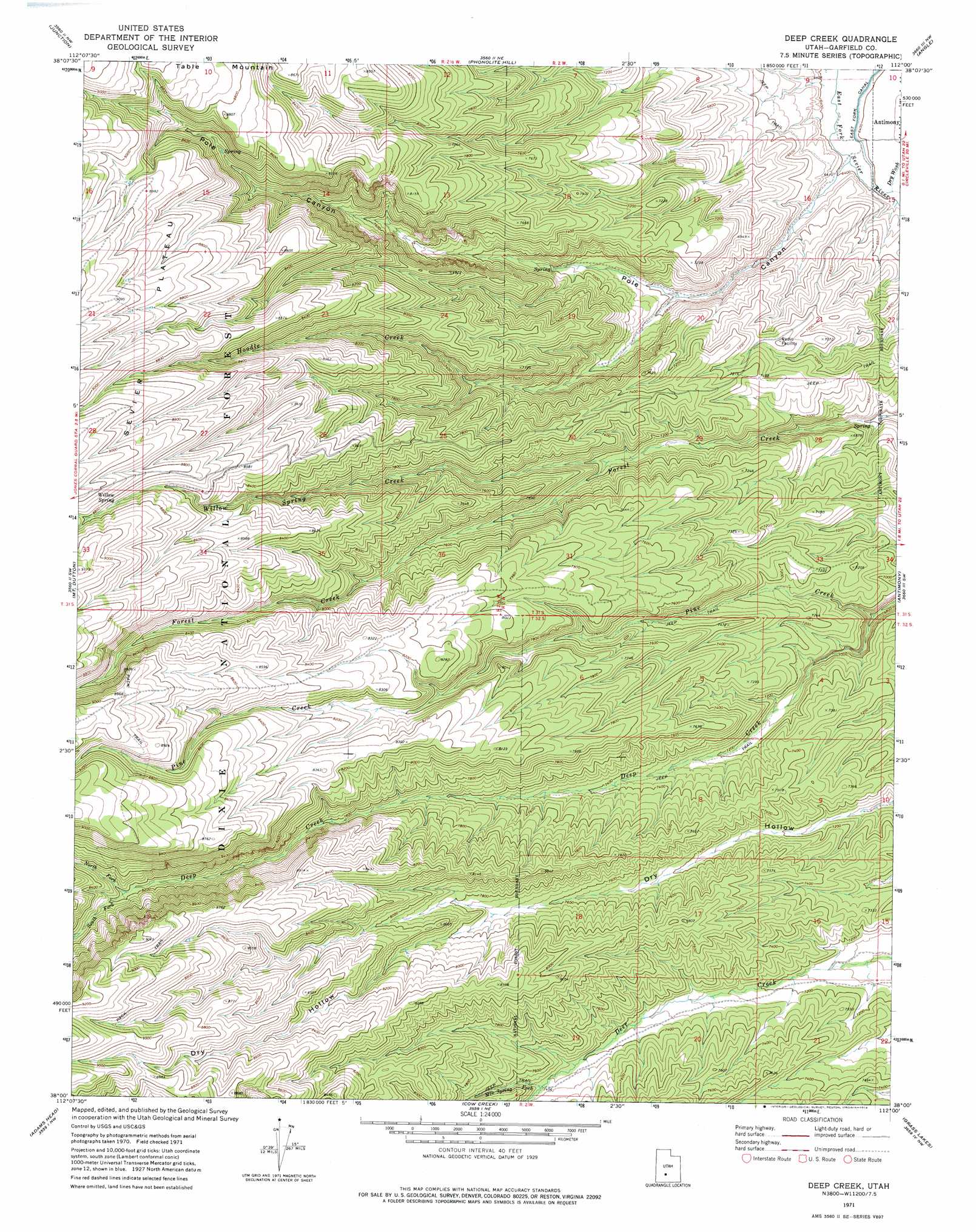
USGS Topo Quad 38112a1 - 1:24,000 scale
| Topo Map Name: | Deep Creek |
| USGS Topo Quad ID: | 38112a1 |
| Print Size: | ca. 21 1/4" wide x 27" high |
| Southeast Coordinates: | 38° N latitude / 112° W longitude |
| Map Center Coordinates: | 38.0625° N latitude / 112.0625° W longitude |
| U.S. State: | UT |
| Filename: | o38112a1.jpg |
| Download Map JPG Image: | Deep Creek topo map 1:24,000 scale |
| Map Type: | Topographic |
| Topo Series: | 7.5´ |
| Map Scale: | 1:24,000 |
| Source of Map Images: | United States Geological Survey (USGS) |
| Alternate Map Versions: |
Deep Creek UT 1971, updated 1974 Download PDF Buy paper map Deep Creek UT 2002, updated 2005 Download PDF Buy paper map Deep Creek UT 2011 Download PDF Buy paper map Deep Creek UT 2014 Download PDF Buy paper map |
| FStopo: | US Forest Service topo Deep Creek is available: Download FStopo PDF Download FStopo TIF |
1:24,000 Topo Quads surrounding Deep Creek
Delano Peak |
Piute Reservoir |
Malmsten Peak |
Parker Knoll |
Jakes Knoll |
Circleville |
Junction |
Phonolite Hill |
Angle |
Flossie Knoll |
Bull Rush Peak |
Mount Dutton |
Deep Creek |
Antimony |
Pollywog Lake |
Blind Spring Mountain |
Adams Head |
Cow Creek |
Grass Lakes |
Barker Reservoir |
Casto Canyon |
Flake Mountain West |
Flake Mountain East |
Sweetwater Creek |
Griffin Point |
> Back to 38112a1 at 1:100,000 scale
> Back to 38112a1 at 1:250,000 scale
> Back to U.S. Topo Maps home
Deep Creek topo map: Gazetteer
Deep Creek: Plains
Sevier Plateau elevation 2696m 8845′Deep Creek: Springs
Willow Spring elevation 2654m 8707′Deep Creek: Streams
Deep Creek elevation 2068m 6784′Hoodle Creek elevation 2055m 6742′
Mountain Spring Fork elevation 2277m 7470′
North Fork Deep Creek elevation 2498m 8195′
South Fork Deep Creek elevation 2498m 8195′
Willow Spring Creek elevation 2240m 7349′
Deep Creek: Valleys
Dry Wash elevation 1955m 6414′Pole Canyon elevation 1949m 6394′
Deep Creek digital topo map on disk
Buy this Deep Creek topo map showing relief, roads, GPS coordinates and other geographical features, as a high-resolution digital map file on DVD: