Fremont Pass Topo Map Utah
To zoom in, hover over the map of Fremont Pass
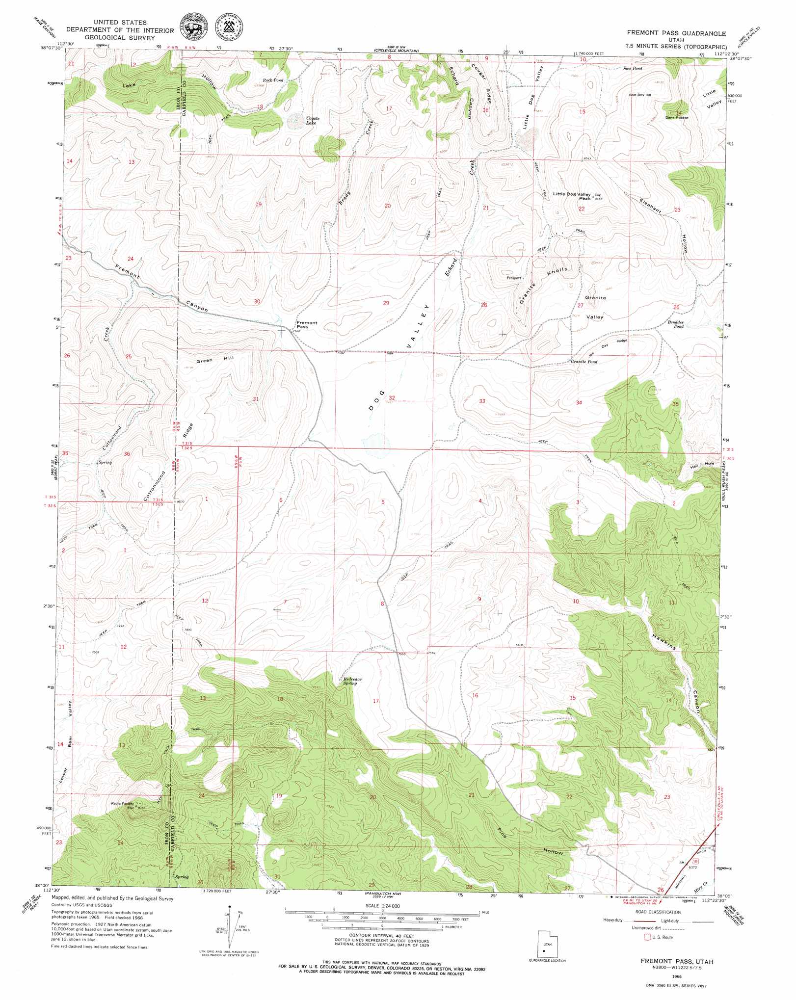
USGS Topo Quad 38112a4 - 1:24,000 scale
| Topo Map Name: | Fremont Pass |
| USGS Topo Quad ID: | 38112a4 |
| Print Size: | ca. 21 1/4" wide x 27" high |
| Southeast Coordinates: | 38° N latitude / 112.375° W longitude |
| Map Center Coordinates: | 38.0625° N latitude / 112.4375° W longitude |
| U.S. State: | UT |
| Filename: | o38112a4.jpg |
| Download Map JPG Image: | Fremont Pass topo map 1:24,000 scale |
| Map Type: | Topographic |
| Topo Series: | 7.5´ |
| Map Scale: | 1:24,000 |
| Source of Map Images: | United States Geological Survey (USGS) |
| Alternate Map Versions: |
Fremont Pass UT 1966, updated 1968 Download PDF Buy paper map Fremont Pass UT 1966, updated 1979 Download PDF Buy paper map Fremont Pass UT 2011 Download PDF Buy paper map Fremont Pass UT 2014 Download PDF Buy paper map |
1:24,000 Topo Quads surrounding Fremont Pass
Beaver |
Beaver Se |
Shelly Baldy Peak |
Delano Peak |
Piute Reservoir |
Greenville Bench |
Kane Canyon |
Circleville Mountain |
Circleville |
Junction |
Buckhorn Flat |
Burnt Peak |
Fremont Pass |
Bull Rush Peak |
Mount Dutton |
Cottonwood Mountain |
Little Creek Peak |
Panguitch Nw |
Blind Spring Mountain |
Adams Head |
Red Creek Reservoir |
Fivemile Ridge |
Panguitch |
Casto Canyon |
Flake Mountain West |
> Back to 38112a1 at 1:100,000 scale
> Back to 38112a1 at 1:250,000 scale
> Back to U.S. Topo Maps home
Fremont Pass topo map: Gazetteer
Fremont Pass: Basins
Granite Valley elevation 2332m 7650′Fremont Pass: Gaps
Fremont Pass elevation 2295m 7529′Fremont Pass: Lakes
Bendder Pond elevation 2295m 7529′Coyote Lake elevation 2533m 8310′
Dry Lake elevation 2399m 7870′
Granite Pond elevation 2302m 7552′
Joes Pond elevation 2396m 7860′
Fremont Pass: Springs
Redcedar Spring elevation 2353m 7719′Fremont Pass: Streams
Brady Creek elevation 2331m 7647′Echard Creek elevation 2278m 7473′
Fremont Pass: Summits
Granite Knolls elevation 2455m 8054′Green Hill elevation 2492m 8175′
Little Dog Valley Peak elevation 2613m 8572′
Fremont Pass: Valleys
Dog Valley elevation 2278m 7473′Echard Canyon elevation 2299m 7542′
Elephant Hollow elevation 2274m 7460′
Little Dog Valley elevation 2399m 7870′
Fremont Pass digital topo map on disk
Buy this Fremont Pass topo map showing relief, roads, GPS coordinates and other geographical features, as a high-resolution digital map file on DVD: