Malmsten Peak Topo Map Utah
To zoom in, hover over the map of Malmsten Peak
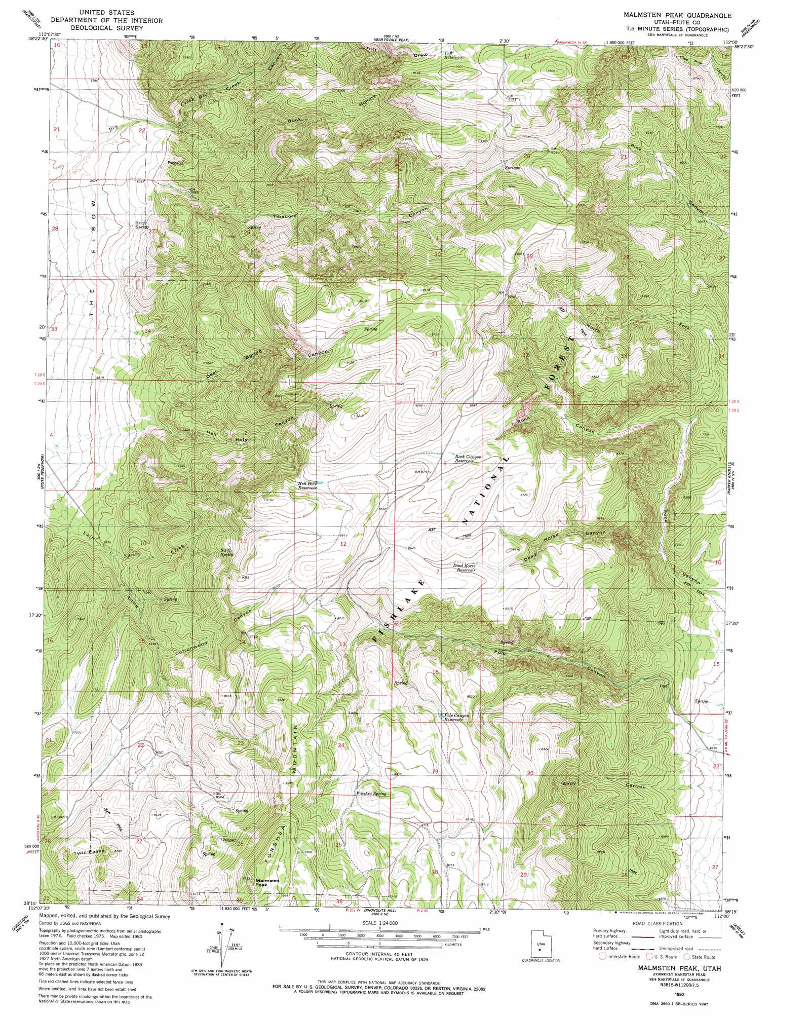
USGS Topo Quad 38112c1 - 1:24,000 scale
| Topo Map Name: | Malmsten Peak |
| USGS Topo Quad ID: | 38112c1 |
| Print Size: | ca. 21 1/4" wide x 27" high |
| Southeast Coordinates: | 38.25° N latitude / 112° W longitude |
| Map Center Coordinates: | 38.3125° N latitude / 112.0625° W longitude |
| U.S. State: | UT |
| Filename: | o38112c1.jpg |
| Download Map JPG Image: | Malmsten Peak topo map 1:24,000 scale |
| Map Type: | Topographic |
| Topo Series: | 7.5´ |
| Map Scale: | 1:24,000 |
| Source of Map Images: | United States Geological Survey (USGS) |
| Alternate Map Versions: |
Mahustan Peak UT 1980, updated 1981 Download PDF Buy paper map Malmsten Peak UT 1980, updated 1983 Download PDF Buy paper map Malmsten Peak UT 2001, updated 2003 Download PDF Buy paper map Malmsten Peak UT 2011 Download PDF Buy paper map Malmsten Peak UT 2014 Download PDF Buy paper map |
| FStopo: | US Forest Service topo Malmsten Peak is available: Download FStopo PDF Download FStopo TIF |
1:24,000 Topo Quads surrounding Malmsten Peak
Marysvale Canyon |
Antelope Range |
Monroe Peak |
Koosharem |
Burrville |
Mount Brigham |
Marysvale |
Marysvale Peak |
Greenwich |
Abes Knoll |
Delano Peak |
Piute Reservoir |
Malmsten Peak |
Parker Knoll |
Jakes Knoll |
Circleville |
Junction |
Phonolite Hill |
Angle |
Flossie Knoll |
Bull Rush Peak |
Mount Dutton |
Deep Creek |
Antimony |
Pollywog Lake |
> Back to 38112a1 at 1:100,000 scale
> Back to 38112a1 at 1:250,000 scale
> Back to U.S. Topo Maps home
Malmsten Peak topo map: Gazetteer
Malmsten Peak: Flats
Forshea Pasture elevation 2754m 9035′Malmsten Peak: Reservoirs
Dead Horse Reservoir elevation 2596m 8517′Hell Hole Reservoir elevation 2686m 8812′
Pole Canyon Reservoir elevation 2597m 8520′
Rock Canyon Reservoir elevation 2652m 8700′
Tuft Reservoir elevation 2877m 9438′
Malmsten Peak: Springs
Brindley Spring elevation 2550m 8366′Deer Springs elevation 2669m 8756′
Forshea Spring elevation 2691m 8828′
Sevy Spring elevation 2038m 6686′
Swift Spring elevation 2466m 8090′
Malmsten Peak: Summits
Forshea Mountain elevation 2978m 9770′Malmsten Peak elevation 2988m 9803′
Twin Peaks elevation 2644m 8674′
Malmsten Peak: Valleys
Buck Hollow elevation 2201m 7221′Dead Horse Canyon elevation 2132m 6994′
Deer Spring Canyon elevation 2139m 7017′
Dry Creek Canyon elevation 2034m 6673′
Hell Hole Canyon elevation 2051m 6729′
Little Cottonwood Canyon elevation 2266m 7434′
North Fork Rock Canyon elevation 2239m 7345′
Tibadore Canyon elevation 2057m 6748′
Malmsten Peak digital topo map on disk
Buy this Malmsten Peak topo map showing relief, roads, GPS coordinates and other geographical features, as a high-resolution digital map file on DVD: