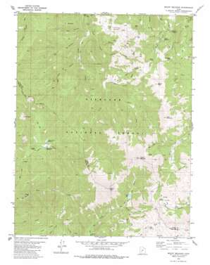
Mount Belknap Topo Map Utah
To zoom in, hover over the map of Mount Belknap
USGS Topo Quad 38112d4 - 1:24,000 scale
| Topo Map Name: | Mount Belknap |
| USGS Topo Quad ID: | 38112d4 |
| Print Size: | ca. 21 1/4" wide x 27" high |
| Southeast Coordinates: | 38.375° N latitude / 112.375° W longitude |
| Map Center Coordinates: | 38.4375° N latitude / 112.4375° W longitude |
| U.S. State: | UT |
| Filename: | o38112d4.jpg |
| Download Map JPG Image: | Mount Belknap topo map 1:24,000 scale |
| Map Type: | Topographic |
| Topo Series: | 7.5´ |
| Map Scale: | 1:24,000 |
| Source of Map Images: | United States Geological Survey (USGS) |
| Alternate Map Versions: |
Mount Belknap UT 1980, updated 1981 Download PDF Buy paper map Mount Belknap UT 2001, updated 2003 Download PDF Buy paper map Mount Belknap UT 2011 Download PDF Buy paper map Mount Belknap UT 2014 Download PDF Buy paper map |
| FStopo: | US Forest Service topo Mount Belknap is available: Download FStopo PDF Download FStopo TIF |
1:24,000 Topo Quads surrounding Mount Belknap
> Back to 38112a1 at 1:100,000 scale
> Back to 38112a1 at 1:250,000 scale
> Back to U.S. Topo Maps home
Mount Belknap topo map: Gazetteer
Mount Belknap: Dams
Blue Lake Dam elevation 2972m 9750′Indian Creek Dam elevation 2472m 8110′
Manderfield Dam elevation 2425m 7956′
Mount Belknap: Flats
Big Meadow elevation 3035m 9957′Bullion Pasture elevation 3316m 10879′
Fish Creek Meadows elevation 2464m 8083′
Mount Belknap: Lakes
Mud Lake elevation 3352m 10997′Mount Belknap: Mines
Grasshopper Mine elevation 3012m 9881′Lower Kimberly Mine elevation 2574m 8444′
Sevier Mine elevation 2770m 9087′
Upper Kimbaberly Mine elevation 2712m 8897′
Mount Belknap: Populated Places
Lower Kimberly elevation 2614m 8576′Upper Kimberly elevation 2734m 8969′
Mount Belknap: Reservoirs
Blue Lake elevation 2972m 9750′Indian Creek Reservoir elevation 2472m 8110′
Manderfield Reservoir elevation 2425m 7956′
Mount Belknap: Streams
Blue Lake Creek elevation 2884m 9461′East Fork Fish Creek elevation 2462m 8077′
Middle Fork Mill Creek elevation 2526m 8287′
North Creek elevation 2884m 9461′
Picnic Creek elevation 2179m 7148′
Trappers Creek elevation 2407m 7896′
Tribune Creek elevation 2368m 7769′
Wilson Creek elevation 2284m 7493′
Mount Belknap: Summits
Gold Mountain elevation 3552m 11653′Hogback elevation 2751m 9025′
Little Shelly elevation 3007m 9865′
Marbletop elevation 2673m 8769′
Mount Baldy elevation 3685m 12089′
Mount Belknap elevation 3694m 12119′
Signal Peak elevation 3441m 11289′
Tip Top elevation 3003m 9852′
Winkler Point elevation 3008m 9868′
Mount Belknap: Trails
Pipeline Trail elevation 2895m 9498′Tushar Trail elevation 3046m 9993′
Mount Belknap: Valleys
Hop Canyon elevation 2228m 7309′Line Canyon elevation 2255m 7398′
Suprise Gulch elevation 2601m 8533′
Trail Canyon elevation 2302m 7552′
Mount Belknap digital topo map on disk
Buy this Mount Belknap topo map showing relief, roads, GPS coordinates and other geographical features, as a high-resolution digital map file on DVD:


