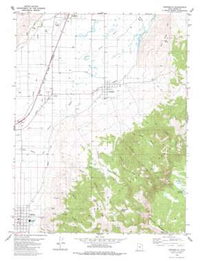
Annabella Topo Map Utah
To zoom in, hover over the map of Annabella
USGS Topo Quad 38112f1 - 1:24,000 scale
| Topo Map Name: | Annabella |
| USGS Topo Quad ID: | 38112f1 |
| Print Size: | ca. 21 1/4" wide x 27" high |
| Southeast Coordinates: | 38.625° N latitude / 112° W longitude |
| Map Center Coordinates: | 38.6875° N latitude / 112.0625° W longitude |
| U.S. State: | UT |
| Filename: | o38112f1.jpg |
| Download Map JPG Image: | Annabella topo map 1:24,000 scale |
| Map Type: | Topographic |
| Topo Series: | 7.5´ |
| Map Scale: | 1:24,000 |
| Source of Map Images: | United States Geological Survey (USGS) |
| Alternate Map Versions: |
Annabella UT 1980, updated 1981 Download PDF Buy paper map Annabella UT 2001, updated 2003 Download PDF Buy paper map Annabella UT 2011 Download PDF Buy paper map Annabella UT 2014 Download PDF Buy paper map |
| FStopo: | US Forest Service topo Annabella is available: Download FStopo PDF Download FStopo TIF |
1:24,000 Topo Quads surrounding Annabella
> Back to 38112e1 at 1:100,000 scale
> Back to 38112a1 at 1:250,000 scale
> Back to U.S. Topo Maps home
Annabella topo map: Gazetteer
Annabella: Airports
Richfield Municipal Airport elevation 1612m 5288′Annabella: Canals
Annabella Canal elevation 1614m 5295′Elisnore Canal elevation 1620m 5314′
Monroe Canal elevation 1636m 5367′
Annabella: Dams
Annabella Dam elevation 2999m 9839′Annabella: Lakes
Hepplers Ponds elevation 1609m 5278′Annabella: Parks
Monroe Hot Springs Resort elevation 1664m 5459′Annabella: Populated Places
Annabella elevation 1613m 5291′Austin elevation 1618m 5308′
Central Valley elevation 1617m 5305′
Jensen elevation 1615m 5298′
Monroe elevation 1644m 5393′
Nibley elevation 1629m 5344′
Annabella: Post Offices
Annabella Post Office elevation 1615m 5298′Monroe Post Office elevation 1642m 5387′
Annabella: Reservoirs
Annabella Reservoir elevation 2999m 9839′Annabella: Springs
Hot Springs elevation 1712m 5616′Jensen Spring elevation 2220m 7283′
Washburn Spring elevation 2546m 8353′
Annabella: Streams
Cottonwood Creek elevation 1643m 5390′Maple Creek elevation 1676m 5498′
Norton Creek elevation 1647m 5403′
Thompson Creek elevation 1647m 5403′
Annabella: Summits
Bull Claim Hill elevation 2005m 6578′Signal Peak elevation 3414m 11200′
Annabella: Swamps
Duck Lake elevation 2998m 9835′Annabella: Trails
Winkel Bob Trail elevation 2369m 7772′Annabella: Valleys
Cliff Canyon elevation 1737m 5698′Jensen Canyon elevation 1699m 5574′
Order Dugway Canyon elevation 1733m 5685′
Red Butte Canyon elevation 1842m 6043′
Sand Canyon elevation 1713m 5620′
Winget Canyon elevation 1701m 5580′
Annabella digital topo map on disk
Buy this Annabella topo map showing relief, roads, GPS coordinates and other geographical features, as a high-resolution digital map file on DVD:


