White Pine Peak Topo Map Utah
To zoom in, hover over the map of White Pine Peak
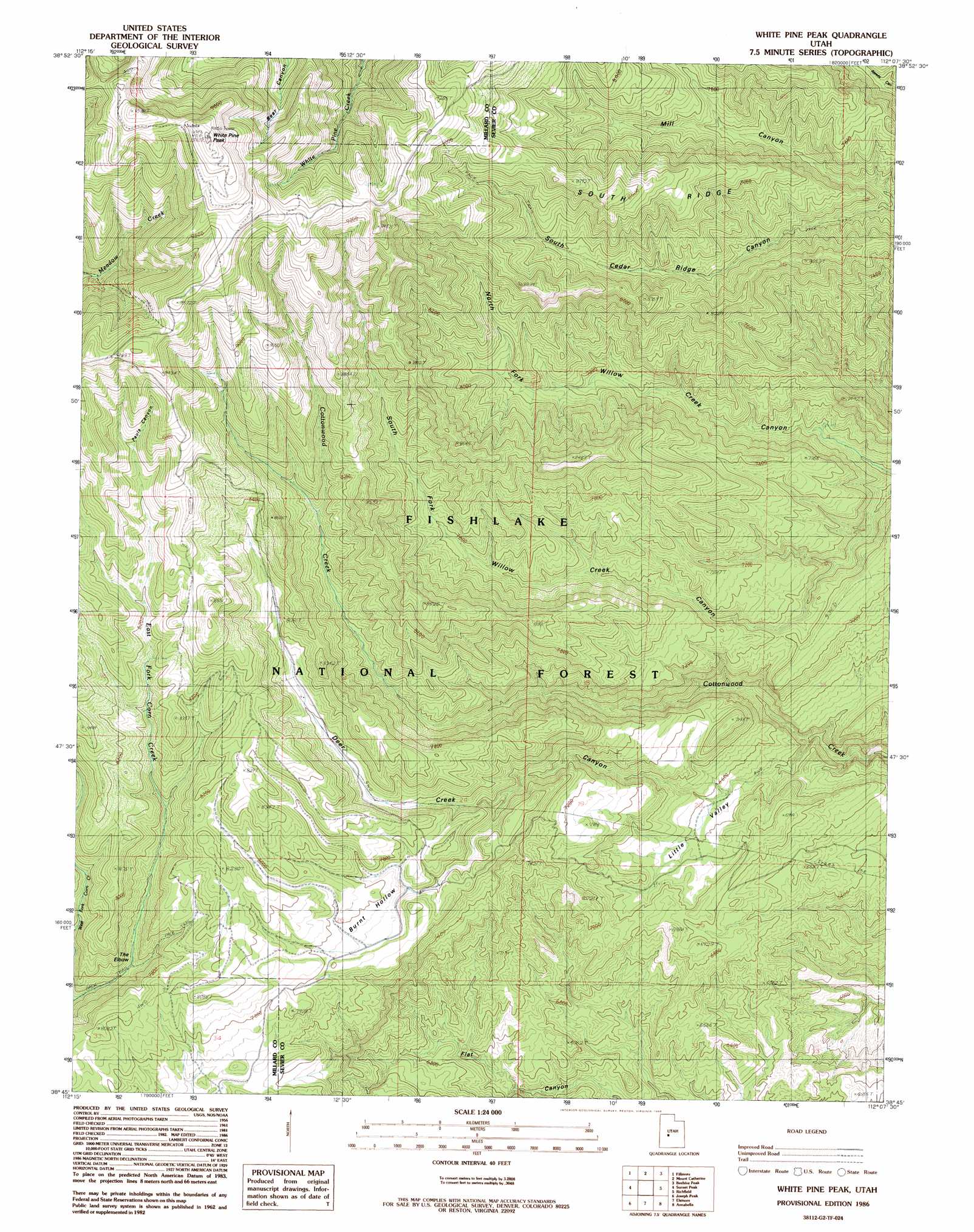
USGS Topo Quad 38112g2 - 1:24,000 scale
| Topo Map Name: | White Pine Peak |
| USGS Topo Quad ID: | 38112g2 |
| Print Size: | ca. 21 1/4" wide x 27" high |
| Southeast Coordinates: | 38.75° N latitude / 112.125° W longitude |
| Map Center Coordinates: | 38.8125° N latitude / 112.1875° W longitude |
| U.S. State: | UT |
| Filename: | o38112g2.jpg |
| Download Map JPG Image: | White Pine Peak topo map 1:24,000 scale |
| Map Type: | Topographic |
| Topo Series: | 7.5´ |
| Map Scale: | 1:24,000 |
| Source of Map Images: | United States Geological Survey (USGS) |
| Alternate Map Versions: |
White Pine Peak UT 1986, updated 1986 Download PDF Buy paper map White Pine Peak UT 2001, updated 2003 Download PDF Buy paper map White Pine Peak UT 2011 Download PDF Buy paper map White Pine Peak UT 2014 Download PDF Buy paper map |
| FStopo: | US Forest Service topo White Pine Peak is available: Download FStopo PDF Download FStopo TIF |
1:24,000 Topo Quads surrounding White Pine Peak
The Sink |
Holden |
Coffee Peak |
Scipio Lake |
Redmond Canyon |
Meadow |
Fillmore |
Mount Catherine |
Beehive Peak |
Aurora |
Kanosh |
Sunset Peak |
White Pine Peak |
Richfield |
Sigurd |
Red Ridge |
Joseph Peak |
Elsinore |
Annabella |
Water Creek Canyon |
Trail Mountain |
Marysvale Canyon |
Antelope Range |
Monroe Peak |
Koosharem |
> Back to 38112e1 at 1:100,000 scale
> Back to 38112a1 at 1:250,000 scale
> Back to U.S. Topo Maps home
White Pine Peak topo map: Gazetteer
White Pine Peak: Bends
The Elbow elevation 2265m 7431′White Pine Peak: Flats
Burnt Hollow elevation 2360m 7742′White Pine Peak: Ranges
Pahvant Range elevation 3112m 10209′White Pine Peak: Ridges
South Ridge elevation 2551m 8369′White Pine Peak: Springs
Little Valley Spring elevation 2025m 6643′White Pine Peak: Summits
White Pine Peak elevation 2901m 9517′White Pine Peak: Valleys
Death Canyon elevation 2845m 9333′Deer Creek Canyon elevation 1905m 6250′
Little Valley elevation 1990m 6528′
Mill Canyon elevation 2205m 7234′
Pauls Canyon elevation 2579m 8461′
White Pine Peak digital topo map on disk
Buy this White Pine Peak topo map showing relief, roads, GPS coordinates and other geographical features, as a high-resolution digital map file on DVD: