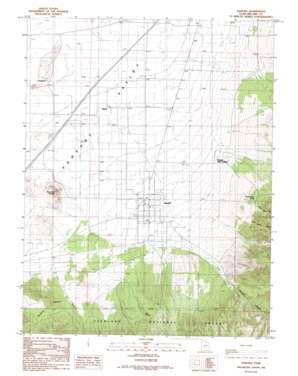
Kanosh Topo Map Utah
To zoom in, hover over the map of Kanosh
USGS Topo Quad 38112g4 - 1:24,000 scale
| Topo Map Name: | Kanosh |
| USGS Topo Quad ID: | 38112g4 |
| Print Size: | ca. 21 1/4" wide x 27" high |
| Southeast Coordinates: | 38.75° N latitude / 112.375° W longitude |
| Map Center Coordinates: | 38.8125° N latitude / 112.4375° W longitude |
| U.S. State: | UT |
| Filename: | o38112g4.jpg |
| Download Map JPG Image: | Kanosh topo map 1:24,000 scale |
| Map Type: | Topographic |
| Topo Series: | 7.5´ |
| Map Scale: | 1:24,000 |
| Source of Map Images: | United States Geological Survey (USGS) |
| Alternate Map Versions: |
Kanosh UT 1986, updated 1986 Download PDF Buy paper map Kanosh UT 2001, updated 2003 Download PDF Buy paper map Kanosh UT 2011 Download PDF Buy paper map Kanosh UT 2014 Download PDF Buy paper map |
| FStopo: | US Forest Service topo Kanosh is available: Download FStopo PDF Download FStopo TIF |
1:24,000 Topo Quads surrounding Kanosh
> Back to 38112e1 at 1:100,000 scale
> Back to 38112a1 at 1:250,000 scale
> Back to U.S. Topo Maps home
Kanosh topo map: Gazetteer
Kanosh: Mines
Rock Corral Quarry elevation 1484m 4868′Kanosh: Parks
Corn Creek Wildlife Management Area elevation 1658m 5439′Kanosh Wildlife Management Area elevation 1667m 5469′
Kanosh: Populated Places
Hatton elevation 1471m 4826′Kanosh elevation 1530m 5019′
Kanosh Indian Village elevation 1537m 5042′
Kanosh: Springs
Corn Creek Bench Spring elevation 1640m 5380′Dual Springs elevation 1706m 5597′
Frank Barney Spring elevation 1665m 5462′
Hot Spring elevation 1467m 4812′
John Watts Spring elevation 1851m 6072′
Kanosh: Streams
Corn Creek elevation 1499m 4917′Kanosh: Summits
Black Rock Volcano elevation 1583m 5193′Kanosh: Valleys
Brush Hollow Canyon elevation 1669m 5475′Dameron Canyon elevation 1584m 5196′
Kanosh Canyon elevation 1676m 5498′
Limekiln Canyon elevation 1693m 5554′
Wine Hollow Canyon elevation 1697m 5567′
Kanosh digital topo map on disk
Buy this Kanosh topo map showing relief, roads, GPS coordinates and other geographical features, as a high-resolution digital map file on DVD:


