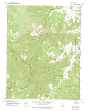
Mount Catherine Topo Map Utah
To zoom in, hover over the map of Mount Catherine
USGS Topo Quad 38112h2 - 1:24,000 scale
| Topo Map Name: | Mount Catherine |
| USGS Topo Quad ID: | 38112h2 |
| Print Size: | ca. 21 1/4" wide x 27" high |
| Southeast Coordinates: | 38.875° N latitude / 112.125° W longitude |
| Map Center Coordinates: | 38.9375° N latitude / 112.1875° W longitude |
| U.S. State: | UT |
| Filename: | o38112h2.jpg |
| Download Map JPG Image: | Mount Catherine topo map 1:24,000 scale |
| Map Type: | Topographic |
| Topo Series: | 7.5´ |
| Map Scale: | 1:24,000 |
| Source of Map Images: | United States Geological Survey (USGS) |
| Alternate Map Versions: |
Mt. Catherine UT 1961, updated 1963 Download PDF Buy paper map Mt. Catherine UT 1961, updated 1977 Download PDF Buy paper map Mount Catherine UT 2001, updated 2003 Download PDF Buy paper map Mount Catherine UT 2011 Download PDF Buy paper map Mount Catherine UT 2014 Download PDF Buy paper map |
| FStopo: | US Forest Service topo Mount Catherine is available: Download FStopo PDF Download FStopo TIF |
1:24,000 Topo Quads surrounding Mount Catherine
> Back to 38112e1 at 1:100,000 scale
> Back to 38112a1 at 1:250,000 scale
> Back to U.S. Topo Maps home
Mount Catherine topo map: Gazetteer
Mount Catherine: Flats
White Sage Flat elevation 2027m 6650′Mount Catherine: Lakes
The Lakes elevation 2182m 7158′Mount Catherine: Ridges
Blue Ridge elevation 2758m 9048′Hans Ridge elevation 2696m 8845′
Teeples Ridge elevation 2920m 9580′
Mount Catherine: Springs
Balsam Spring elevation 1950m 6397′Bear Hollow Spring elevation 2721m 8927′
Black Cedar Hills Spring elevation 2024m 6640′
Cottonwood Spring elevation 2365m 7759′
Indian Springs elevation 2823m 9261′
Lone Pine Spring elevation 2579m 8461′
Number Three Spring elevation 2581m 8467′
Number Two Spring elevation 2465m 8087′
Shingle Mill Spring elevation 2100m 6889′
Teeples Spring elevation 2912m 9553′
Turner Timber Spring elevation 2718m 8917′
Mount Catherine: Streams
Chokecherry Creek elevation 1998m 6555′Copley Creek elevation 1831m 6007′
Paradise Creek elevation 2455m 8054′
Three Forks elevation 2091m 6860′
White Pine Creek elevation 2219m 7280′
Mount Catherine: Summits
Jacks Peak elevation 3040m 9973′Mount Catherine elevation 3051m 10009′
Pioneer Peak elevation 3088m 10131′
Sugarloaf Mountain elevation 2555m 8382′
Willow Creek Peak elevation 2974m 9757′
Mount Catherine: Valleys
Bear Canyon elevation 2182m 7158′Bear Hollow elevation 2457m 8061′
Broad Canyon elevation 2375m 7791′
Buck Hollow elevation 1911m 6269′
Burned Point Canyon elevation 2310m 7578′
Cedar Springs Canyon elevation 2176m 7139′
Copley Canyon elevation 1854m 6082′
Cottonwood Canyon elevation 2245m 7365′
Deer Canyon elevation 1850m 6069′
Fall Canyon elevation 1826m 5990′
Flat Canyon elevation 2263m 7424′
Hardscrabble Canyon elevation 2135m 7004′
Horse Hollow elevation 1800m 5905′
Jacks Twist elevation 2116m 6942′
Lone Pine Canyon elevation 2477m 8126′
Lost Canyon elevation 2392m 7847′
Magpie Canyon elevation 2002m 6568′
Mason Gulch elevation 2347m 7700′
Mountain Sheep Canyon elevation 2059m 6755′
Nephi Canyon elevation 2281m 7483′
Paradise Canyon elevation 2449m 8034′
Reece Canyon elevation 2047m 6715′
Rock Canyon elevation 2632m 8635′
Rocky Canyon elevation 1961m 6433′
Shingle Mill Canyon elevation 2088m 6850′
Sims Canyon elevation 1926m 6318′
Snow Canyon elevation 1801m 5908′
Teeples Wash elevation 2234m 7329′
Turner Wash elevation 2191m 7188′
Water Canyon elevation 2282m 7486′
Mount Catherine digital topo map on disk
Buy this Mount Catherine topo map showing relief, roads, GPS coordinates and other geographical features, as a high-resolution digital map file on DVD:


