Lamerdorf Peak Topo Map Utah
To zoom in, hover over the map of Lamerdorf Peak
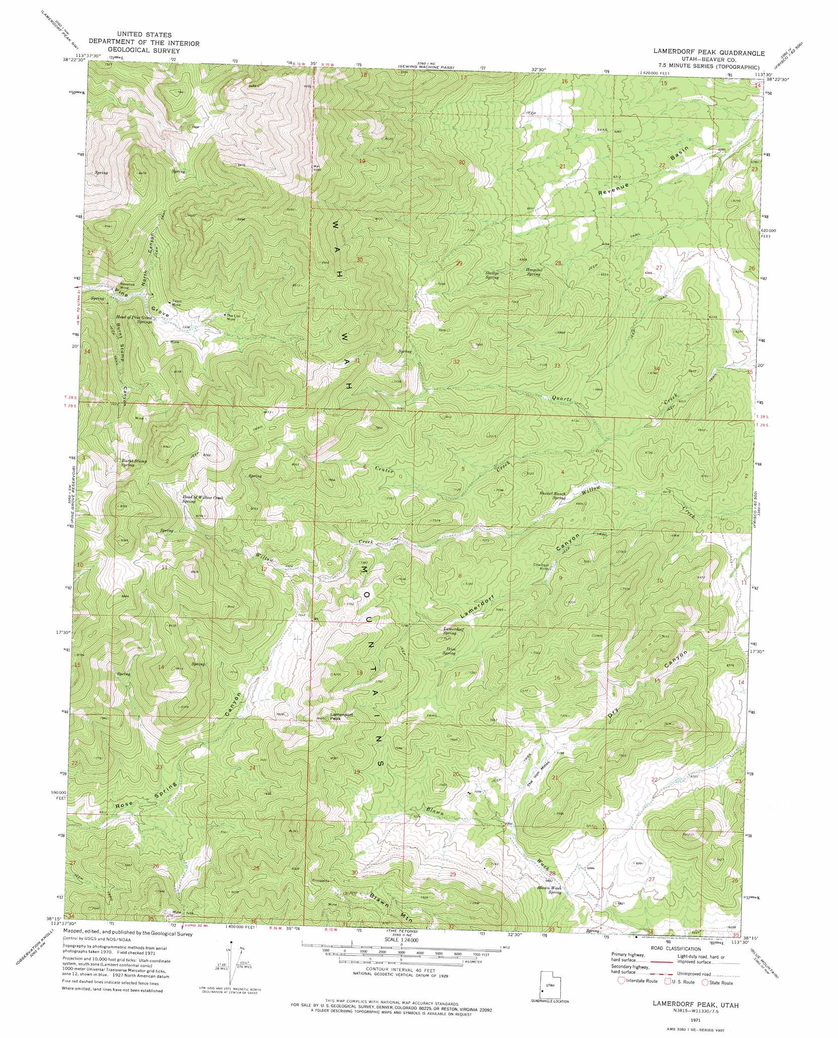
USGS Topo Quad 38113c5 - 1:24,000 scale
| Topo Map Name: | Lamerdorf Peak |
| USGS Topo Quad ID: | 38113c5 |
| Print Size: | ca. 21 1/4" wide x 27" high |
| Southeast Coordinates: | 38.25° N latitude / 113.5° W longitude |
| Map Center Coordinates: | 38.3125° N latitude / 113.5625° W longitude |
| U.S. State: | UT |
| Filename: | o38113c5.jpg |
| Download Map JPG Image: | Lamerdorf Peak topo map 1:24,000 scale |
| Map Type: | Topographic |
| Topo Series: | 7.5´ |
| Map Scale: | 1:24,000 |
| Source of Map Images: | United States Geological Survey (USGS) |
| Alternate Map Versions: |
Lamerdorf Peak UT 1971, updated 1975 Download PDF Buy paper map Lamerdorf Peak UT 2010 Download PDF Buy paper map Lamerdorf Peak UT 2014 Download PDF Buy paper map |
1:24,000 Topo Quads surrounding Lamerdorf Peak
Halfway Summit |
Pine Valley Hardpan South |
Wah Wah Summit |
Wah Wah Cove |
Frisco Peak |
Sawtooth Peak |
Lamerdorf Peak Nw |
Sewing Machine Pass |
Wallaces Peak |
Frisco |
Buckhorn Spring |
Pine Grove Reservoir |
Lamerdorf Peak |
Frisco Sw |
White Mountain |
Pinto Spring |
Observation Knoll |
The Tetons |
Blue Mountain |
Burns Knoll |
Steamboat Mountain |
Bible Spring |
Mountain Spring Peak |
Lund |
Latimer |
> Back to 38113a1 at 1:100,000 scale
> Back to 38112a1 at 1:250,000 scale
> Back to U.S. Topo Maps home
Lamerdorf Peak topo map: Gazetteer
Lamerdorf Peak: Areas
The Iron Mines elevation 2172m 7125′Lamerdorf Peak: Basins
Revenue Basin elevation 1884m 6181′Lamerdorf Peak: Mines
Revenue Mine elevation 2169m 7116′Tasso Mine elevation 2259m 7411′
The Lou Mine elevation 2299m 7542′
Lamerdorf Peak: Springs
Blawn Wash Spring elevation 2087m 6847′Bucket Ranch Spring elevation 2007m 6584′
Burnt Stump Spring elevation 2435m 7988′
Head of Pine Grove Springs elevation 2199m 7214′
Head of Willow Creek Spring elevation 2455m 8054′
Hospital Spring elevation 2010m 6594′
Ikies Spring elevation 2168m 7112′
Lamerdorf Spring elevation 2174m 7132′
Skellys Spring elevation 2064m 6771′
Lamerdorf Peak: Streams
Center Creek elevation 1975m 6479′Lamerdorf Peak: Summits
Lamerdorf Peak elevation 2549m 8362′Lamerdorf Peak: Valleys
Burnt Stump Canyon elevation 2152m 7060′Dry Canyon elevation 1993m 6538′
Lamerdorf Canyon elevation 1980m 6496′
North Canyon elevation 2175m 7135′
Lamerdorf Peak digital topo map on disk
Buy this Lamerdorf Peak topo map showing relief, roads, GPS coordinates and other geographical features, as a high-resolution digital map file on DVD: