Buckhorn Spring Topo Map Utah
To zoom in, hover over the map of Buckhorn Spring
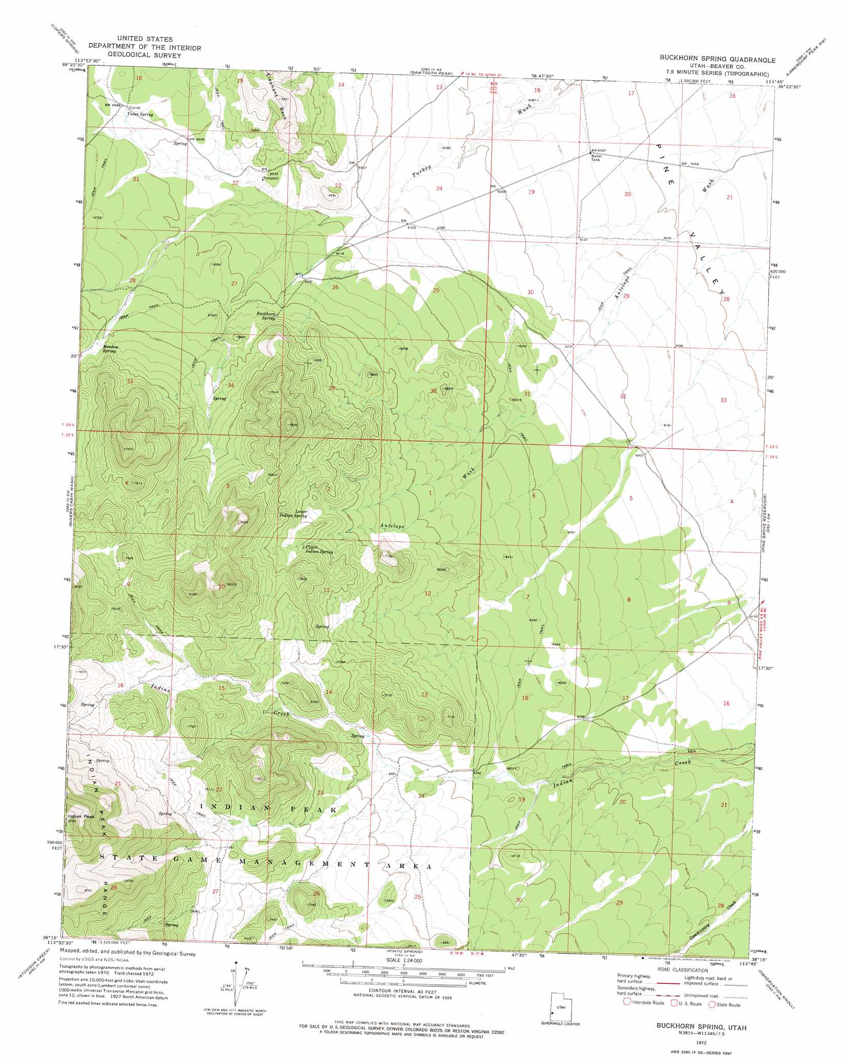
USGS Topo Quad 38113c7 - 1:24,000 scale
| Topo Map Name: | Buckhorn Spring |
| USGS Topo Quad ID: | 38113c7 |
| Print Size: | ca. 21 1/4" wide x 27" high |
| Southeast Coordinates: | 38.25° N latitude / 113.75° W longitude |
| Map Center Coordinates: | 38.3125° N latitude / 113.8125° W longitude |
| U.S. State: | UT |
| Filename: | o38113c7.jpg |
| Download Map JPG Image: | Buckhorn Spring topo map 1:24,000 scale |
| Map Type: | Topographic |
| Topo Series: | 7.5´ |
| Map Scale: | 1:24,000 |
| Source of Map Images: | United States Geological Survey (USGS) |
| Alternate Map Versions: |
Buckhorn Spring UT 1972, updated 1975 Download PDF Buy paper map Buckhorn Spring UT 2010 Download PDF Buy paper map Buckhorn Spring UT 2014 Download PDF Buy paper map |
1:24,000 Topo Quads surrounding Buckhorn Spring
Miller Wash |
Mountain Home Pass |
Halfway Summit |
Pine Valley Hardpan South |
Wah Wah Summit |
Hamlin Well |
Lopers Spring |
Sawtooth Peak |
Lamerdorf Peak Nw |
Sewing Machine Pass |
Gleason Basin |
Miners Cabin Wash |
Buckhorn Spring |
Pine Grove Reservoir |
Lamerdorf Peak |
White Rock Peak |
Atchison Creek |
Pinto Spring |
Observation Knoll |
The Tetons |
Rice Mountain |
Steamboat Mountain Sw |
Steamboat Mountain |
Bible Spring |
Mountain Spring Peak |
> Back to 38113a1 at 1:100,000 scale
> Back to 38112a1 at 1:250,000 scale
> Back to U.S. Topo Maps home
Buckhorn Spring topo map: Gazetteer
Buckhorn Spring: Parks
Indian Peak State Game Management Area elevation 2187m 7175′Buckhorn Spring: Springs
Buckhorn Spring elevation 2030m 6660′Lower Indian Spring elevation 2120m 6955′
Meadow Spring elevation 2088m 6850′
Upper Indian Spring elevation 2134m 7001′
Vance Spring elevation 2036m 6679′
Buckhorn Spring digital topo map on disk
Buy this Buckhorn Spring topo map showing relief, roads, GPS coordinates and other geographical features, as a high-resolution digital map file on DVD: