Lopers Spring Topo Map Utah
To zoom in, hover over the map of Lopers Spring
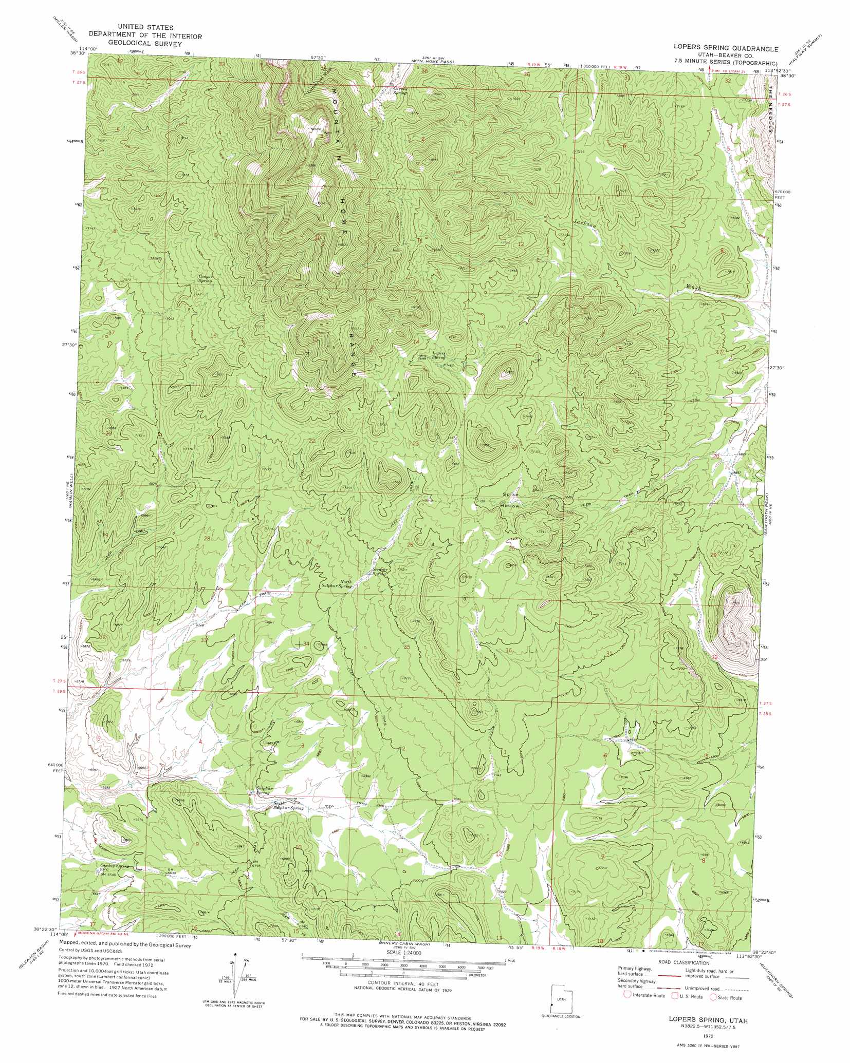
USGS Topo Quad 38113d8 - 1:24,000 scale
| Topo Map Name: | Lopers Spring |
| USGS Topo Quad ID: | 38113d8 |
| Print Size: | ca. 21 1/4" wide x 27" high |
| Southeast Coordinates: | 38.375° N latitude / 113.875° W longitude |
| Map Center Coordinates: | 38.4375° N latitude / 113.9375° W longitude |
| U.S. State: | UT |
| Filename: | o38113d8.jpg |
| Download Map JPG Image: | Lopers Spring topo map 1:24,000 scale |
| Map Type: | Topographic |
| Topo Series: | 7.5´ |
| Map Scale: | 1:24,000 |
| Source of Map Images: | United States Geological Survey (USGS) |
| Alternate Map Versions: |
Lopers Spring UT 1972, updated 1974 Download PDF Buy paper map Lopers Spring UT 2010 Download PDF Buy paper map Lopers Spring UT 2014 Download PDF Buy paper map |
1:24,000 Topo Quads surrounding Lopers Spring
Big Springs |
Tweedy Wash |
Mormon Gap |
Tunnel Spring |
Pine Valley Hardpan North |
Hyde Well |
Miller Wash |
Mountain Home Pass |
Halfway Summit |
Pine Valley Hardpan South |
Rosencrans Knolls |
Hamlin Well |
Lopers Spring |
Sawtooth Peak |
Lamerdorf Peak Nw |
Miller Canyon |
Gleason Basin |
Miners Cabin Wash |
Buckhorn Spring |
Pine Grove Reservoir |
Buck Wash Well |
White Rock Peak |
Atchison Creek |
Pinto Spring |
Observation Knoll |
> Back to 38113a1 at 1:100,000 scale
> Back to 38112a1 at 1:250,000 scale
> Back to U.S. Topo Maps home
Lopers Spring topo map: Gazetteer
Lopers Spring: Pillars
The Needles elevation 2282m 7486′Lopers Spring: Springs
Carney Spring elevation 2397m 7864′Cougar Spring elevation 2219m 7280′
Cowboy Spring elevation 1997m 6551′
Lopers Spring elevation 2291m 7516′
North Sulphur Spring elevation 2155m 7070′
Scraper Spring elevation 2172m 7125′
South Sulphur Spring elevation 2067m 6781′
Sulphur Spring elevation 2069m 6788′
Lopers Spring: Valleys
Spike Hollow elevation 2170m 7119′Lopers Spring digital topo map on disk
Buy this Lopers Spring topo map showing relief, roads, GPS coordinates and other geographical features, as a high-resolution digital map file on DVD: