Pine Valley Hardpan South Topo Map Utah
To zoom in, hover over the map of Pine Valley Hardpan South
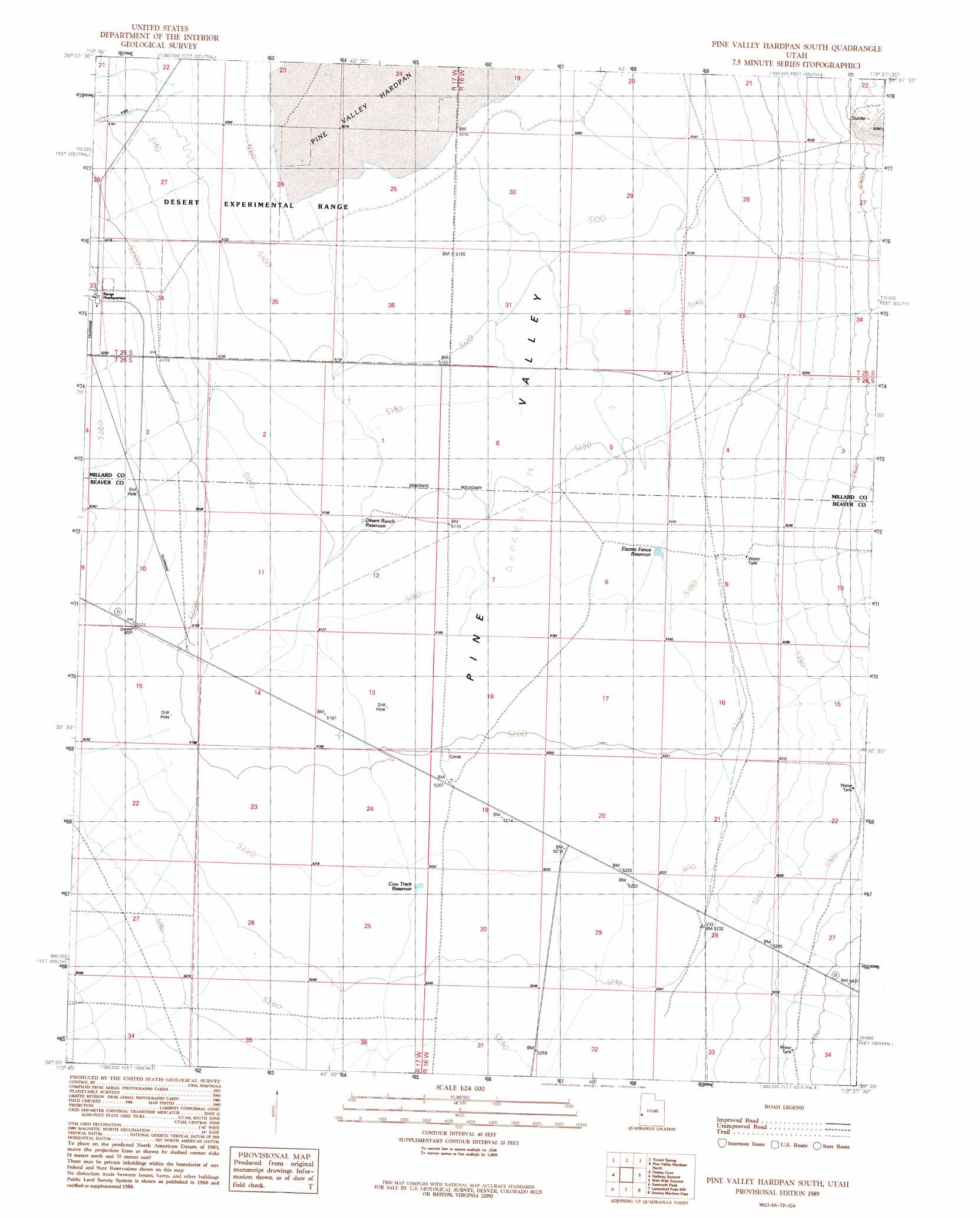
USGS Topo Quad 38113e6 - 1:24,000 scale
| Topo Map Name: | Pine Valley Hardpan South |
| USGS Topo Quad ID: | 38113e6 |
| Print Size: | ca. 21 1/4" wide x 27" high |
| Southeast Coordinates: | 38.5° N latitude / 113.625° W longitude |
| Map Center Coordinates: | 38.5625° N latitude / 113.6875° W longitude |
| U.S. State: | UT |
| Filename: | o38113e6.jpg |
| Download Map JPG Image: | Pine Valley Hardpan South topo map 1:24,000 scale |
| Map Type: | Topographic |
| Topo Series: | 7.5´ |
| Map Scale: | 1:24,000 |
| Source of Map Images: | United States Geological Survey (USGS) |
| Alternate Map Versions: |
Pine Valley Hardpan South UT 1989, updated 1989 Download PDF Buy paper map Pine Valley Hardpan South UT 2010 Download PDF Buy paper map Pine Valley Hardpan South UT 2014 Download PDF Buy paper map |
| FStopo: | US Forest Service topo Pine Valley Hardpan South is available: Download FStopo PDF Download FStopo TIF |
1:24,000 Topo Quads surrounding Pine Valley Hardpan South
Cedar Pass |
Big Jensen Pass |
Middle Mountain |
Crystal Peak |
Warm Point |
Mormon Gap |
Tunnel Spring |
Pine Valley Hardpan North |
Grassy Cove |
Fifteenmile Point |
Mountain Home Pass |
Halfway Summit |
Pine Valley Hardpan South |
Wah Wah Summit |
Wah Wah Cove |
Lopers Spring |
Sawtooth Peak |
Lamerdorf Peak Nw |
Sewing Machine Pass |
Wallaces Peak |
Miners Cabin Wash |
Buckhorn Spring |
Pine Grove Reservoir |
Lamerdorf Peak |
Frisco Sw |
> Back to 38113e1 at 1:100,000 scale
> Back to 38112a1 at 1:250,000 scale
> Back to U.S. Topo Maps home
Pine Valley Hardpan South topo map: Gazetteer
Pine Valley Hardpan South: Flats
Pine Valley Hardpan elevation 1548m 5078′Pine Valley Hardpan South: Reservoirs
Cow Track Reservoir elevation 1593m 5226′Desert Ranch Reservoir elevation 1573m 5160′
Electric Fence Reservoir elevation 1578m 5177′
Pine Valley Hardpan South: Wells
Cow Camp Well elevation 1588m 5209′Pine Valley Hardpan South digital topo map on disk
Buy this Pine Valley Hardpan South topo map showing relief, roads, GPS coordinates and other geographical features, as a high-resolution digital map file on DVD: