Tunnel Spring Topo Map Utah
To zoom in, hover over the map of Tunnel Spring
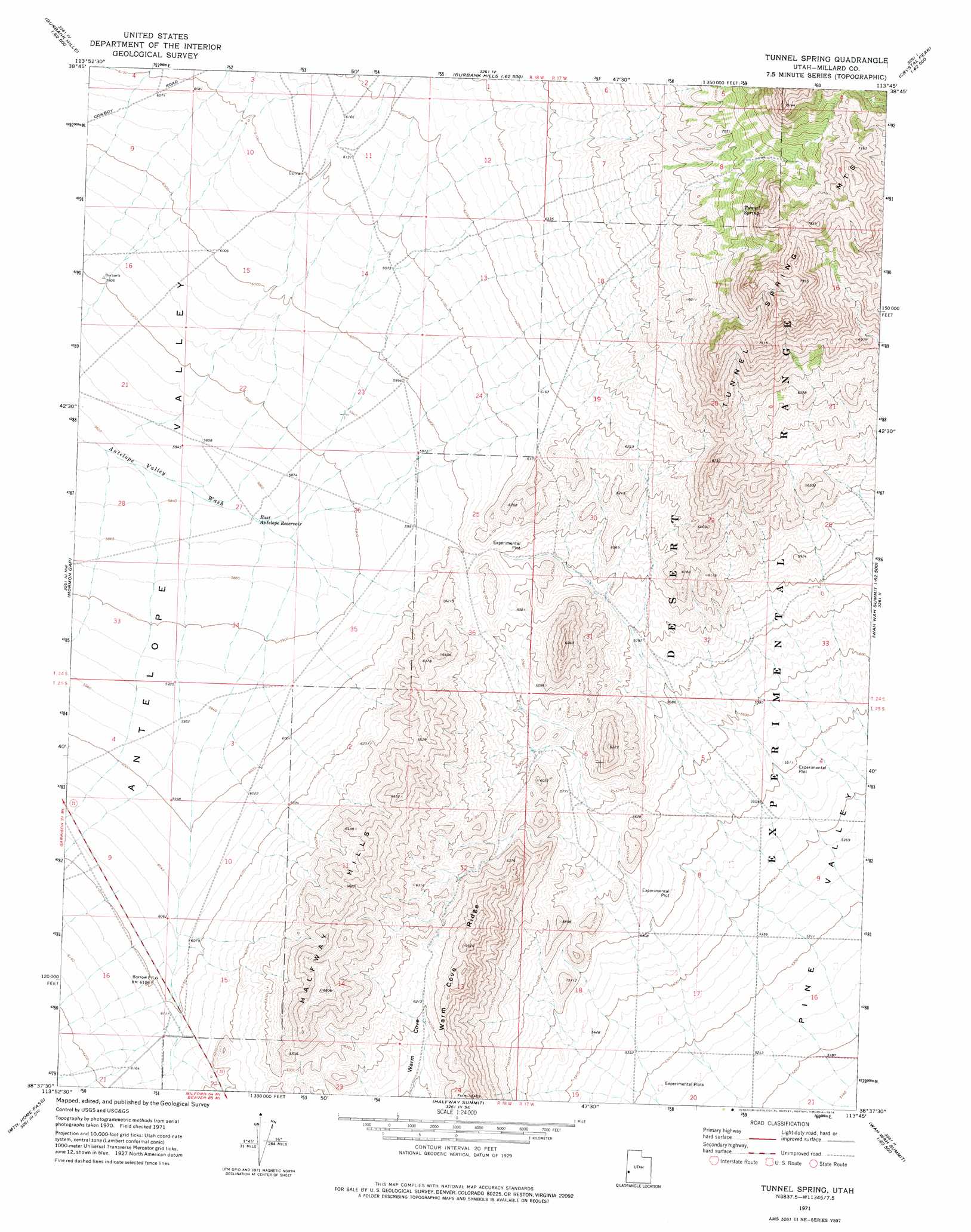
USGS Topo Quad 38113f7 - 1:24,000 scale
| Topo Map Name: | Tunnel Spring |
| USGS Topo Quad ID: | 38113f7 |
| Print Size: | ca. 21 1/4" wide x 27" high |
| Southeast Coordinates: | 38.625° N latitude / 113.75° W longitude |
| Map Center Coordinates: | 38.6875° N latitude / 113.8125° W longitude |
| U.S. State: | UT |
| Filename: | o38113f7.jpg |
| Download Map JPG Image: | Tunnel Spring topo map 1:24,000 scale |
| Map Type: | Topographic |
| Topo Series: | 7.5´ |
| Map Scale: | 1:24,000 |
| Source of Map Images: | United States Geological Survey (USGS) |
| Alternate Map Versions: |
Tunnel Spring UT 1971, updated 1974 Download PDF Buy paper map Tunnel Spring UT 2010 Download PDF Buy paper map Tunnel Spring UT 2014 Download PDF Buy paper map |
| FStopo: | US Forest Service topo Tunnel Spring is available: Download FStopo PDF Download FStopo TIF |
1:24,000 Topo Quads surrounding Tunnel Spring
Garrison |
Burbank Pass |
Deadman Point |
Pyramid Knoll |
King Top |
Needle Point Spring |
Cedar Pass |
Big Jensen Pass |
Middle Mountain |
Crystal Peak |
Tweedy Wash |
Mormon Gap |
Tunnel Spring |
Pine Valley Hardpan North |
Grassy Cove |
Miller Wash |
Mountain Home Pass |
Halfway Summit |
Pine Valley Hardpan South |
Wah Wah Summit |
Hamlin Well |
Lopers Spring |
Sawtooth Peak |
Lamerdorf Peak Nw |
Sewing Machine Pass |
> Back to 38113e1 at 1:100,000 scale
> Back to 38112a1 at 1:250,000 scale
> Back to U.S. Topo Maps home
Tunnel Spring topo map: Gazetteer
Tunnel Spring: Forests
Desert Experimental Range elevation 1703m 5587′Tunnel Spring: Reservoirs
East Antelope Reservoir elevation 1784m 5853′Tunnel Spring: Ridges
Warm Cove Ridge elevation 1952m 6404′Tunnel Spring: Springs
Tunnel Spring elevation 2163m 7096′Tunnel Spring: Summits
Halfway Hills elevation 2064m 6771′Tunnel Spring digital topo map on disk
Buy this Tunnel Spring topo map showing relief, roads, GPS coordinates and other geographical features, as a high-resolution digital map file on DVD: