Warm Point Topo Map Utah
To zoom in, hover over the map of Warm Point
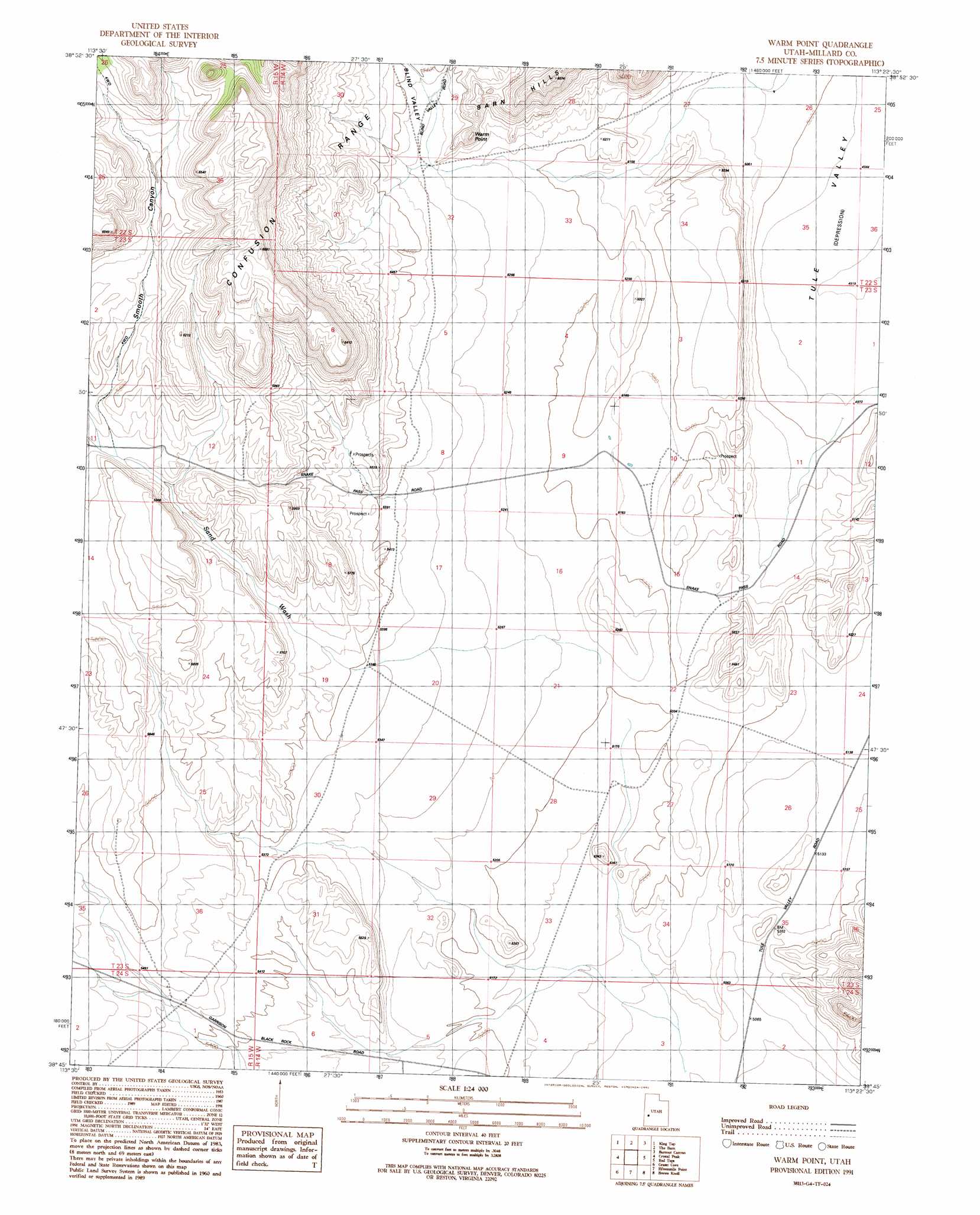
USGS Topo Quad 38113g4 - 1:24,000 scale
| Topo Map Name: | Warm Point |
| USGS Topo Quad ID: | 38113g4 |
| Print Size: | ca. 21 1/4" wide x 27" high |
| Southeast Coordinates: | 38.75° N latitude / 113.375° W longitude |
| Map Center Coordinates: | 38.8125° N latitude / 113.4375° W longitude |
| U.S. State: | UT |
| Filename: | o38113g4.jpg |
| Download Map JPG Image: | Warm Point topo map 1:24,000 scale |
| Map Type: | Topographic |
| Topo Series: | 7.5´ |
| Map Scale: | 1:24,000 |
| Source of Map Images: | United States Geological Survey (USGS) |
| Alternate Map Versions: |
Warm Point UT 1991, updated 1991 Download PDF Buy paper map Warm Point UT 2010 Download PDF Buy paper map Warm Point UT 2014 Download PDF Buy paper map |
1:24,000 Topo Quads surrounding Warm Point
Thompson Knoll |
Bullgrass Knoll |
Hell'N Maria Canyon |
Skull Rock Pass |
Long Ridge Sw |
Pyramid Knoll |
King Top |
The Barn |
Burnout Canyon |
Needle Point |
Middle Mountain |
Crystal Peak |
Warm Point |
Red Tops |
Sevier Lake Sw |
Pine Valley Hardpan North |
Grassy Cove |
Fifteenmile Point |
Brown Knoll |
Iron Mine Pass |
Pine Valley Hardpan South |
Wah Wah Summit |
Wah Wah Cove |
Frisco Peak |
High Rock |
> Back to 38113e1 at 1:100,000 scale
> Back to 38112a1 at 1:250,000 scale
> Back to U.S. Topo Maps home
Warm Point topo map: Gazetteer
Warm Point: Arroyos
Sand Wash elevation 1598m 5242′Warm Point: Summits
Warm Point elevation 1714m 5623′Warm Point: Valleys
Blind Valley elevation 1632m 5354′Smooth Canyon elevation 1735m 5692′
Warm Point digital topo map on disk
Buy this Warm Point topo map showing relief, roads, GPS coordinates and other geographical features, as a high-resolution digital map file on DVD: