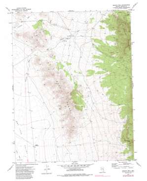
Bristol Well Topo Map Nevada
To zoom in, hover over the map of Bristol Well
USGS Topo Quad 38114a6 - 1:24,000 scale
| Topo Map Name: | Bristol Well |
| USGS Topo Quad ID: | 38114a6 |
| Print Size: | ca. 21 1/4" wide x 27" high |
| Southeast Coordinates: | 38° N latitude / 114.625° W longitude |
| Map Center Coordinates: | 38.0625° N latitude / 114.6875° W longitude |
| U.S. State: | NV |
| Filename: | o38114a6.jpg |
| Download Map JPG Image: | Bristol Well topo map 1:24,000 scale |
| Map Type: | Topographic |
| Topo Series: | 7.5´ |
| Map Scale: | 1:24,000 |
| Source of Map Images: | United States Geological Survey (USGS) |
| Alternate Map Versions: |
Bristol Well NV 1971, updated 1973 Download PDF Buy paper map Bristol Well NV 1971, updated 1986 Download PDF Buy paper map Bristol Well NV 2012 Download PDF Buy paper map Bristol Well NV 2014 Download PDF Buy paper map |
1:24,000 Topo Quads surrounding Bristol Well
> Back to 38114a1 at 1:100,000 scale
> Back to 38114a1 at 1:250,000 scale
> Back to U.S. Topo Maps home
Bristol Well topo map: Gazetteer
Bristol Well: Basins
Bristol Valley elevation 1642m 5387′Bristol Well: Gaps
Bristol Pass elevation 1875m 6151′Bristol Well: Mines
Combined Metals Mine elevation 1653m 5423′Woodbutcher Mine elevation 2040m 6692′
Bristol Well: Populated Places
Bristol Well (historical) elevation 1659m 5442′Bristol Well: Post Offices
Bristol Well Post Office (historical) elevation 1659m 5442′Bristol Well: Reservoirs
Dry Lake Reservoir elevation 1490m 4888′Middle Reservoir elevation 1477m 4845′
Bristol Well: Ridges
West Range elevation 1802m 5912′Bristol Well: Springs
Blind Mountain Spring elevation 1969m 6459′Bristol Well: Streams
Fairview Wash elevation 1475m 4839′Scotty Wash elevation 1618m 5308′
Bristol Well: Wells
Bristol Well elevation 1660m 5446′Bristol Well digital topo map on disk
Buy this Bristol Well topo map showing relief, roads, GPS coordinates and other geographical features, as a high-resolution digital map file on DVD:


