Parsnip Peak Topo Map Nevada
To zoom in, hover over the map of Parsnip Peak
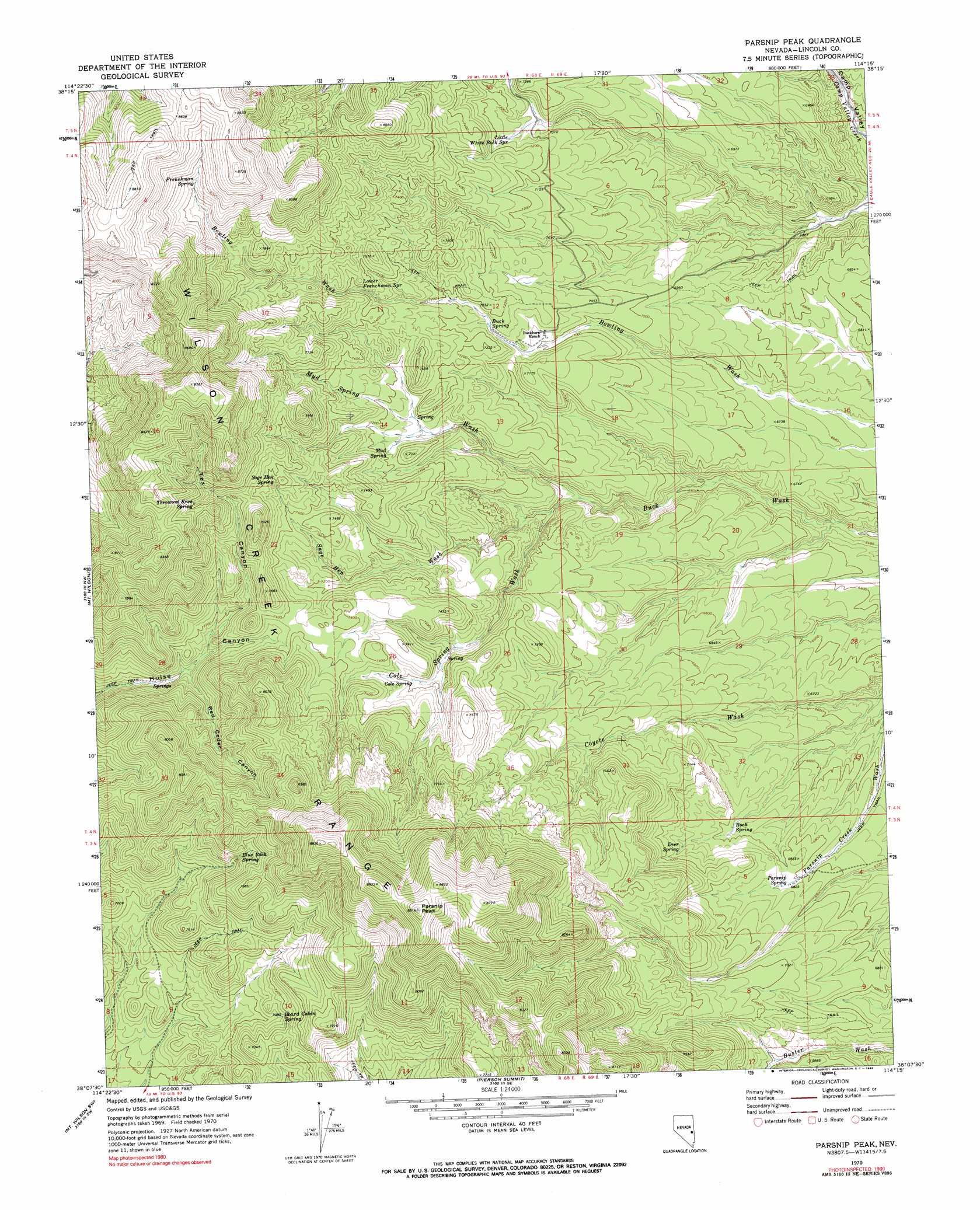
USGS Topo Quad 38114b3 - 1:24,000 scale
| Topo Map Name: | Parsnip Peak |
| USGS Topo Quad ID: | 38114b3 |
| Print Size: | ca. 21 1/4" wide x 27" high |
| Southeast Coordinates: | 38.125° N latitude / 114.25° W longitude |
| Map Center Coordinates: | 38.1875° N latitude / 114.3125° W longitude |
| U.S. State: | NV |
| Filename: | o38114b3.jpg |
| Download Map JPG Image: | Parsnip Peak topo map 1:24,000 scale |
| Map Type: | Topographic |
| Topo Series: | 7.5´ |
| Map Scale: | 1:24,000 |
| Source of Map Images: | United States Geological Survey (USGS) |
| Alternate Map Versions: |
Parsnip Peak NV 1970, updated 1973 Download PDF Buy paper map Parsnip Peak NV 1970, updated 1990 Download PDF Buy paper map Parsnip Peak NV 2012 Download PDF Buy paper map Parsnip Peak NV 2014 Download PDF Buy paper map |
1:24,000 Topo Quads surrounding Parsnip Peak
Mustang Well |
Horse Corral Pass |
Atlanta |
Rosencrans Knolls |
Hamlin Well |
Pony Springs |
Schoolmarm Basin |
Trail Canyon |
Miller Canyon |
Gleason Basin |
Bristol Range Ne |
Mount Wilson |
Parsnip Peak |
Buck Wash Well |
White Rock Peak |
Bristol Range Se |
Mount Wilson Sw |
Pierson Summit |
Eagle Valley Reservoir |
Rice Mountain |
Highland Peak |
Pioche |
Rose Valley |
Ursine |
Deer Lodge Canyon |
> Back to 38114a1 at 1:100,000 scale
> Back to 38114a1 at 1:250,000 scale
> Back to U.S. Topo Maps home
Parsnip Peak topo map: Gazetteer
Parsnip Peak: Mines
Hollinger Mine elevation 2157m 7076′Parsnip Peak: Ranges
Wilson Creek Range elevation 2247m 7372′Parsnip Peak: Springs
Blue Rock Spring elevation 2279m 7477′Board Cabin Spring elevation 2159m 7083′
Buck Spring elevation 2170m 7119′
Cold Spring elevation 2163m 7096′
Cole Spring elevation 2186m 7171′
Deer Spring elevation 2101m 6893′
Frenchman Spring elevation 2468m 8097′
Little Mud Springs elevation 2176m 7139′
Little White Rock Spring elevation 2174m 7132′
Lower Frenchman Spring elevation 2237m 7339′
Middle Cole Spring elevation 2164m 7099′
Mud Spring elevation 2182m 7158′
Muddy Spring elevation 2139m 7017′
North Cole Spring elevation 2146m 7040′
Parsnip Spring elevation 2084m 6837′
Red Cedar Spring elevation 2282m 7486′
Rock Spring elevation 2062m 6765′
Sage Hen Spring elevation 2317m 7601′
Throwout Knee Spring elevation 2377m 7798′
Parsnip Peak: Streams
Cole Spring Wash elevation 2055m 6742′Mud Spring Wash elevation 2055m 6742′
Sage Hen Wash elevation 2073m 6801′
Parsnip Peak: Summits
Parsnip Peak elevation 2707m 8881′Parsnip Peak: Valleys
Red Cedar Canyon elevation 2144m 7034′Tex Canyon elevation 2157m 7076′
Parsnip Peak digital topo map on disk
Buy this Parsnip Peak topo map showing relief, roads, GPS coordinates and other geographical features, as a high-resolution digital map file on DVD: