Tweedy Wash Topo Map Nevada
To zoom in, hover over the map of Tweedy Wash
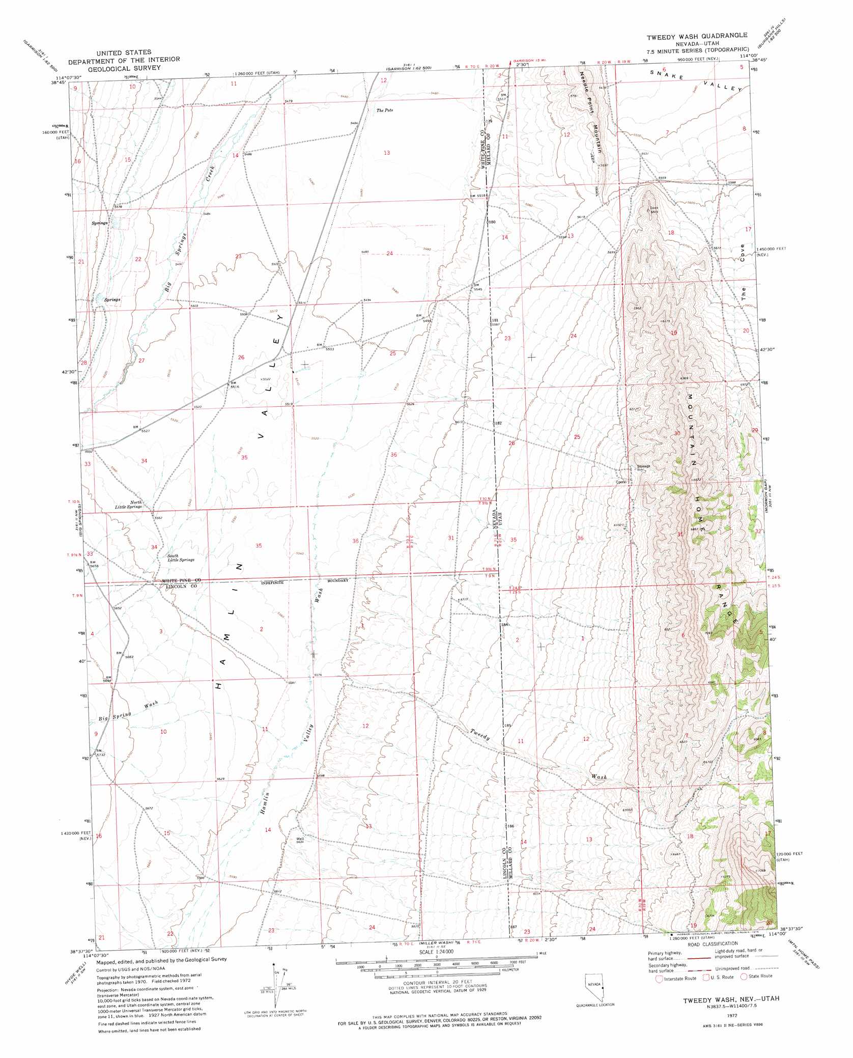
USGS Topo Quad 38114f1 - 1:24,000 scale
| Topo Map Name: | Tweedy Wash |
| USGS Topo Quad ID: | 38114f1 |
| Print Size: | ca. 21 1/4" wide x 27" high |
| Southeast Coordinates: | 38.625° N latitude / 114° W longitude |
| Map Center Coordinates: | 38.6875° N latitude / 114.0625° W longitude |
| U.S. States: | NV, UT |
| Filename: | o38114f1.jpg |
| Download Map JPG Image: | Tweedy Wash topo map 1:24,000 scale |
| Map Type: | Topographic |
| Topo Series: | 7.5´ |
| Map Scale: | 1:24,000 |
| Source of Map Images: | United States Geological Survey (USGS) |
| Alternate Map Versions: |
Tweedy Wash NV 1972, updated 1975 Download PDF Buy paper map Tweedy Wash NV 2012 Download PDF Buy paper map Tweedy Wash NV 2015 Download PDF Buy paper map |
1:24,000 Topo Quads surrounding Tweedy Wash
Wheeler Peak |
Kious Spring |
Garrison |
Burbank Pass |
Deadman Point |
Minerva Canyon |
Arch Canyon |
Needle Point Spring |
Cedar Pass |
Big Jensen Pass |
Red Ledges |
Big Springs |
Tweedy Wash |
Mormon Gap |
Tunnel Spring |
Wells Summit |
Hyde Well |
Miller Wash |
Mountain Home Pass |
Halfway Summit |
Atlanta |
Rosencrans Knolls |
Hamlin Well |
Lopers Spring |
Sawtooth Peak |
> Back to 38114e1 at 1:100,000 scale
> Back to 38114a1 at 1:250,000 scale
> Back to U.S. Topo Maps home
Tweedy Wash topo map: Gazetteer
Tweedy Wash: Canals
Hamblin Valley Flood Water Wash Ditch elevation 1677m 5501′Tweedy Wash: Springs
North Little Springs elevation 1695m 5561′South Little Springs elevation 1697m 5567′
The Pots elevation 1668m 5472′
Tweedy Wash: Streams
Big Spring Wash elevation 1696m 5564′Hamlin Valley Wash elevation 1679m 5508′
Hyde Wash elevation 1704m 5590′
Tweedy Wash elevation 1706m 5597′
Tweedy Wash: Summits
Needle Point Mountain elevation 1758m 5767′Tweedy Wash: Valleys
The Cove elevation 1684m 5524′Tweedy Wash elevation 1707m 5600′
Tweedy Wash digital topo map on disk
Buy this Tweedy Wash topo map showing relief, roads, GPS coordinates and other geographical features, as a high-resolution digital map file on DVD: