Big Creek Ranch Topo Map Nevada
To zoom in, hover over the map of Big Creek Ranch
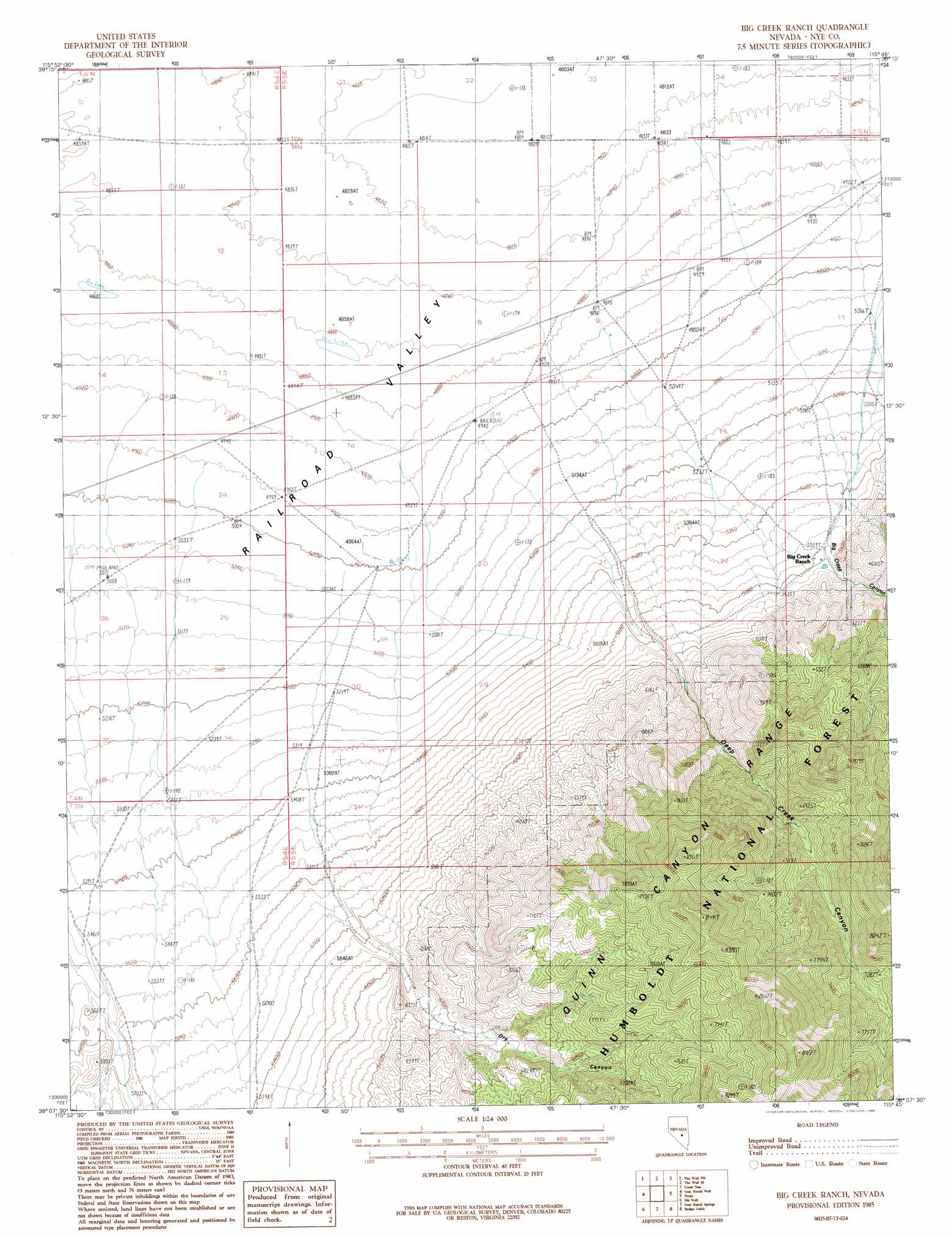
USGS Topo Quad 38115b7 - 1:24,000 scale
| Topo Map Name: | Big Creek Ranch |
| USGS Topo Quad ID: | 38115b7 |
| Print Size: | ca. 21 1/4" wide x 27" high |
| Southeast Coordinates: | 38.125° N latitude / 115.75° W longitude |
| Map Center Coordinates: | 38.1875° N latitude / 115.8125° W longitude |
| U.S. State: | NV |
| Filename: | o38115b7.jpg |
| Download Map JPG Image: | Big Creek Ranch topo map 1:24,000 scale |
| Map Type: | Topographic |
| Topo Series: | 7.5´ |
| Map Scale: | 1:24,000 |
| Source of Map Images: | United States Geological Survey (USGS) |
| Alternate Map Versions: |
Big Creek Ranch NV 1985, updated 1986 Download PDF Buy paper map Big Creek Ranch NV 2012 Download PDF Buy paper map Big Creek Ranch NV 2014 Download PDF Buy paper map |
| FStopo: | US Forest Service topo Big Creek Ranch is available: Download FStopo PDF Download FStopo TIF |
1:24,000 Topo Quads surrounding Big Creek Ranch
Lunar Crater |
The Wall |
The Wall Ne |
Christian Spring |
Bullwhacker Springs |
Chuck Wagon Flat |
The Wall Sw |
The Wall Se |
Crows Nest |
Troy Canyon |
Echo Canyon |
Goat Ranch Well |
Big Creek Ranch |
Nyala |
Adaven |
Reveille Se |
Eds Well |
Goat Ranch Springs |
Badger Gulch |
Wadsworth Ranch |
Freds Well |
Quinn Canyon Springs Nw |
Quinn Canyon Springs |
Mccutchen Spring |
Worthington Peak |
> Back to 38115a1 at 1:100,000 scale
> Back to 38114a1 at 1:250,000 scale
> Back to U.S. Topo Maps home
Big Creek Ranch topo map: Gazetteer
Big Creek Ranch: Reservoirs
Big Creek Reservoir elevation 1492m 4895′Big Creek Ranch: Springs
Antelope Spring elevation 2173m 7129′Big Creek Ranch: Streams
Big Creek elevation 1475m 4839′Dry Creek elevation 1656m 5433′
Big Creek Ranch: Valleys
Big Creek Canyon elevation 1632m 5354′Deep Creek Canyon elevation 1647m 5403′
Dry Canyon elevation 1722m 5649′
Big Creek Ranch digital topo map on disk
Buy this Big Creek Ranch topo map showing relief, roads, GPS coordinates and other geographical features, as a high-resolution digital map file on DVD: