Moorman Spring Se Topo Map Nevada
To zoom in, hover over the map of Moorman Spring Se
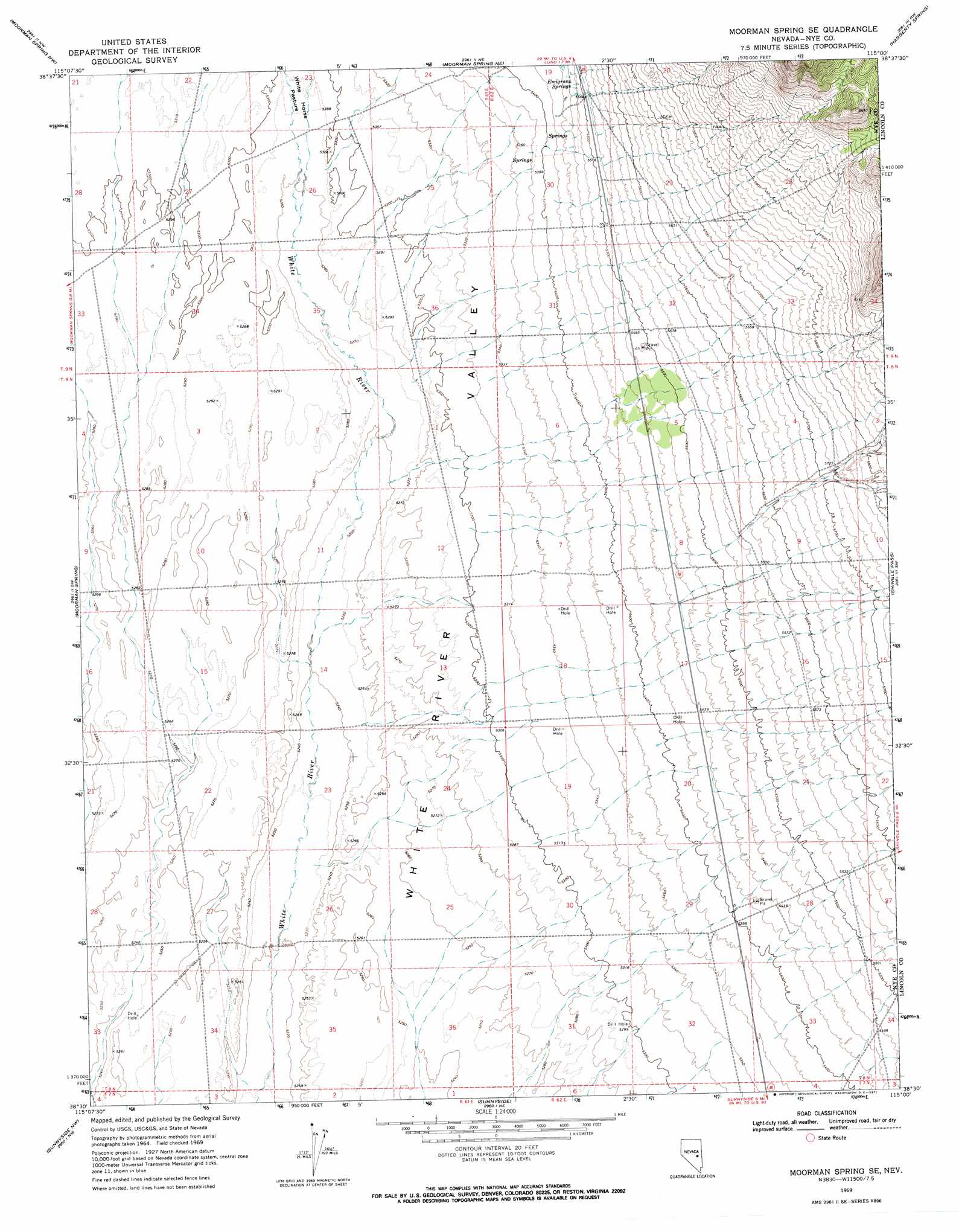
USGS Topo Quad 38115e1 - 1:24,000 scale
| Topo Map Name: | Moorman Spring Se |
| USGS Topo Quad ID: | 38115e1 |
| Print Size: | ca. 21 1/4" wide x 27" high |
| Southeast Coordinates: | 38.5° N latitude / 115° W longitude |
| Map Center Coordinates: | 38.5625° N latitude / 115.0625° W longitude |
| U.S. State: | NV |
| Filename: | o38115e1.jpg |
| Download Map JPG Image: | Moorman Spring Se topo map 1:24,000 scale |
| Map Type: | Topographic |
| Topo Series: | 7.5´ |
| Map Scale: | 1:24,000 |
| Source of Map Images: | United States Geological Survey (USGS) |
| Alternate Map Versions: |
Moorman Spring SE NV 1969, updated 1971 Download PDF Buy paper map Moorman Spring SE NV 2012 Download PDF Buy paper map Moorman Spring SE NV 2014 Download PDF Buy paper map |
1:24,000 Topo Quads surrounding Moorman Spring Se
Currant Summit |
Douglas |
Lund |
Brown Knoll |
Bullwhack Summit |
Callaway Well |
Moorman Spring Nw |
Hardy Springs |
Haggerty Spring |
Parker Station |
Wells Station |
Moorman Spring |
Moorman Spring Se |
Shingle Pass |
Shingle Pass Se |
Forest Home Ne |
Sunnyside Nw |
Sunnyside |
Cave Valley Well |
Sidehill Spring |
Forest Home |
Hot Creek Butte |
Gap Mountain |
Silver King Well |
Sidehill Pass |
> Back to 38115e1 at 1:100,000 scale
> Back to 38114a1 at 1:250,000 scale
> Back to U.S. Topo Maps home
Moorman Spring Se topo map: Gazetteer
Moorman Spring Se: Flats
White Horse Pasture elevation 1614m 5295′Moorman Spring Se: Springs
Emigrant Springs elevation 1679m 5508′Moorman Spring Se digital topo map on disk
Buy this Moorman Spring Se topo map showing relief, roads, GPS coordinates and other geographical features, as a high-resolution digital map file on DVD: