Portuguese Mountain Topo Map Nevada
To zoom in, hover over the map of Portuguese Mountain
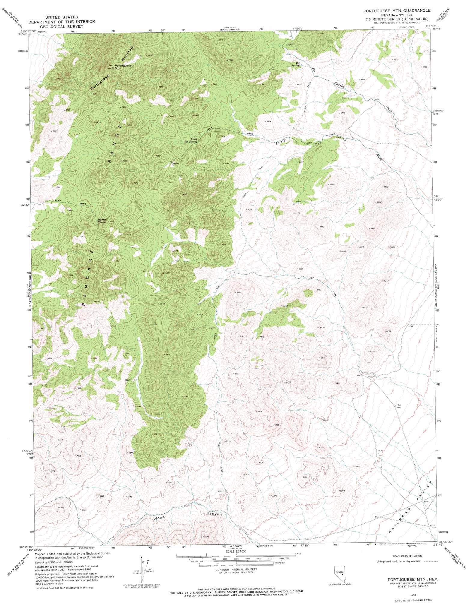
USGS Topo Quad 38115f7 - 1:24,000 scale
| Topo Map Name: | Portuguese Mountain |
| USGS Topo Quad ID: | 38115f7 |
| Print Size: | ca. 21 1/4" wide x 27" high |
| Southeast Coordinates: | 38.625° N latitude / 115.75° W longitude |
| Map Center Coordinates: | 38.6875° N latitude / 115.8125° W longitude |
| U.S. State: | NV |
| Filename: | o38115f7.jpg |
| Download Map JPG Image: | Portuguese Mountain topo map 1:24,000 scale |
| Map Type: | Topographic |
| Topo Series: | 7.5´ |
| Map Scale: | 1:24,000 |
| Source of Map Images: | United States Geological Survey (USGS) |
| Alternate Map Versions: |
Portuguese Mtn NV 1968, updated 1972 Download PDF Buy paper map Portuguese Mountain NV 2012 Download PDF Buy paper map Portuguese Mountain NV 2014 Download PDF Buy paper map |
1:24,000 Topo Quads surrounding Portuguese Mountain
Summit Station |
Brown Summit Nw |
Brown Summit |
Duckwater |
Duckwater Ne |
Red Ring Mountain |
Brown Summit Sw |
Sand Spring |
Bradshaw Spring |
Duckwater Se |
Chaos Creek |
Portuguese Mountain Nw |
Portuguese Mountain |
Meteorite Crater |
Blue Eagle Springs Ne |
Moores Station Se |
Black Rock Summit |
Lockes |
Blue Eagle Springs Sw |
Blue Eagle Springs |
Lunar Crater |
The Wall |
The Wall Ne |
Christian Spring |
Bullwhacker Springs |
> Back to 38115e1 at 1:100,000 scale
> Back to 38114a1 at 1:250,000 scale
> Back to U.S. Topo Maps home
Portuguese Mountain topo map: Gazetteer
Portuguese Mountain: Ridges
Portuguese Mountain elevation 2614m 8576′Portuguese Mountain: Springs
Ike Spring elevation 2013m 6604′Little Ike Spring elevation 2147m 7043′
Martin Spring elevation 2233m 7326′
Portuguese Mountain: Summits
Portuguese Mountain elevation 2795m 9169′Portuguese Mountain digital topo map on disk
Buy this Portuguese Mountain topo map showing relief, roads, GPS coordinates and other geographical features, as a high-resolution digital map file on DVD: