Duckwater Ne Topo Map Nevada
To zoom in, hover over the map of Duckwater Ne
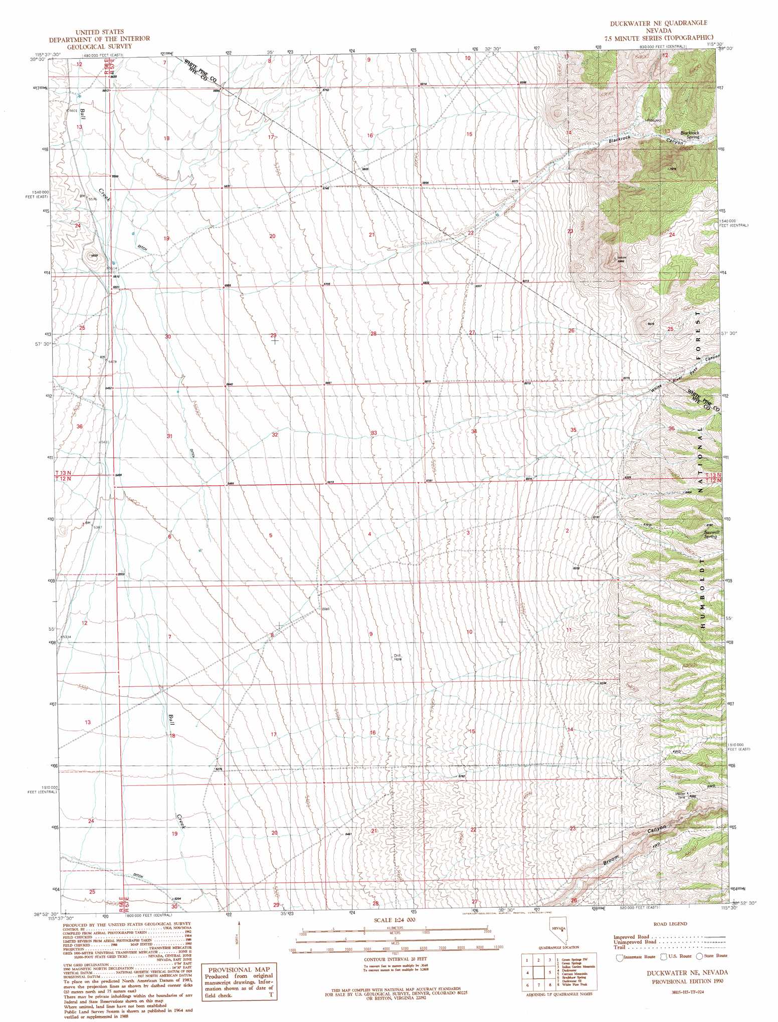
USGS Topo Quad 38115h5 - 1:24,000 scale
| Topo Map Name: | Duckwater Ne |
| USGS Topo Quad ID: | 38115h5 |
| Print Size: | ca. 21 1/4" wide x 27" high |
| Southeast Coordinates: | 38.875° N latitude / 115.5° W longitude |
| Map Center Coordinates: | 38.9375° N latitude / 115.5625° W longitude |
| U.S. State: | NV |
| Filename: | o38115h5.jpg |
| Download Map JPG Image: | Duckwater Ne topo map 1:24,000 scale |
| Map Type: | Topographic |
| Topo Series: | 7.5´ |
| Map Scale: | 1:24,000 |
| Source of Map Images: | United States Geological Survey (USGS) |
| Alternate Map Versions: |
Duckwater NE NV 1990, updated 1990 Download PDF Buy paper map Duckwater NE NV 2012 Download PDF Buy paper map Duckwater NE NV 2014 Download PDF Buy paper map |
| FStopo: | US Forest Service topo Duckwater NE is available: Download FStopo PDF Download FStopo TIF |
1:24,000 Topo Quads surrounding Duckwater Ne
Pogues Station |
Green Springs Nw |
Mount Hamilton |
Treasure Hill |
Limestone Peak |
Bull Fork |
Green Springs Sw |
Green Springs |
Indian Garden Mountain |
Easter Springs |
Brown Summit |
Duckwater |
Duckwater Ne |
Currant Mountain |
Horse Track Spring |
Sand Spring |
Bradshaw Spring |
Duckwater Se |
White Pine Peak |
Currant Summit |
Portuguese Mountain |
Meteorite Crater |
Blue Eagle Springs Ne |
Currant |
Callaway Well |
> Back to 38115e1 at 1:100,000 scale
> Back to 38114a1 at 1:250,000 scale
> Back to U.S. Topo Maps home
Duckwater Ne topo map: Gazetteer
Duckwater Ne: Basins
Railroad Valley elevation 1585m 5200′Duckwater Ne: Springs
Blackrock Spring elevation 1974m 6476′Sawmill Spring elevation 2029m 6656′
Vanover Spring elevation 2044m 6706′
Duckwater Ne: Streams
Black Canyon Wash elevation 1787m 5862′Freeland Canyon Wash elevation 1684m 5524′
Lampson Canyon Wash elevation 1684m 5524′
Duckwater Ne: Valleys
Blackrock Canyon elevation 1865m 6118′White River Pass Canyon elevation 1921m 6302′
Duckwater Ne: Wells
Bull Creek Well Number Two elevation 1678m 5505′Duckwater Ne digital topo map on disk
Buy this Duckwater Ne topo map showing relief, roads, GPS coordinates and other geographical features, as a high-resolution digital map file on DVD: