Warm Springs Topo Map Nevada
To zoom in, hover over the map of Warm Springs
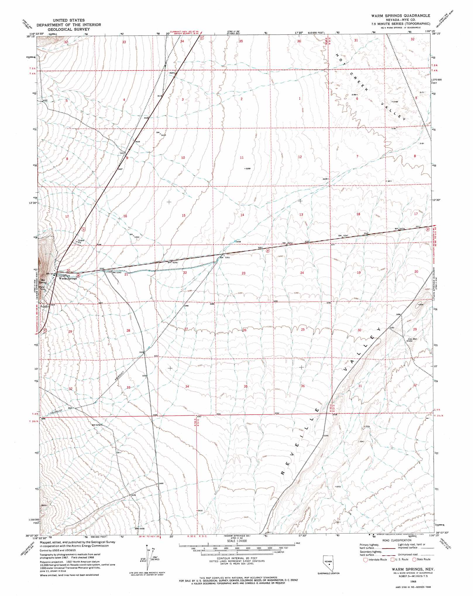
USGS Topo Quad 38116b3 - 1:24,000 scale
| Topo Map Name: | Warm Springs |
| USGS Topo Quad ID: | 38116b3 |
| Print Size: | ca. 21 1/4" wide x 27" high |
| Southeast Coordinates: | 38.125° N latitude / 116.25° W longitude |
| Map Center Coordinates: | 38.1875° N latitude / 116.3125° W longitude |
| U.S. State: | NV |
| Filename: | o38116b3.jpg |
| Download Map JPG Image: | Warm Springs topo map 1:24,000 scale |
| Map Type: | Topographic |
| Topo Series: | 7.5´ |
| Map Scale: | 1:24,000 |
| Source of Map Images: | United States Geological Survey (USGS) |
| Alternate Map Versions: |
Warm Springs NV 1968, updated 1973 Download PDF Buy paper map Warm Springs NV 2012 Download PDF Buy paper map Warm Springs NV 2014 Download PDF Buy paper map |
1:24,000 Topo Quads surrounding Warm Springs
Mcintyre Summit |
Flagstaff Mountain |
Blue Jay Spring |
Palisade Mesa |
Lunar Crater |
Georges Canyon Rim Se |
Tybo |
Tybo Well |
Buckwheat Rim |
Chuck Wagon Flat |
Stone Cabin Ranch Ne |
Warm Springs Summit |
Warm Springs |
Twin Springs Slough |
Echo Canyon |
Stone Cabin Ranch Se |
Bellehelen |
Warm Springs Se |
Reveille |
Reveille Se |
Stinking Spring |
Kawich Peak |
Kawich Peak Ne |
Reveille Peak Nw |
Freds Well |
> Back to 38116a1 at 1:100,000 scale
> Back to 38116a1 at 1:250,000 scale
> Back to U.S. Topo Maps home
Warm Springs topo map: Gazetteer
Warm Springs: Airports
Warm Springs Airport elevation 1651m 5416′Warm Springs: Populated Places
Warm Springs elevation 1653m 5423′Warm Springs: Post Offices
Warm Springs Post Office (historical) elevation 1654m 5426′Warm Springs: Springs
Hot Spring elevation 1688m 5538′Warm Springs: Valleys
Cow Canyon elevation 1705m 5593′Warm Springs: Wells
Joes Well elevation 1606m 5269′Warm Springs digital topo map on disk
Buy this Warm Springs topo map showing relief, roads, GPS coordinates and other geographical features, as a high-resolution digital map file on DVD: