Warm Springs Summit Topo Map Nevada
To zoom in, hover over the map of Warm Springs Summit
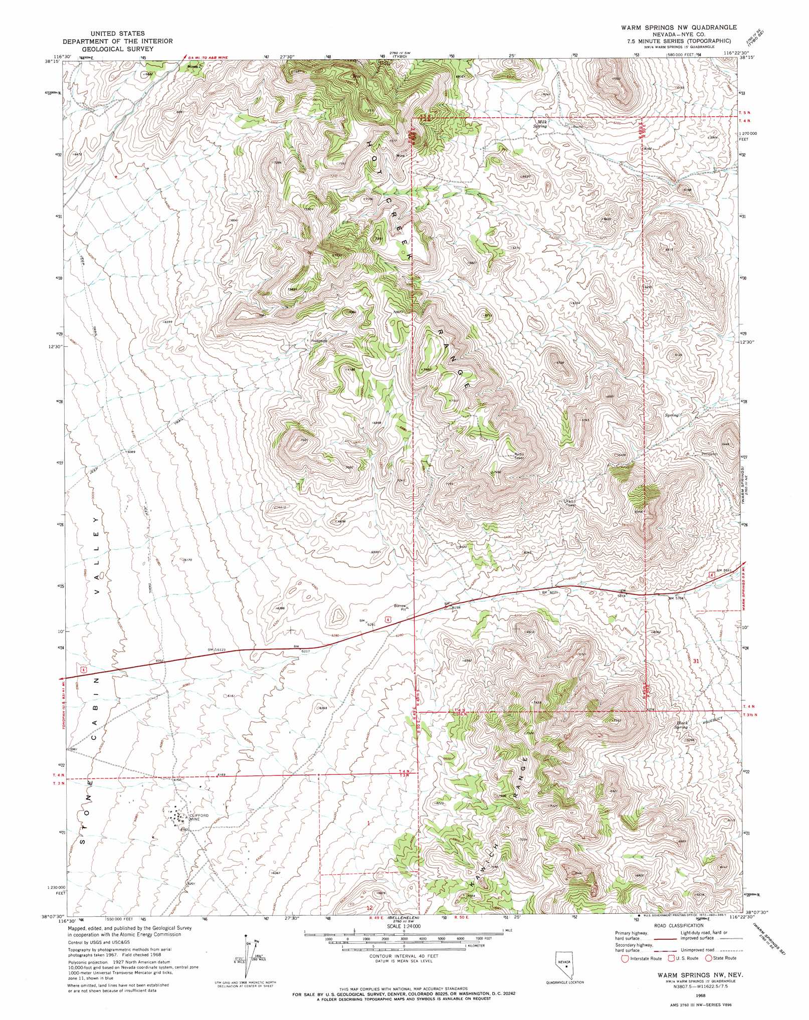
USGS Topo Quad 38116b4 - 1:24,000 scale
| Topo Map Name: | Warm Springs Summit |
| USGS Topo Quad ID: | 38116b4 |
| Print Size: | ca. 21 1/4" wide x 27" high |
| Southeast Coordinates: | 38.125° N latitude / 116.375° W longitude |
| Map Center Coordinates: | 38.1875° N latitude / 116.4375° W longitude |
| U.S. State: | NV |
| Filename: | o38116b4.jpg |
| Download Map JPG Image: | Warm Springs Summit topo map 1:24,000 scale |
| Map Type: | Topographic |
| Topo Series: | 7.5´ |
| Map Scale: | 1:24,000 |
| Source of Map Images: | United States Geological Survey (USGS) |
| Alternate Map Versions: |
Warm Springs NW NV 1968, updated 1972 Download PDF Buy paper map Warm Springs Summit NV 2012 Download PDF Buy paper map Warm Springs Summit NV 2014 Download PDF Buy paper map |
1:24,000 Topo Quads surrounding Warm Springs Summit
Mccann Canyon |
Mcintyre Summit |
Flagstaff Mountain |
Blue Jay Spring |
Palisade Mesa |
Georges Canyon Rim |
Georges Canyon Rim Se |
Tybo |
Tybo Well |
Buckwheat Rim |
Stone Cabin Ranch |
Stone Cabin Ranch Ne |
Warm Springs Summit |
Warm Springs |
Twin Springs Slough |
Stone Cabin Ranch Sw |
Stone Cabin Ranch Se |
Bellehelen |
Warm Springs Se |
Reveille |
Stinking Spring Nw |
Stinking Spring |
Kawich Peak |
Kawich Peak Ne |
Reveille Peak Nw |
> Back to 38116a1 at 1:100,000 scale
> Back to 38116a1 at 1:250,000 scale
> Back to U.S. Topo Maps home
Warm Springs Summit topo map: Gazetteer
Warm Springs Summit: Gaps
Warm Springs Summit elevation 1916m 6286′Warm Springs Summit: Mines
Clifford Mine elevation 1879m 6164′Warm Springs Summit: Populated Places
Helena (historical) elevation 1881m 6171′Warm Springs Summit: Post Offices
Helena Post Office (historical) elevation 1881m 6171′Warm Springs Summit: Springs
Black Rock Spring elevation 1996m 6548′Black Spring elevation 1806m 5925′
Milk Spring elevation 1883m 6177′
Warm Springs Summit digital topo map on disk
Buy this Warm Springs Summit topo map showing relief, roads, GPS coordinates and other geographical features, as a high-resolution digital map file on DVD: